The Milles Gouttes, Salon du Capucin and Rigolet circular loop, starting from Mont-Dore

Le Mont-Dore is a tourist destination for three main reasons: hiking in the Sancy massif, the winter sports resort and the spa town. For all these good reasons, there are numerous hiking trails around Le Mont-Dore and the surrounding area. It would be a shame not to mention that this is a welcoming region where life is good. Who wouldn’t be tempted, whilst out on a hike, to stop for a snack of bread, cheese and cold meats, not forgetting to finish off with a slice of blueberry tart! It is against this backdrop that the suggested walk is a circular route starting from the thermal baths, running alongside the funicular railway, reaching the Salon du Capucin after working up quite a sweat, then winding gently back down through magnificent woodland and countryside, passing through Rigolet and Les Vergnes before returning to Mont-Dore and its thermal baths. The walk can also start from the Tourist Office in the town centre.

Details

n°109056410
Creation:
Last update:
Last review:
–
  • Walking
    Activity: Walking
  • ↔
    Distance: 3.36 mi
  • ◔
    Average duration: 2h 15 
  • ▲
    Difficulty: Moderate

  • ⚐
    Back to start: Yes
  • ↗
    Ascent: + 814 ft
  • ↘
    Descent: - 833 ft

  • ▲
    Highest point: 4,101 ft
  • ▼
    Lowest point: 3,356 ft

Photos

Description of the walk

(S/E) The walk begins in the small square in front of the Mont-Dore spa. With your back to the spa, take Rue Ramond opposite, then turn left onto a small path that crosses the spa grounds just after Rue Meynadier. Leave the grounds and take Rue Duchatel on the right to reach, on the left, the entrance to the Chemin de Mille Gouttes, which is very clearly signposted with yellow signs.

(1) Start your ascent on the left, heading towards the Salon du Capucin, which is a waypoint for climbing the Pic du Capucin (1,463 m). You’ll reach the junction with the Chemin des Artistes.

(2) Take this path on the left until you reach the bridge spanning the funicular railway line.

(3) Turn back to the junction.

(2) Continue straight on for a few dozen metres, then turn left to reach the funicular’s upper station.

(4) Pass thefirst path on the right, Chemin des Médecins, and continue along thesecond path on the right for 200 metres to reach the Salon du Capucin.

(5) Take the road on the right until it splits; follow the right-hand branch downhill, which runs parallel to the road that branches off to the left. Pass the junction with Chemin des Médecins coming from the right, carry on straight ahead, continuing downhill to the hamlet of Rigolet Haut. Turn right to reach the square with the fountain: sign for “Le Mont-Dore 1.7 km”.

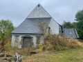
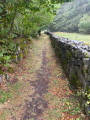
(6) Go round the chapel on the right, take the slight bend to the left and turn right onto the Chemin Marie Curie, which will take you through pleasant meadows. At the junction, turn right at a 90° angle to join the Route du Petit Vincennes to Vergnes (D645).

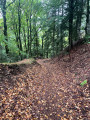
(7) Cross the road and, opposite, near the signposts, take Chemin des Verges (Mont-Dore Communal Forest). Follow this path, which descends steeply as it is more of a mountain bike track, but which leads through pleasant woodland to the hamlet of Les Sources, where you’ll find the first houses of the town of Mont-Dore.

(8) Continue to the right along the D130, which is called Boulevard Mirabeau here: on the right, a sign indicates that you are heading towards Clermont-Ferrand, Murol, Saint-Nectaire and Issoire. Pass the car repair garage, take the left-hand bend and continue to the bridge over the Dordogne, which is actually formed by the confluence of two streams further upstream: the Dore and the Dogne. Once at the roundabout, take Rue Sidoine Apollinaire on the right, then turn left in front of the hospital to follow Rue du Capitaine Chazotte. Pass Rue Meynadier on your right as you come within sight of the town hall and Saint-Pardoux Church.

(9) Take the street on the right, which leads onto Rue Montlosier, then first turn left then right to immediately reach the Place du Panthéon and the thermal baths (S/E).

Waypoints

  1. S/E : mi 0 - alt. 3,419 ft - Place des Thermes - Thermes du Mont Dore
  2. 1 : mi 0.21 - alt. 3,435 ft - Chemin des Mille Gouttes - Funiculaire du Capucin
  3. 2 : mi 0.43 - alt. 3,675 ft - Chemin des Artistes junction
  4. 3 : mi 0.61 - alt. 3,675 ft - Bridge over the funicular
  5. 4 : mi 1.3 - alt. 4,049 ft - Funicular arrival station - Funiculaire du Capucin
  6. 5 : mi 1.41 - alt. 4,098 ft - Salon du Capucin - Le Capucin (1463 m)
  7. 6 : mi 2.02 - alt. 3,848 ft - Rigolet Haut – Chapel
  8. 7 : mi 2.47 - alt. 3,707 ft - Route du Petit Vincennes
  9. 8 : mi 2.85 - alt. 3,356 ft - Hameau des Sources – D645
  10. 9 : mi 3.26 - alt. 3,399 ft - Saint-Pardoux Church
  11. S/E : mi 3.36 - alt. 3,419 ft - Place des Thermes - Thermes du Mont Dore

Notes

Depending on the season, you may find places to eat at the Salon du Capucin.

A spot of shopping in the Thermes district will be a delight for all Mont-Dorian shopkeepers. The Thermes, for their part, are an unmissable destination for many spa-goers.

The town boasts a wide variety of shops. The Tourist Office, located in the town centre, will be able to answer any questions you may have.

(2) The Chemin des Artistes continues straight ahead. This could be a way to reach Rigolet Haut directly (5) and thus shorten the route by taking a shorter circular loop.

Worth a visit

(S) The former ‘Le Sarciron’ hotel, crossing the Dordogne.

(1) The funicular’s lower station.

(4) The funicular’s arrival station.

(5) The Salon du Capucin stop, the starting point for several walking and mountain biking trails.

Chemin des Médecins and the Sylvatorium

(6) Rigolet Haut with its fountain and chapel.

The Dordogne: the confluence of the Dore and Dogne streams in the Sancy massif.

(9) Saint-Pardoux Church and the town’s historic centre.

Other walks in the area

For more walks, use our search engine .

The GPS track and description are the property of this route's author. Please do not copy them without permission.