Puy du Pariou circular walk, alternative route from the Goules car park

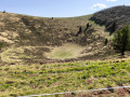
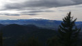
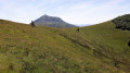
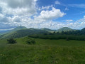
This route is an alternative to the “Le Puy Pariou from the Goules car park” route. The return journey, after descending the 555 steps of the staircase,involves walking a circular route around Le Puy, passing at the foot of the Col des Goules. The return route begins by crossing a mountain pasture and continues along a forest track.
Please note: it is forbidden to descend to the bottom of the crater or to walk all the way round the crater.

Details

n°110403914
Creation:
Last update:
Last review:
–
  • Walking
    Activity: Walking
  • ↔
    Distance: 4.03 mi
  • ◔
    Average duration: 2h 30 
  • ▲
    Difficulty: Easy

  • ⚐
    Back to start: Yes
  • ↗
    Ascent: + 699 ft
  • ↘
    Descent: - 699 ft

  • ▲
    Highest point: 3,901 ft
  • ▼
    Lowest point: 3,199 ft

Description of the walk

Park at the Parking des Goules car park.

(S/E) Cross the D541 at the protected pedestrian crossing and enter the slightly wooded area opposite. Take a path on the right leading to the shooting range path.

(1) Cut across this path and continue straight ahead behind the barrier signposting the direction of Puy du Pariou. Carry on to a junction marking the start of the circular route.

(2) Take the path on the left and continue through the woodland until you reach the edge of the Puy du Pariou after a climb of nearly 200 metres.

(3) Carry on to the left – please note that it is forbidden to descend into the crater – then move away from the crater to reach a footbridge at the bottom of the steps.

(4) Take the path on the right, facing the Puy de Dôme, and carry on, leaving a path towards Vulcania on your left. Continue until you reach the junction you took on the way there.

(2) Follow the route you took on the way there in the opposite direction to return to the Goules car park (S/E).

Waypoints

  1. S/E : mi 0 - alt. 3,202 ft - Les Goules car park - Col des Goules (997 m)
  2. 1 : mi 0.16 - alt. 3,209 ft - Shooting Range Path
  3. 2 : mi 0.68 - alt. 3,353 ft - Crossroads of the circular loop
  4. 3 : mi 1.61 - alt. 3,809 ft - Crater of the - Puy Pariou
  5. 4 : mi 2.16 - alt. 3,556 ft - At the bottom of the stairs
  6. S/E : mi 4.03 - alt. 3,202 ft - Les Goules car park - Camp de la Fontaine du Berger (Orcines)

Notes

No water sources or shelter.
Observe the restrictions: the crater floor and the upper part of the ‘caldeira’

Worth a visit

On the way back, on your left, you can see a sort of rusty metal vat. This rusty object in the middle of the forest is a charcoal kiln. It is a large metal container formerly used to produce charcoal by covering wood with earth or burning it slowly, particularly on a large scale during the first half ofthe 20th century and the Second World War

Other walks in the area

For more walks, use our search engine .

The GPS track and description are the property of this route's author. Please do not copy them without permission.