Country:

 City:
City:


The walk begins at the Place du Panthéon, in front of the Mont-Dore spa.
(S/E) Opposite the thermal baths, follow Rue Favart to the left. At the town hall, take Rue Marie-Thérèse to the right, then immediately turn left up the steps to come out onto Rue Étienne Chabory. Take a short right-left turn to reach Rue des Bains de César and follow this to the left until you reach the cul-de-sac. Then turn right onto Chemin de Chappes and follow it uphill until you reach Chemin de Melchi Roze, which forms part of the GR®4.
(1) Keep heading in the same direction along this path, which descends gently to Avenue de Clermont (D996). Cross it at the pedestrian crossing and turn right, walking along the left-hand pavement until you reach No. 71 bis.
(2) Take the somewhat uneven path on the left leading to Chemin des Monteyroux in Le Queureuilh. Head to the right, then turn left twice to follow Rue des Écureuils to the nearby Avenue de la Bourboule. Cross at the pedestrian crossing set back to the left, head back to the right, then turn left onto Rue Hélène Boucher. Turn left again to follow Rue des Chasseurs Alpins, passing between the gendarmerie and the heliport. Once you reach the bend, turn right onto the small path called Défi No. 3 (going against the flow of traffic), pass under the railway bridge and follow the banks of the Dordogne until you emerge near the old station: as you pass, you can see the tracks of the old railway line in the undergrowth.
(3) Continue to the right along Allée André Audebert, crossing the bridge over the Dordogne. Join Boulevard Mirabeau (D130), turn left along the side road and arrive at the primary school situated on the bend. Turn right onto Avenue Jules Ferry.
(4) Before reaching the junction with the road leading to La Tour d’Auvergne (D645), take the steps on the right which lead up to it, serving as a shortcut. Continue to the right along this road, which is called Avenue de la Libération at this point.
(5) Immediately after passing the 1 km marker, take a hairpin bend on the left just before a concrete building marked ‘Chemin des Artistes’. Follow this path until it joins the Chemin des Mille Gouttes.
(6) Carry on straight ahead, staying on the Chemin des Artistes, cross the small bridge over the funicular railway, then take the path on the left which leads back down towards Mont-Dore. Once at the bottom, follow the Allée du Lieutenant Farmont to the right.
(7) Take Avenue René Cassin on the right, cross the bridge over the Dordogne, then take Rue de la Saigne and go up the steps opposite, slightly to the right. Join Avenue Georges Clémenceau, turn left and continue until you reach the restaurant “Le Bougnat”.
(8) Just before the restaurant, take a sharp right-hand bend to follow the Chemin du Poète, which leads to the Route de Besse (D36) after you’ve gone up a flight of steps. Follow it to the left, pass two tight bends and reach the start of the Chemin de Melchi Roze, situated to the left of the road.
(9) Leave the Route de Besse and take this path. As you go, you can admire a superb view of the Pic du Capucin on your left.
(10) Take the Chemin de la Bane on the left, which descends quite steeply with steps that are sometimes quite high. Once you reach the square, admire its staircase and bandstand, then turn right onto Rue Rigny to arrive immediately at the Place du Panthéon (S/E).
 Visorando Member
 Moderate
 Difficult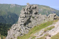
 Association / Club / Walk leader