Four Waterfalls Route from Mont-Dore

The aim of this walk is to complete a route taking in the four main waterfalls of Mont-Dore: the Grande Cascade, Rossignolet, Queureuil and Saut du Loup.
Three of the waterfalls are in roughly the same area. This leaves the option of visiting the Grande Cascade at a later date. In that case, simply take the Chemin de Chappes on the right as you set off from the town hall; this leads up to the Melchi-Roze path, and then continue the route to the left.

Details

n°109415669
Creation:
Last update:
Last review:
–
  • Walking
    Activity: Walking
  • ↔
    Distance: 6.97 mi
  • ◔
    Average duration: 4h 35 
  • ▲
    Difficulty: Moderate

  • ⚐
    Back to start: Yes
  • ↗
    Ascent: + 1,591 ft
  • ↘
    Descent: - 1,598 ft

  • ▲
    Highest point: 4,216 ft
  • ▼
    Lowest point: 3,281 ft

Description of the walk

Park opposite the spa and the Place du Panthéon in Mont-Dore.

(S/E) Take Rue Rigny on the right for 420 m; after the restaurant Le Bougnat, turn left onto Chemin du Poète. Continue up the steps to reach Route de Besse. Take this road to the left, pass two hairpin bends and reach the junction with a footpath.

(1) Turn right onto the path to complete the climb to the foot of the Grande Waterfall.

(2) Return to the previous junction with the D36.

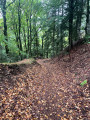
(1) Take the Chemin de Melchi-Rose on the right through the woods until you reach the D996.

(3) Turn right and stay on the left-hand pavement for 200 m until you reach the start of the Monteyroux path. Turn left onto this path; this is the GR®4 variant, signposted in white and red. Continue along the Route des Cascades and then take the Route de Prends-Toi-Garde. Walk past the campsite and leave the tarmac road to continue on the GR® to the right of the landscaped cemetery car park. At the first junction, turn left, following the sign for the Rossignolet waterfall, and head towards it.

(4) Go round it on the left and continue to the left to reach the summit; continue down the slope until you reach the junction where you’ll find the GR®4. Take it to the left to reach the Waterfall de Queureuil.

(5) Take the path on the right and climb up to a junction. Leave the GR®4 here and turn left onto the forest track. Reach the D996 and follow it to the left. At the next bend, leave the road and head up the hill opposite (signposted) to the Waterfall du Saut du Loup.

(6) Return to the D996 and follow it to reach the junction you passed earlier. Continue along the D996 and you’ll come to a fork you passed on the way out.

(3) Keep right onto the D996 – also known as Avenue du Général Leclerc – which takes you via Rue Favart to the car park at the Thermes du Mont-Dore (S/E).

Waypoints

  1. S/E : mi 0 - alt. 3,422 ft - Car park at Place du Panthéon and - Thermes du Mont Dore
  2. 1 : mi 0.61 - alt. 3,665 ft - Trail junction
  3. 2 : mi 1.22 - alt. 4,213 ft - La Grande Cascade (Mont Dore)
  4. 3 : mi 2.79 - alt. 3,524 ft - D996
  5. 4 : mi 4.09 - alt. 3,461 ft - Cascade du Rossignolet
  6. 5 : mi 4.47 - alt. 3,501 ft - Queureuilh Waterfall
  7. 6 : mi 5.19 - alt. 3,917 ft - Saut du Loup Waterfall
  8. S/E : mi 6.97 - alt. 3,422 ft - Car park at Place du Panthéon and - Thermes du Mont Dore

Notes

(S/E) At the start of the walk, there are numerous shops of all kinds.
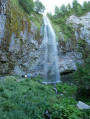
(2) The Grande Cascade: at 32 metres high, it is the highest waterfall in Auvergne. On the left, you can see the Pic du Capucin and two trailheads leading down towards the town centre. After crossing the Clermont road, the descent along the Monteyroux path may be tricky due to roadworks.
(2) It is possible to climb up to the Durbise plateau at an altitude of 1,450 metres.
(4) and (5): this is a very interesting area as it brings together two beautiful waterfalls and their streams in pleasant woodland.
(6) Saut du Loup Waterfall: this is the smallest of the four waterfalls, but it is set in a spot well worth a visit, to the left of a cliff that resembles a small cirque.
From (6) to (S/E): the descent towards Mont-Dore follows a tarmac local road. It is always possible to leave the road, first turning right onto the Monteyroux path and then left onto the Melchi-Roze path.

Worth a visit

Note: a guided tour may be available from the Tourist Office on Avenue de la Libération; the entranceis next to the bowling alley, within the sports and leisure complex at the thermal spa. Tel: 04 73 65 20 21.

Always be cautious and plan ahead when you're outdoors. Visorando and the author of this route cannot be held responsible for any accidents occurring on this route.

The GR® and PR® markings are the intellectual property of the Fédération Française de Randonnée Pédestre.

Other walks in the area

For more walks, use our search engine .

The GPS track and description are the property of this route's author. Please do not copy them without permission.