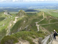
The Mont-Dore Artists’ Trail: a circular route via Rigolet Bas and Rigolet Haut

This walk first takes us through the streets of Mont-Dore, from the thermal baths to the old railway station. After a short detour along the River Dordogne, you’ll need to cross the municipal workshops to take a footpath between the old railway line and the River Dordogne, before heading up towards Rigolet Bas and the golf course, then Rigolet Haut, and finally down again to join the Chemin des Artistes, followed by the Chemin des Mille Gouttes, before returning to the town near the Tourist Office.

Details

n°109541084
Creation:
Last update:
Last review:
–
  • Walking
    Activity: Walking
  • ↔
    Distance: 5.15 mi
  • ◔
    Average duration: 3h 15 
  • ▲
    Difficulty: Moderate

  • ⚐
    Back to start: Yes
  • ↗
    Ascent: + 978 ft
  • ↘
    Descent: - 984 ft

  • ▲
    Highest point: 3,845 ft
  • ▼
    Lowest point: 3,071 ft

Description of the walk

Starting point: Place du Panthéon – Les Thermes du Mont-Dore. In the description below, an asterisk (*) indicates that further details can be found in the ‘Practical Information’ section.

(S/E) With your back to the thermal baths, take Rue Favart on the right, then turn left onto Rue du Capitaine Chazotte. At the hospital, continue right onto Rue Sidonie Apollinaire.

(1) Go round the roundabout on the right and continue straight on along Rue du Dr François Claude until you reach Avenue Michel Bertrand. Follow this road, keeping slightly to the left, until you reach the old Mont-Dore railway station (*).

(2) Turn left through a small gate to follow the path running along the right bank of the Dordogne. Pass under the railway bridge, then turn left onto Rue des Chasseurs Alpins. Walk past the gendarmerie by about a hundred metres.

(3) Cross the bridge over the Dordogne and turn immediately right into the Queureuilh business park. Enter the municipal workshops area by following the pedestrian crossing marked on the ground. Then go to the right of the fence to follow the footpath between it and the river.

(4) Cross a road (*) and continue along the path leading towards La Bourboule. Cross the footbridge over the Dordogne to reach the right bank and continue to the next footbridge at Moulin Compissade (*), from where you can see the pools of the Fontaine Pétrifiante hot spring below.

(5) Take the path on the left, cross the footbridge and reach the level crossing, where you’ll find the signposts again. Cross the Route de la Salade (D130) and begin the climb towards Rigolet-Bas via the Chemin du Salon Mirabeau. Follow this path to reach the centre of the hamlet.

(6) First turn left then right to follow the path which passes through a small wooded area and leads onto the Chemin de la Parisienne. Follow it to the left until you reach the junction with the Route du Golf.

(7) Turn left to follow this road, passing the entrance to the golf course on your left, and continue to the D645 (Route de la Tour d’Auvergne).

(8) Cross it and continue straight on along Rue Simone Veil, running alongside the La Plage Verte campsite. You’ll reach the hamlet of Rigolet Haut. After the first few houses, turn left onto Rue Simone de Beauvoir, passing the drinking trough and the chapel.

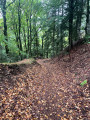
(9) Turn onto Chemin de Fond de Bois, signposted by a rustic sign reading ‘Le Mont-Dore’ in blue on a white background. Follow this path down to the junction with Chemin des Artistes.

(10) Take this path on the right until you reach the Chemin des Mille Gouttes.

(11) Leave this path and continue straight on along the Chemin des Artistes to see, 300 metres further on, the bridge over the funicular railway.

(12) Retrace your steps and head down to the right along the Chemin des Mille Gouttes, then join the Avenue de la Libération.

(13) Cross it and take the Allée Georges Lagaye opposite. Also cross the Avenue Jules Ferry and Rue Meynadier, then head straight on along Rue Duchatel to return to the Place du Panthéon and the Thermes via Rue de Rigny on the left (S/E).

Waypoints

  1. S/E : mi 0 - alt. 3,422 ft - Place du Panthéon - Thermes du Mont Dore
  2. 1 : mi 0.32 - alt. 3,363 ft - Roundabout
  3. 2 : mi 0.6 - alt. 3,307 ft - Former Mont-Dore railway station
  4. 3 : mi 0.91 - alt. 3,258 ft - Bridge over the Dordogne
  5. 4 : mi 1.45 - alt. 3,182 ft - Bridge - Dordogne (fleuve)
  6. 5 : mi 1.93 - alt. 3,071 ft - The Petrifying Fountain
  7. 6 : mi 2.62 - alt. 3,533 ft - Rigolet Bas
  8. 7 : mi 2.87 - alt. 3,661 ft - Route du Golf
  9. 8 : mi 3.34 - alt. 3,789 ft - D465 road
  10. 9 : mi 3.72 - alt. 3,845 ft - Rigolet Haut
  11. 10 : mi 4.05 - alt. 3,615 ft - Chemin des Artistes
  12. 11 : mi 4.29 - alt. 3,678 ft - Junction with the Chemin des Mille Gouttes
  13. 12 : mi 4.52 - alt. 3,678 ft - Bridge over the - Funiculaire du Capucin
  14. 13 : mi 4.97 - alt. 3,455 ft - Avenue de la Libération
  15. S/E : mi 5.15 - alt. 3,422 ft - Place du Panthéon - Thermes du Mont Dore

Notes

From the starting point at Place du Panthéon, you’ll find plenty of shops, a bank, a chemist’s, and so on.

By going round the old railway station on the left, you can cross the tracks to reach the car park of the “Le Panier Sympa” supermarket. You will then need to head left onto Rue des Chasseurs Alpins to rejoin the route described.

Before finishing the walk, at the bottom of the Sentier des Mille Gouttes, you can visit the lower station of the funicular (on the right), the Tourist Office (on the left) and the River Dordogne, and finish by continuing along Rue Duchatel until you reach Rue Rigny. You then simply turn left to return to Place du Panthéon.

Worth a visit

(*) For those interested in the remains of Mont-Dore’s railway heritage: to the left of the old station building, past the wire fence, walk round the building to see the platforms of the magnificent passenger station. Note the numerous railway tracks, which were probably used to store large numbers of wagons. Heading upstream along the tracks, you’ll find a turning loop as well as a wide variety of equipment and machinery. Return to the walking route on the Dordogne side.

(*) After crossing the road linking Avenue de la Bourboule and Route de la Salade, a row of large stones signals that you should turn left onto a path which takes a short detour along the railway line to a wrought-iron gate. The path then descends towards the footbridge over the Dordogne. A little further on, just before the Moulin Compissade, a path joins the (upper) Route de la Bourboule. After the house, another path leads us towards the Taillerie du Sancy.

* Moulin de la Compissade (5): a historic site where electricity was generated to power the Capucin funicular. This hydroelectric power station currently operates when the flow of the Dordogne is sufficient (450 l/s).

Other walks in the area

For more walks, use our search engine .

The GPS track and description are the property of this route's author. Please do not copy them without permission.