Around Mehun-sur-Yèvre from the station

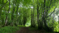
From Mehun-sur-Yèvre railway station, the suggested route is a circular route that takes you round the outer edge of the town. As the route passes close to the main sights, you can always veer off the route to visit a particular site. The historic sites are covered by a separate walking tour within the town of Mehun.

Details

n°108797777
Creation:
Last update:
Last review:
–
  • Walking
    Activity: Walking
  • ↔
    Distance: 9.55 mi
  • ◔
    Average duration: 4h 25 
  • ▲
    Difficulty: Moderate

  • ⚐
    Back to start: Yes
  • ↗
    Ascent: + 36 ft
  • ↘
    Descent: - 36 ft

  • ▲
    Highest point: 430 ft
  • ▼
    Lowest point: 364 ft

Description of the walk

The suggested route begins in front of the railway station, where there are two car parks.

(S/E) Walk round the station, cross the level crossing, continue left onto Avenue Pierre Sémard and head towards Chaussée de César on the right.

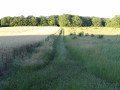
(1) Turn right onto it, pass by the Stade des Acacias and continue along a dirt track after Rue des Fours à Chaux. Turn right onto another dirt track towards the gatekeeper’s house, cross the railway line, go round the Nexans factory on the left and join the D60.

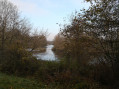
(2) Follow it to the right, then turn left towards Crécy (a former parish before 1789) and reach the Canal de Berry.

(3) Follow it to the right as far as Rue Camille Mérault (named after a former mayor).

(4) Turn left and continue to Rue Henri Boulard (named after another former mayor), which you follow to the left until you reach the junction with the D2076.

(5) Cross the road at the pedestrian crossing, pass between the medical centre on the left and the chemist’s on the right, and go round the École Marcel Pagnol and the Gymnase Maurice Herzog on the right. Continue to the D79, where you’ll find the new Mehun gendarmerie in the Malandries neighbourhood.

(6) Turn right and carry on until you rejoin the D2076, which you should follow to the left.

(7) After a few dozen metres, turn left onto Allée de Chantaloup. Towards the end of this lane, turn left through the Chantaloup housing estate and, after a few twists and turns, you’ll reach Rue du Chemin Vert

(8) Follow it to the right and carry on until you reach the Route d’Allogny, the D20 in the Saint-Jean neighbourhood.

(9) Cross this road carefully and continue along Rue Marius Ameline until you reach Route de Bourges (Avenue Raoul Aladenize – D2076). Turn left and head towards the Tourist Office, situated on the left at the far end of Place du 14 Juillet (formerly Place Moÿret, named after the former mayor).

(10) Walk round the square towards the former White Cross Hotel on Rue Jeanne d’Arc, then turn left onto the D2076. Cross the road carefully and turn right past the former gendarmerie. Cross the bridge over the Annan, a river which rises between Allogny and Saint-Éloy-de-Gy and joins the Yèvre at the foot of the Château de Charles VII. It is along the banks of the Annan that most of the town’s old wash houses are found.

(11) Turn left into Rue de la Belle Fontaine. After passing numerous gardens on your left, you’ll reach the Belle Fontaine, which is on your left. Some locals refer to a washhouse; indeed, a flight of steps leads down to the spring, where one can easily imagine finding washerwomen. The spring water is channelled towards a branch of the Annain (which you can reach by walking through the gardens to see the washhouses or what remains of them).

(12) A little further on, turn right, cross the housing estate towards the water tower until you reach the Chemin du Melerat, which you should take on the left. Continue along this path to the supermarket; cross its car park to reach the D68 roundabout, then, on the right, the D2076 roundabout. Go round it on the left and join the Route du Paradis.

(13) Turn left onto Chemin du Paradis, which leads to the hamlet of Montcorneau, so named because it is the highest point in the parish (126 m).

(14) Cross the D60 with care and continue straight ahead along the Route de Montcorneau to the Place de Barmont (formerly Thinay).

(15) Carry straight on along Avenue du Général de Gaulle, then turn left onto Chemin de la Tour des Champs, a path popular with walkers.

(16) Follow this path, which leads to Mehun Castle, which you can see on your left. After the first few houses and before the bend to the right, turn left to cross the castle’s meadow. On your right, you can admire the wash houses.

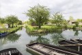
(17) Walk round the castle on the left to reach the gardens of Duke Jean de Berry, crossing a small bridge over the Yèvre on the left. At the far end of the gardens, turn right and walk alongside the Canal de Berry until you reach Rue Jeanne d’Arc.

(18) Turn left onto this street, then left again onto Place du Saint-Syph and almost immediately right onto Rue Jean Vacher to reach the railway station (S/E).

Waypoints

  1. S/E : mi 0 - alt. 394 ft - Gare de Mehun-sur-Yèvre
  2. 1 : mi 0.28 - alt. 397 ft - Chaussée de César
  3. 2 : mi 1.41 - alt. 390 ft - D60 road
  4. 3 : mi 1.75 - alt. 374 ft - The village of Crécy - Canal de Fontblisse
  5. 4 : mi 2.36 - alt. 381 ft - Rue Camille Mérault
  6. 5 : mi 3.21 - alt. 377 ft - Route de Vierzon (D 2076)
  7. 6 : mi 3.47 - alt. 400 ft - New police station
  8. 7 : mi 3.83 - alt. 397 ft - Route de Vierzon (D2076)
  9. 8 : mi 4.14 - alt. 420 ft - Rue du Chemin Vert
  10. 9 : mi 4.43 - alt. 400 ft - Saint-Jean district
  11. 10 : mi 4.7 - alt. 384 ft - Place du 14 Juillet
  12. 11 : mi 4.89 - alt. 384 ft - Rue de la Belle Fontaine - Annain (rivière) - Affluent de l'Yèvre
  13. 12 : mi 5.3 - alt. 381 ft - The Belle Fontaine neighbourhood
  14. 13 : mi 6.37 - alt. 407 ft - Route du Paradis
  15. 14 : mi 6.93 - alt. 384 ft - D60 road
  16. 15 : mi 7.44 - alt. 384 ft - Place de Barmont (Thinay)
  17. 16 : mi 7.77 - alt. 377 ft - Chemin de la Tour des Champs
  18. 17 : mi 8.74 - alt. 374 ft - Château de Charles VII (Mehun-sur-Yèvre)
  19. 18 : mi 9.22 - alt. 377 ft - Rue Jeanne d’Arc
  20. S/E : mi 9.55 - alt. 394 ft - Gare de Mehun-sur-Yèvre

Notes

In the town centre, you’ll find all sorts of shops (bakeries, grocery shops, butchers and delicatessens, cafés) as well as medical and paramedical services, chemists, a library, the post office, the town hall, the Tourist Office, a wide variety of restaurants, hairdressers, perfume shops, jewellers, banks… the list goes on.

In the historic centre, you’ll find information boards marking out a short historical route. We hope you’ll get to know the local ‘Bouniotte’ statue, situated between the town hall and the CACL Bank.

Worth a visit

(1) The Chaussée de César can be followed on either side of Mehun, particularly towards Vierzon, where you can join the GR® 41 at La Chevalerie along the Canal de Berry.

(3) Crécy: the canal, the mill (guest rooms).

(4) Moulin des Préaux (private property), statue of Camille Mérault by Jean Baffier, at the junction with Rue Henri Boulard.

(9) Saint-Jean Chapel (private property) on Rue Marius Ameline.

(10) The Place du 14 Juillet is (was) surrounded by cafés, hotels and restaurants. In medieval times, the road from Bourges to Vierzon did not pass through here; it turned left onto Rue Jeanne d’Arc as far as Rue Agnès Sorel (Grande Rue), in order to pass through the fortified town and pay the octroi duties (what we would call a toll today) before joining the Route d’Orléans. In this neighbourhood, there used to be a cinema (the Casino) on Rue Émile Burieau. For information on commercial activity along Rue Jeanne d’Arc (including Rue de la White Cross, Rue Saint-Honoré and Rue des Ponts), see the historical route of Mehun-sur-Yèvre.

(11) The Annain is the watercourse where most of the wash houses are found; one of them can be seen from the Annain Bridge, on the side opposite the former gendarmerie. The other wash houses are located in Somme, Chardoille, at Porte Barbarine and on Place de Barmont.

(12) La Belle Fontaine is well worth a visit to understand its construction and purpose.

(13) Paradis / Montcorneau: this is an area where you’ll find all sorts of shops and medical and paramedical services. Here you’ll cross the GR® 31, which comes from Mehun and heads towards Bourges via Le Chantelat, then the Canal de Berry.

(15) Place de Barmont: take a short detour to the left to see the wash house and catch a glimpse of the old mill. You’ll pass between the “Château de Barmont” and the Chapelle Saint-Martin (the sole remaining vestige of the former parish of Barmont).

(16) Chemin de la Tour des Champs: a lovely walk running parallel to the River Yèvre, leading to the former hospice built on the initiative of Camille Mérault. Take a look at the old wash houses and the castle meadow. It is worth visiting the Place du Château, which sits on the rocky promontory where a wooden fort was once built during the time of the Bituriges-Cubes, before Béatrix de Mehun, Duke Jean de Berry and Charles VII transformed it into a magnificent royal castle. In the centre of the square stands the new statue of Joan of Arc, and in the background are the Collegiate Church of Notre-Dame and the Chapel of Regnault Thierry.

(E) Just before the station, on Place du Saint-Syph (named after Saint Symphorien, patron saint of the parish of Crécy), there are all sorts of shops; the grocery shop has replaced the old cinema, and the statue of Saint Symphorien stands in a niche above the café. In the middle of Rue Jean Vacher, at No. 18, was Mehun’s first gendarmerie station...

Always be cautious and plan ahead when you're outdoors. Visorando and the author of this route cannot be held responsible for any accidents occurring on this route.

The GR® and PR® markings are the intellectual property of the Fédération Française de Randonnée Pédestre.

Other walks in the area

For more walks, use our search engine .

The GPS track and description are the property of this route's author. Please do not copy them without permission.