


Refine your search for walks in Pleudaniel
Pleudaniel walks


 Banks of the Trieux and Pleudaniel countryside
 Visorando Member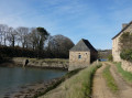
 6.96 mi
 +387 ft
 -384 ft
 3h 30
3h 30
 Moderate
 Departure from Pleudaniel (Côtes-d'Armor)
A pleasant route through the Pleudaniel countryside and along the Trieux, either overlooking it or running alongside it.Several beautiful wayside crosses mark this route, as well as two chapels.Discover a tide mill and oyster farming.
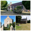
The three chapels of Plourivo (red route)
 Local authority
 7.19 mi
+446 ft
-440 ft
3h 45
Moderate
Departure from Plourivo (Côtes-d'Armor)
7.19 mi
+446 ft
-440 ft
3h 45
Moderate
Departure from Plourivo (Côtes-d'Armor)
The three chapels of Plourivo are finally united in a single hike! Lancerf overlooks the Trieux, Saint-Ambroise has its miraculous fountain, and Saint-Jean is nestled in the hamlet of Penhoat. Three chapels, three different environments. A modest heritage, but one worth discovering. Hike along the edges of fields, farm tracks and pine woods. Finish your tour by sitting down at a picnic table facing the Trieux, just across the railway line. The setting is peaceful and relaxing.
From Traounez to Frynaudour in the Bois de Penhoat-Lancerf
 6.21 mi
+518 ft
-525 ft
3h 20
Moderate
Departure from Plourivo (Côtes-d'Armor)
6.21 mi
+518 ft
-525 ft
3h 20
Moderate
Departure from Plourivo (Côtes-d'Armor)
A relatively easy hike, but with some elevation changes. Half of the route runs along the Trieux River, with higher sections offering views of Château de la Roche Jagu and even the Lézardrieux bridge in the distance.
In the woods of Penhouat-Lancerf
 5.49 mi
+482 ft
-489 ft
2h 55
5.49 mi
+482 ft
-489 ft
2h 55
 Easy
Departure from Plourivo (Côtes-d'Armor)
Easy
Departure from Plourivo (Côtes-d'Armor)
A magnificent walk through a pine forest. After following the Trieux river and passing through a tunnel through the hill, we walk alongside the Trieux tourist railway line to admire the chimneys of the Château de la Roche Jagu in the distance and reach the Saint-Jean Chapel. Don't be alarmed by the sound of gunshots: there is a clay pigeon shooting range nearby.
From Lancerf to the Trieux
8.16 mi
+636 ft
-636 ft
4h 20
Moderate
Departure from Plourivo (Côtes-d'Armor)
The magnificent Penhoat-Lancerf pine forest and the majestic banks of the Trieux are the two main attractions of this hike. In addition to the Lancerf Chapel, this hike allows you to discover the Maison de l'Estuaire. This is infamous because, in 1924, the Traou-Nez site belonged to Pierre Quemeneur and Guillaume Seznec had agreed to buy it: this is where one of the very first episodes of the Seznec Affair took place...
From Lédano to Lancerf, following the Trieux
 4.97 mi
+144 ft
-148 ft
2h 25
Easy
Departure from Paimpol (Côtes-d'Armor)
4.97 mi
+144 ft
-148 ft
2h 25
Easy
Departure from Paimpol (Côtes-d'Armor)
An easy walk along the water’s edge through a landscape typical of Goëlo. Half the route follows the banks of the Ria du Trieux, which is flooded by the sea with the tides.In the second part, you’ll walk through fields of vegetables (artichokes, cauliflowers, potatoes...) – crops that are emblematic of this rich agricultural region.Please note that parts of this route may be impassable during high tides.
Lézardrieux and the Trieux
 7.09 mi
+584 ft
-571 ft
3h 45
Moderate
Departure from Lézardrieux (Côtes-d'Armor)
7.09 mi
+584 ft
-571 ft
3h 45
Moderate
Departure from Lézardrieux (Côtes-d'Armor)
Lézardrieux is situated on the left bank of the Trieux estuary, which, together with the Jaudy, forms the Pleubian peninsula. This extends into the English Channel via the Sillon de Talbert. Furthermore, with the town of Tréguier to the west, Pontrieux to the south and Paimpol to the east, Lézardrieux is the ideal base from which to explore this part of the Trégor region, close to the Île de Bréhat.
This route allows you to discover the Trieux with its lighthouses as well as the Chapel of Kermaria.
Trieux Loop part 1 (Boucle du Trieux)
 5.20 mi
+436 ft
-446 ft
2h 45
Moderate
Departure from Paimpol (Côtes-d'Armor)
5.20 mi
+436 ft
-446 ft
2h 45
Moderate
Departure from Paimpol (Côtes-d'Armor)
Loop along part of the Trieux river towards the sea and back through the countryside.
La Roche Jagu Park and its surroundings
4.60 mi
+535 ft
-535 ft
2h 30
Easy
Departure from Ploëzal (Côtes-d'Armor)
A circular route starting from the car park at Château de la Roche Jagu, allowing you to explore the château grounds (open all year round), the surrounding countryside and the banks of the Trieux, whilst enjoying beautiful views of the river. The duration and distance are approximate; it all depends on how long you fancy wandering around the grounds.
Along the Trieux via the Penhoat woods
 11.08 mi
+1,063 ft
-1,070 ft
6h 00
Moderate
Departure from Plourivo (Côtes-d'Armor)
11.08 mi
+1,063 ft
-1,070 ft
6h 00
Moderate
Departure from Plourivo (Côtes-d'Armor)
Wander along the eastern bank of the Trieux through heathland, pine forests and magnificent viewpoints. You’ll be immersed in its unique historical and natural heritage: Château de la Roche-Jagu, flax drying sheds, the steam railway line, the Maison de l’Estuaire, and protected flora and fauna.
The cross-country trails of Plourivo (Orange Trail)
 7.18 mi
+564 ft
-564 ft
3h 50
Moderate
Departure from Plourivo (Côtes-d'Armor)
7.18 mi
+564 ft
-564 ft
3h 50
Moderate
Departure from Plourivo (Côtes-d'Armor)
This walk takes you through deciduous and coniferous woods where you can take the time to enjoy the cool air. You will also walk along farm tracks and past crops. After a few sections of road, which are nevertheless peaceful, you will return to the undergrowth and the coolness of the stream. This first part is fairly easy going. Then you will walk along the Leff river, with a few more technical sections, and the final climb will bring you to an unexpected finish. You will discover another part of the commune, not far from the Penhoat-Lancerf massif.
Walk through the heart of Trégor between Pouldouran and Troguéry
 4.91 mi
+171 ft
-154 ft
2h 25
Easy
Departure from Pouldouran (Côtes-d'Armor)
4.91 mi
+171 ft
-154 ft
2h 25
Easy
Departure from Pouldouran (Côtes-d'Armor)
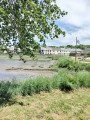
An easy walk offering typical landscapes between the river and the countryside, as well as numerous examples of Trégor’s heritage, including the famous flax-drying sheds, the cultivation of which brought prosperity to this corner of Trégor.
A journey back in time with the Trégor routoirs
 7.08 mi
+315 ft
-292 ft
3h 30
Moderate
Departure from Pouldouran (Côtes-d'Armor)
7.08 mi
+315 ft
-292 ft
3h 30
Moderate
Departure from Pouldouran (Côtes-d'Armor)
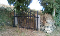
After walking along the Bizien Mill Stream, you will come across the first routoirs. Then, after crossing the Rolland Mill, there is a whole route to explore the main routoirs of the Trégorrois region.
Hent Glas route around Hengoat
 6.07 mi
+243 ft
-236 ft
3h 00
Moderate
Departure from Hengoat (Côtes-d'Armor)
6.07 mi
+243 ft
-236 ft
3h 00
Moderate
Departure from Hengoat (Côtes-d'Armor)
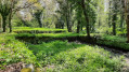
A walk through the Hengoat countryside: a peaceful, quiet route with no particular difficulty. You can take the time to listen, hear and admire the birds!
The route is well signposted; the blue markings were put in place by volunteers from the Glad war dro Hengoad association (Hengoat heritage). A map of the route is available outside the town hall at the start of the walk.
The sunken paths north of Hengoat
7.33 mi
+262 ft
-266 ft
3h 35
Moderate
Departure from Hengoat (Côtes-d'Armor)
Hengoat, a small commune in the Côtes-d’Armor whose name can be translated into French as “The Old Wood” (hen = old and goat = wood), was voted “Commune of the World” in 2012.
This route, which unfortunately runs on tarmac for too much of the way, allows you to explore the surroundings of this Breton village via some very beautiful sunken paths.