Country:

 City:
City:


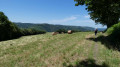
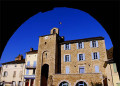
Car park, suitable for motorhomes, near the church and the town hall, at a place called La Ramade.
(S/E) Follow the signposts for the “Sentier le Luthier”. Walk up the small street, continue straight on and pass the church. Carry on towards Le Soulié. Cross a road, take the footpath and join another road at Las Garrigues.
(1) Carry on straight ahead along this road, heading due north, until you reach Pébiau.
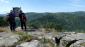
(2) Turn left between the houses, following the yellow signposts. Take the path leading to the Roc de Peyremouron through woods and over granite boulders. Ford a stream and arrive at the viewpoint.
(3) Take in the magnificent view. Retrace your steps back to Pébiau.
(2) Walk up the street on the left to La Borie de Mialhe, a drystone shelter.
(4) Pass between two houses, following the path leading to Armengaud.
(5) Go through the archway and turn right. About 200 metres further on, turn left towards Le Suquet. Walk downhill to a gate by a house, where you’ll need to take the path on the right until you reach a path on the left.
(6) Turn left to cross the stream. Head uphill following the yellow markings and arrive at Cabrespine.
(7) Cross the road and continue climbing straight ahead. Follow the path up to the summit, at a crossroads (elevation 710).
(8) Turn right onto the path, which becomes very gentle and descends steadily. Continue in this direction, keeping straight on at the various junctions, until you reach Ferrières.
(9) Cross the road, walk past the castle and continue down the narrow street. The path is signposted to the right of the last house and leads down to the river, which you cross via a small bridge. Walk back up to the D53.
(10) There are two options:
- either cross the road to take the path opposite, which leads back up to the road, and return to the right, via thePR®, in the opposite direction to the outward journey, back to the start (S/E).
- or, following the route, turn right and walk alongside the D53 to the car park (S/E).

 Tourist office
 Easy
Easy 
 Visorando Member
 Difficult