The Plos circular route via Ferrières

Hiking trail in the commune of Fontrieu, in Sidobre & Vallées in the Tarn – Occitanie.

Hiking trail at the gateway to the Pays Montanhol, where the stones tell the story of the Sidobre. Places to visit: the Museum of Protestantism and Ferrières Castle.

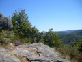
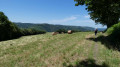
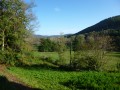
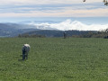
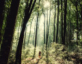
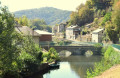
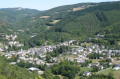
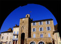
Start opposite the town hall annexe, at La Ramade. A walk through woodland, fields and meadows, with numerous viewpoints. Magnificent panoramic views of the Monts de Lacaune, the Sidobre, the Montagne Noire and the Pyrenees. The route passes through the village of Ferrières, where you can see the château and the watermills, and follow the route of the little train that operated until 1962, which had opened up this entire hilly region.

Details

73023185
Creation:
Last update:
Last review:
  • Walking
    Activity: Walking
  • ↔
    Distance: 8.99 mi
  • ◔
    Average duration: 5h 15 
  • ▲
    Difficulty: Moderate

  • ⚐
    Back to start: Yes
  • ↗
    Ascent: + 1,325 ft
  • ↘
    Descent: - 1,302 ft

  • ▲
    Highest point: 2,418 ft
  • ▼
    Lowest point: 1,398 ft

Photos

Description of the walk

Car park opposite the town hall, at La Ramade, near Ferrières.

(S/E) Take the small road that passes beneath the church. Ignore a path on the right. Walk through the hamlet of Le Soulié and, at the cross, continue along the path lined with standing stones, opposite. Join the road and follow it to the left as far as Pébiau. Turn right into the hamlet to leave it.

(1) Take the path on the left. The path joins a stony track which you should follow uphill. Here begins a walk through woods, fields and meadows, with numerous views. Continue straight ahead until you reach a three-way junction in the path opposite (junction with the Puèch de Bourion path not far away).

(2) Carry on straight ahead along the grassy track between two fields. The path passes through woodland before joining a forest track. Follow it to the right until you reach a small road. 

(3) Then turn left and walk through the hamlet of La Canipèze. Take the path on the left. The path narrows and winds through the woods to Cazalits.

(4) Walk through the hamlet, keeping to the right, and, at the D66, continue straight ahead, then immediately turn right. The track climbs up to the ridge path. You’ll come to a four-way junction.

(5) Turn right. This track marks the boundary between the former communes of Ferrières and Castelnau-de-Brassac, now merged under the name Fontrieu. As you descend, you can enjoy magnificent panoramic views of the Monts de Lacaune, the Sidobre, the Montagne Noire and the Pyrenees. Walk past a menhir statue. You’ll come to a crossroads.

(6) Ignore a path on the right. Pass the hunters’ hut and, at the next junction, continue to the left. After the farm buildings, follow the road to the right.

(7) Follow this road, ignore a path on the left, and take the track beneath Travez Castle. Join a track, which you should follow to the left, passing the houses at Vaissassou, and join the D53. 

(8) Follow the road to the right as far as Ferrières Castle. Take the footpath on the left, beneath the road, cross the road, then follow it to the right until you reach the forecourt of the old narrow-gauge railway station. View of the mills at Ferrières and Record.

(9) Follow the railway track to the right. Go through the tunnel and continue. View of the Agout, transformed into a rocky stream. You’ll come to a Fork in the road.

(10) Follow the small path which climbs to the right, pass over the penstock, and join another path. Descend to the left, cross the stream, and climb back up to the D53. Follow the road to the right until you reach the car park (S/E).

Waypoints

  1. S/E : mi 0 - alt. 1,644 ft - La Ramade Town Hall
  2. 1 : mi 0.58 - alt. 1,919 ft - The hamlet of Pébiau
  3. 2 : mi 1.41 - alt. 2,116 ft - Three-way junction
  4. 3 : mi 2.39 - alt. 1,962 ft - Route
  5. 4 : mi 3.19 - alt. 2,254 ft - Casalits
  6. 5 : mi 3.83 - alt. 2,418 ft - junction
  7. 6 : mi 4.58 - alt. 2,323 ft - Fork in the road towards the hunters’ hut
  8. 7 : mi 5.93 - alt. 2,113 ft - Route
  9. 8 : mi 6.87 - alt. 1,801 ft - Ferrières Castle
  10. 9 : mi 7.42 - alt. 1,509 ft - D53, esplanade of the old railway station - Agout (rivière)
  11. 10 : mi 8.13 - alt. 1,411 ft - Crossroads
  12. S/E : mi 8.99 - alt. 1,644 ft - La Ramade Town Hall

Notes

Start: Picnic area carpark

Finish: same place as the start

Towns: Fontrieu

Road access and parking: via the D53 or the D66

Parking: in the car park at the picnic area opposite Ferrières Town Hall

Worth a visit

Accommodation

Museum of Protestantism

Reviews and comments

4.5 / 5
Based on 3 reviews

Reliability of the description
4.5 / 5
Ease of following the route
4.7 / 5
Route interest
4.3 / 5
Marc40
Marc40

Overall rating : 4.7 / 5

Date of your route : Jun 14, 2026
Reliability of the description : ★★★★★ Very good
Ease of following the route : ★★★★★ Very good
Route interest : ★★★★☆ Good
Very busy route : No

A fairly varied route with lovely scenery, mostly shaded and therefore pleasant in hot weather. Very well signposted.
The descent from Ferrières towards the Agout, on the south-facing slope, is blocked by fallen trees. It’s a shame this hasn’t been cleared.

Machine-translated

henri auriol
henri auriol

Overall rating : 4.7 / 5

Date of your route : Jun 16, 2025
Reliability of the description : ★★★★☆ Good
Ease of following the route : ★★★★★ Very good
Route interest : ★★★★★ Very good
Very busy route : No

Well done to those who marked the route.
I recommend this route in hot weather, as it is mostly shaded.

Machine-translated

annemeu
annemeu

Overall rating : 4 / 5

Date of your route : Jun 09, 2025
Reliability of the description : Not used / Not applicable
Ease of following the route : ★★★★☆ Good
Route interest : ★★★★☆ Good
Very busy route : No

Superb walk. Varied landscapes. Not difficult (just a little longer than a short walk).

Machine-translated

Other walks in the area

For more walks, use our search engine .

The GPS track and description are the property of this route's author. Please do not copy them without permission.