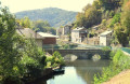
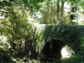
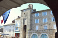
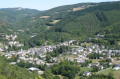
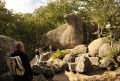
The ridges of the Bau del Poun from Vabre

Hike in Vabre in the Tarn – Destination Sidobre & Vallées.

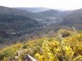
Set between the river and the ridge path, this trail will charm you with its many vantage points and panoramic view of the village of Vabre.

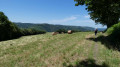
A hiking trail in the heart of nature, running alongside the River Gijou, largely shaded, and offering magnificent views along the ridge path.
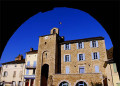
You can also enjoy a visit to the village of Vabre, with its13th-century belfry, its Maquis exhibition, its temple and its many restored wash houses (guided tours are available in July and August on Tuesday mornings; bookings can be made at the tourist office).

Details

72989447
Creation:
Last update:
Last review:
  • Walking
    Activity: Walking
  • ↔
    Distance: 5.74 mi
  • ◔
    Average duration: 3h 25 
  • ▲
    Difficulty: Easy

  • ⚐
    Back to start: Yes
  • ↗
    Ascent: + 843 ft
  • ↘
    Descent: - 869 ft

  • ▲
    Highest point: 1,854 ft
  • ▼
    Lowest point: 1,155 ft

Photos

Description of the walk

Start from the Place du Maquis.

(S/E) Follow the main street to the left, pass the town hall, and cross the bridge. Go down the steps at the station (which no longer exists), and turn left onto the ‘petit train’ path. After a few hundred metres, the tarmac path becomes a stony track. You’ll arrive at the Pont del Ga.

(1) Cross the Pont del Ga and go through the tunnel to join the D 171.

(2) Continue to the left. Turn left downhill after the second left-hand bend. Cross the small bridge over the Gijou, then head back up to the left along the sunken path until you reach the road.

(3) Carry on to the right to reach the fork in the path, between the short route and the long route. For the short route, see the practical information. For the long route, carry on along the grassy path to the right. Cross the D 53, and head up the small road; before the house, take the fairly steep path on the right to reach the road.

(4) Follow the road to the right, then, opposite, take the stony track, which narrows and descends towards the hamlet of Caynac.

(5) Head up the first path on the right, then, straight ahead, take the road to the TV relay station. At the last house, take the path on the left and join the ridge path, which you should follow to the left until you rejoin the road for the short route.

(6) Continue straight on until you reach a three-way junction.

(7) Take the path on the left which descends to the D 55. Turn left and head for the car park via the bridge over the Gijou on the right. At the end, first turn right then left, and head for the car park (S/E).

Waypoints

  1. S/E : mi 0 - alt. 1,211 ft - Place du Maquis
  2. 1 : mi 0.8 - alt. 1,161 ft - Pont del Ga and tunnel - Gijou (rivière)
  3. 2 : mi 1.13 - alt. 1,257 ft - D171
  4. 3 : mi 1.97 - alt. 1,414 ft - Route
  5. 4 : mi 2.42 - alt. 1,781 ft - Route
  6. 5 : mi 2.74 - alt. 1,752 ft - Caynac
  7. 6 : mi 3.46 - alt. 1,768 ft - Junction with the short route
  8. 7 : mi 4.66 - alt. 1,634 ft - Three-Way Junction
  9. S/E : mi 5.74 - alt. 1,211 ft - Place du Maquis

Notes

Start: Place du Maquis

Finish: same place as the start

Towns: Vabre

Road access and car park

From Castres via the D5
From Lacaune via the D171
From Brassac via the D53

Parking: Vabre on the Place du Maquis next to the church – GPS: 43.693003, 2.425250

Public transport: Route 766 Castres – Vabre – Lacaune

Short route: continue along the road to the left, then turn left again onto the D53. After the bend in the road, follow the path leading uphill to the right, cross the road and take the path opposite which winds its way uphill through the woods. When you reach the road, turn left and join the ridge path.

Worth a visit

restaurant (in Vabre)

Café (in Vabre)

Accommodation

swimming pool (in Vabre) 

Reviews and comments

4.3 / 5
Based on 2 reviews

Reliability of the description
4 / 5
Ease of following the route
5 / 5
Route interest
4 / 5
Patrice09
Patrice09

Overall rating : 4.3 / 5

Date of your route : Jun 20, 2026
Reliability of the description : ★★★★☆ Good
Ease of following the route : ★★★★★ Very good
Route interest : ★★★★☆ Good
Very busy route : No

A short stretch along the old railway line (a tunnel) followed by a steep climb up to the hills. A pleasant route with some lovely shaded sections. A beautiful view of Vabre. A long, easy descent on the way back.

Machine-translated

jp11
jp11

Overall rating : 4.3 / 5

Date of your route : Aug 05, 2025
Reliability of the description : ★★★★☆ Good
Ease of following the route : ★★★★★ Very good
Route interest : ★★★★☆ Good
Very busy route : No

On a hot summer day, this is a pleasant walk as it is often shaded.

Machine-translated

Other walks in the area

For more walks, use our search engine .

The GPS track and description are the property of this route's author. Please do not copy them without permission.