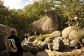
The Berlou ridges from Vabre

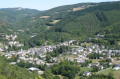
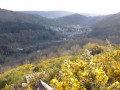
Hike in Vabre in the Tarn. Destination: Sidobre & Valleys. Caminols de Berlon. The route starts in Vabre, a village with a rich heritage. The path continues along the Gijou valley and then the Berlou valley, passing through its pretty hamlets. After La Reloc, the route leaves the valley to climb through the forest towards the ridges. From the ridges, as you descend towards Vabre, you can enjoy the views over the Berlou valley, the Montagnol forest, then the Gijou valley and Vabre. 
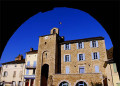
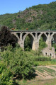
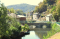
In Vabre, you’ll discover a rich heritage: the ‘Trauc de la Campana’ (a13th-century belfry), the church (one of the largest in France), listed17th-century houses, the Pont Neuf (1850), an exhibition on the Maquis (mornings in July and August) and wash houses.

Details

73032404
Creation:
Last update:
Last review:
  • Walking
    Activity: Walking
  • ↔
    Distance: 7.20 mi
  • ◔
    Average duration: 4h 20 
  • ▲
    Difficulty: Moderate

  • ⚐
    Back to start: Yes
  • ↗
    Ascent: + 1,207 ft
  • ↘
    Descent: - 1,237 ft

  • ▲
    Highest point: 2,139 ft
  • ▼
    Lowest point: 1,161 ft

Photos

Description of the walk

Parking available at Place du Maquis near the church in Vabre. See Practical Information.

(S/E) From Place du Maquis, with your back to the church, turn right and follow the main road to the left, then right past the old town hall and immediately turn left onto Route de Lacaune. Pass Route de la Mouline on your right (which links to the Puech de Bourrion trail) and continue straight on, past the fish farm.

(1) After the fish farm, turn right onto Rue de Lastende. Follow the track which climbs to the left and, at the hairpin bend, take the path leading off to the right. You’ll reach the road.

(2) Continue to the right along Chemin de la Rivière. Pass the former Mouline lodges (junction with the Trois Vallées walk), then carry on to the hamlet of La Rivière.

(3) Pass the junction for the short route on your left and carry on to La Courrège. Walk under the buildings and over the bridge, go up to the right then follow the path that climbs to the left. Pass the Chemin de la Reloc on your left and enter the woods. Ignore a path on your right and climb up to a wide track. 

(4) Pass the path linking to the Sentier de la Forêt de Montagnol on your right and turn left; then, at the junction, turn right up the winding path and climb up to the track on the ridges.

(5) Turn left. After a few hundred metres, pass the junction with the Sentier de la Razigade on your right and continue to follow the ridges. You’ll come to a Fork in the road.

(6) At the track, leave the junction with the Sentier de la Razigade on your right and turn left. All along the ridges, there are beautiful views over the Berlou valley and Vabre. You willthen reachanother junction.

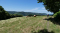
(7) Pass the junction with the short route on your right, continue alongside the meadows and climb towards the summit overlooking Vabre. Then begin the descent towards the village. The path crosses a track, rejoins it further on, then leaves it again before rejoining it once more. Continue to the hairpin bend.

(8) Carry on and, after the second hairpin bend, leave the junction with the Trois Vallées walk on your left and continue down to the Salès housing estate, at the crossroads you passed on the way out.

(2) Follow the road to the right, then turn right again at the bend and continue to a Fork in the road.

(9) Pass the junction for the Trois Vallées walk on your left and turn sharply left. You will come out onto the Route de Lacaune.

(1) Turn left and head back to the village and the car park via the reverse route of the outward journey (S/E).

Waypoints

  1. S/E : mi 0 - alt. 1,211 ft - Place du Maquis
  2. 1 : mi 0.36 - alt. 1,181 ft - Fish farm - Gijou (rivière)
  3. 2 : mi 0.67 - alt. 1,335 ft - Route
  4. 3 : mi 1.99 - alt. 1,302 ft - La Rivière
  5. 4 : mi 3.31 - alt. 1,693 ft - Track, connecting path
  6. 5 : mi 4.04 - alt. 2,090 ft - Crête, Razingade trail
  7. 6 : mi 4.43 - alt. 2,080 ft - Junction
  8. 7 : mi 5.25 - alt. 1,831 ft - Connection to the short route
  9. 8 : mi 6.11 - alt. 1,568 ft - Pin
  10. 9 : mi 6.68 - alt. 1,276 ft - Junction with the Trois Vallées walk - Gijou (rivière)
  11. S/E : mi 7.2 - alt. 1,211 ft - Place du Maquis

Notes

Towns: Vabre, Lacaze

Parking:

Vabre, on Place du Maquis next to the church – GPS co-ordinates for car park: 43.693003, 2.425250

Road access and car park:

From Castres: D55
From Lacaune: D171
From Brassac: D53

Transport:

Bus route 766 Castres – Vabre – Lacaune

Departure/Arrival: Placedu Maquis

Worth a visit

Café (in Vabre)

Restaurant (in Vabre)

Accommodation (in Vabre)

Supermarket (in Vabre)

Reviews and comments

4.3 / 5
Based on 2 reviews

Reliability of the description
4.5 / 5
Ease of following the route
4 / 5
Route interest
4.5 / 5
Aigle noir
Aigle noir

Overall rating : 4 / 5

Date of your route : Nov 10, 2025
Reliability of the description : ★★★★☆ Good
Ease of following the route : ★★★★☆ Good
Route interest : ★★★★☆ Good
Very busy route : No

A beautiful hike in fine weather, with a good climb up to the Berlou ridges, but the reward is a magnificent view of the gorges below and the hills opposite. The route is easy to follow and well worth doing.

Machine-translated

maxcaviso
maxcaviso

The previous review concerns a hike in Lacaune called Boucle au départ de Lacaune.
I am unable to delete this review, which was posted in error.

Machine-translated

maxcaviso
maxcaviso

Overall rating : 4.7 / 5

Date of your route : Jun 16, 2025
Reliability of the description : ★★★★★ Very good
Ease of following the route : ★★★★☆ Good
Route interest : ★★★★★ Very good
Very busy route : No

A pleasant and interesting route with varied terrain.
At WP 2, take care not to miss the Rocher des Ecus, which is on your right before you turn left.
The crossing of the Plo de la Lauze is lovely; there were no herds when we passed through, but if there are any…
You don’t need to climb over any barbed wire; these are removable barriers.
It’s impossible to park at the spinning mill, but there’s a car park before Rue de Peyruc, almost at the start of the signposted route.

Machine-translated

Other walks in the area

For more walks, use our search engine .

The GPS track and description are the property of this route's author. Please do not copy them without permission.