Country:

 City:
City:


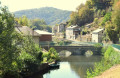
Park your car after the bridge over the Agout, on the D66. There is a picnic area and a good car park.
(S/E) The start of the walk is to the right of the bridge. Cross the road leading up to Ferrières to join the path – which is very wide and flat – that follows the route of the old narrow-gauge railway. It’s an excellent way to warm up. The trail is marked in yellow. Once you reach the Lusières Bas power station, cross the road and continue straight on until you reach the hamlet of Le Bouissas.
(1) At a hairpin bend, turn right onto the uphill road, then leave this very quickly and turn off onto a small path on the right. The path climbs, winding its way up a series of steep hairpin bends, before emerging at the Térondel rugby ground. Walk round the ground, cross the hamlet and continue to a multi-way junction.
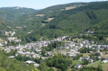
(2) Do take a moment to look back and enjoy the lovely view of Térondel. Carry on straight ahead along the steeply ascending road, passing Lusières Haut.
(3) At the end of the road, at a bend, leave the road and carry on straight ahead along a wide track. Follow the yellow markings, which are consistently excellent. Continue climbing through the forest, heading generally north-east and ignoring several paths branching off to the right and left. You’ll reach the entrance to the hamlet of Bautinès.
(4) Do not continue along the road but turn right onto a path, which narrows, bends to the left and passes in front of a very beautiful stone house.
(5) Immediately afterwards, turn right onto a small, uphill road (yellow arrow at the corner). Follow the yellow markings and ignore several turn-offs to the right. Keep heading generally east and continue along the path, which bends several times before levelling out as it reaches a plateau and comes to a Fork in the road.
(6) Turn right. The path is almost level, giving you a chance to catch your breath. Pass four paths branching off to the right in succession, and you’ll reach a crossroads.
(7) Carry straight on and join another path coming from the right.
(8) Carry on straight ahead and now follow the blue and white signposting, which is just as good as the previous one. About a hundred metres before a four-way junction, turn right at a 90° angle and you’ll come out onto a small road, just before the hamlet of La Canipèze.
(9) Turn left, cross the hamlet and carry on until the second right-hand bend.
(10) Leave the road and head up a path on the left, which soon rejoins the tarmac.
(11) Do not follow the road but turn immediately left (180°) onto a path that quickly leads to Casalits. In the hamlet, turn right and follow the small road to the junction with the D66.
(12) Cross over and continue straight ahead for about a hundred metres, then turn right, continuing to follow the blue and white markings. You’ll reach a four-way junction.
(13) Turn right at a 90° angle and walk for about 200 metres (large holly bush on your right).
(14) At this point, turn left and follow the path leading to a small road, not far from Combe Ginestouse, another pretty hamlet. Turn left and follow the road to the junction with the D155.
(15) Turn right and follow this road for about 2.5 km, until you reach a small bridge over the Vernoubre.
(16) Do not cross the bridge; instead, turn right onto a wide, gently ascending track. Ignore the first track branching off to the left and heading downhill.
(17) Turn left onto the next track. The path becomes less and less marked, but the route is clear. Cross a tiny stream and pass through a cleared area before coming out onto a track leading downhill.
(18) Turn left, pass by a pylon and arrive at the hamlet of Valès Haut.
(19) At the first junction, turn right down a steep slope, then continue straight on along the road. Pass through Valès Bas and, once you reach Le Pujol, turn right to join the D53 almost opposite a fish farm.
(20) Turn right onto the D53 (take care), which you leave after about 800 metres to follow a small road on the left towards Maynadier. Keep to the right about a hundred metres further on to follow a wide track that passes to the north of the hamlet and leads to a hairpin bend.
(21) Carry on straight ahead, rejoining the route of the old narrow-gauge railway, as at the start, and follow it back to the car park (S/E).



 Visorando Member
 Moderate
 Tourist office
 Easy
Easy