The Shepherds’ Trail and Peyremourou

Hiking trail in Fontrieu in Sidobre & Vallées in the Tarn – Occitanie.

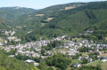
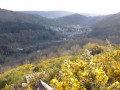
Start with a game of the goose, followed by a lovely climb amongst the rocks, culminating in a magnificent viewpoint.

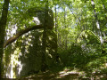
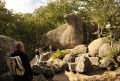
After a game of the Game of the Goose, you’ll set off to explore the Roc de Peyremourou, a former ‘shaking rock’ that toppled over in the early20th century. It was nevertheless listed in 1921 as it remains unique in the Sidobre region.
On the way, stop off at the old shepherds’ hut.
Not to be missed: the Museum of Protestantism, ‘From the Reformation to Secularism’

Details

73095668
Creation:
Last update:
Last review:
  • Walking
    Activity: Walking
  • ↔
    Distance: 2.38 mi
  • ◔
    Average duration: 1h 30 
  • ▲
    Difficulty: Easy

  • ⚐
    Back to start: Yes
  • ↗
    Ascent: + 417 ft
  • ↘
    Descent: - 407 ft

  • ▲
    Highest point: 1,998 ft
  • ▼
    Lowest point: 1,650 ft

Photos

Description of the walk

Park at the motorhome site near the town hall.

(S/E) From the town hall, take the small road that goes uphill next to it (follow signs for Peyremourou) until you reach the bend.

(1) At the bend, carry straight on along the dirt and stone track until you reach a small road.

(2) Keep left onto this road until you reach the hamlet of Pébiau.

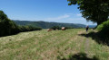
(3) Head straight on down the narrow lane, following signs for Peyremourou. Carry on to the viewpoint.

(4) After enjoying the view from the Peyremourou rock, turn back and head back to the car park via the same route (S/E).

Waypoints

  1. S/E : mi 0 - alt. 1,650 ft - Motorhome parking area near the town hall
  2. 1 : mi 0.21 - alt. 1,703 ft - Bend
  3. 2 : mi 0.32 - alt. 1,781 ft - Narrow road
  4. 3 : mi 0.49 - alt. 1,857 ft - Pebiau hamlet
  5. 4 : mi 1.19 - alt. 1,998 ft - Peyremouron
  6. S/E : mi 2.38 - alt. 1,650 ft - Motorhome parking area near the town hall

Notes

Start: car park opposite the Town Hall annexe at La Ramade

End point: Rocher de Peyremourou

Towns: Fontrieu

Road access and car park: via the D53

Parking: in the car park at the picnic area opposite the Town Hall annexe – GPS: 43.6618, 2.4485

Transport: to Vabre or Brassac

Worth a visit

Accommodation

Reviews and comments

4.5 / 5
Based on 2 reviews

Reliability of the description
4.5 / 5
Ease of following the route
4.5 / 5
Route interest
4.5 / 5
User 3104922

Overall rating : 4 / 5

Date of your route : Aug 27, 2025
Reliability of the description : ★★★★☆ Good
Ease of following the route : ★★★★☆ Good
Route interest : ★★★★☆ Good
Very busy route : Yes

The luthier's loop disrupts the shepherd's path when reaching the viewpoint
No information on time and distance if you take the luthier's path

Machine-translated

jp11
jp11

Overall rating : 5 / 5

Date of your route : Jul 31, 2025
Reliability of the description : ★★★★★ Very good
Ease of following the route : ★★★★★ Very good
Route interest : ★★★★★ Very good
Very busy route : Yes

Granite blocks, forests, small villages that are more or less abandoned: everything that makes Sidobre so charming.
This round trip can be connected to the luthier's loop

Machine-translated

Other walks in the area

For more walks, use our search engine .

The GPS track and description are the property of this route's author. Please do not copy them without permission.