In the footsteps of the Maquis fighters at Puèch de Bourion

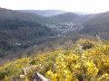
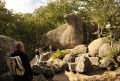
Walk in Vabre in the Tarn – Destination Sidobre & Vallées, also known as the Camin del Puèg de Borion. A lovely path winding through the countryside and lined with hamlets, where you’ll be treated to several beautiful panoramic views. After the hamlet of Brugairoles, you’ll pass some ruins where you can admire two beautiful granite arches.
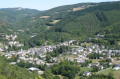
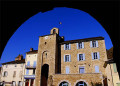
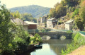
At the end of the walk, take some time to stroll through the charming village of Vabre and explore its belfry – the Trauc de la Campana – its church, its various restored wash houses and the local specialities on offer in the shops.

Details

72995498
Creation:
Last update:
Last review:
  • Walking
    Activity: Walking
  • ↔
    Distance: 7.04 mi
  • ◔
    Average duration: 4h 10 
  • ▲
    Difficulty: Moderate

  • ⚐
    Back to start: Yes
  • ↗
    Ascent: + 1,109 ft
  • ↘
    Descent: - 1,109 ft

  • ▲
    Highest point: 2,185 ft
  • ▼
    Lowest point: 1,171 ft

Photos

Description of the walk

Parking on Place du Maquis next to the church.

(S/E) Follow the main road (D55) to the left, then turn right down Rue de Vabrez until you reach Chemin de la Mouline (towards Lacaze).

(1) Turn right onto the latter. Take the road branching off to the right, heading uphill towards Brugairoles. Pass a track on the right, go past the village’s drinking water reservoirs and turn right onto a track. Pass two tracks on the right and go past the houses in Brugairoles to reach a track.

(2) Ignore the track on the left and carry on straight ahead. Pass some ruins, featuring two fine granite arches. Ignore the two paths on the right and continue uphill. Ignore a track on the left and pass some more ruins. At the top, take the second path on the left. Ignore a footpath on the left and reach a Fork in the road.

(3) Turn right. After the timber landing, follow the path straight ahead. Cross a stream, pass a path on the right and reach the Puech de Bourion junction.

(4) Turn right. Pass two paths on the left and continue to a third Fork in the road.

(5) Turn left. Pass a path on the left, then one on the right. At the next junction, turn right. You’ll reach the road and pass the houses of Beautinés.

(6) Continue downhill. After the second hairpin bend, follow the path to the right. Pass above Bombepanse and then L’Albiguier, and emerge in the middle of the orchards. Pass between the first houses, then turn left towards the police station.

(7) After the police station, turn right onto Rue Principale and head down to the car park (S/E).

Waypoints

  1. S/E : mi 0 - alt. 1,211 ft - Place du Maquis - Gijou (rivière)
  2. 1 : mi 0.22 - alt. 1,175 ft - Chemin de la Mouline - Gijou (rivière)
  3. 2 : mi 1.58 - alt. 1,745 ft - Track
  4. 3 : mi 2.89 - alt. 2,113 ft - Junction
  5. 4 : mi 3.89 - alt. 2,136 ft - Junction for the Puech de Bourion
  6. 5 : mi 4.76 - alt. 2,126 ft - Fork in the road
  7. 6 : mi 5.59 - alt. 1,699 ft - Beautinés
  8. 7 : mi 6.72 - alt. 1,266 ft - Police station
  9. S/E : mi 7.04 - alt. 1,211 ft - Place du Maquis - Gijou (rivière)

Notes

Departure: Place du Maquis

Arrival: Same place as departure

Towns: Vabre, Fontrieu

Road access and parking:

From Castres via the D5
From Lacaune via the D171
From Brassac via the D53

Parking:

Vabre, on the Place du Maquis next to the church

Transport:

Bus route 766: Castres – Vabre – Lacaune

Worth a visit

This nature trail, dotted with several beautiful viewpoints, will take you through the Vabre countryside, nestled between the hills and the valley.

Café (in Vabre)

Restaurant (in Vabre)

Supermarket (in Vabre)

Swimming pool (in Vabre)

Accommodation (in Vabre)

Reviews and comments

3.9 / 5
Based on 3 reviews

Reliability of the description
4.3 / 5
Ease of following the route
4.3 / 5
Route interest
3 / 5
Aigle noir
Aigle noir

Overall rating : 3.7 / 5

Date of your route : Dec 22, 2025
Reliability of the description : ★★★★☆ Good
Ease of following the route : ★★★★☆ Good
Route interest : ★★★☆☆ Average
Very busy route : No

Far too much tarmac and tracks on the first third of the hike, then a lovely stretch through the forest. An enjoyable hike, well signposted.

Machine-translated

sofiou
sofiou

Overall rating : 4 / 5

Date of your route : Jul 28, 2025
Reliability of the description : ★★★★☆ Good
Ease of following the route : ★★★★★ Very good
Route interest : ★★★☆☆ Average
Very busy route : No

A bit disappointing in the first half (tarmac then very straight tracks), but it gets better after that, though it's not exactly an adventure. Very beautiful vegetation, as is often the case in this area.

Machine-translated

jeanmarieeliane
jeanmarieeliane

Overall rating : 4 / 5

Date of your route : May 18, 2025
Reliability of the description : ★★★★★ Very good
Ease of following the route : ★★★★☆ Good
Route interest : ★★★☆☆ Average
Very busy route : No

Very good in hot weather, mostly in the shade

Machine-translated

Other walks in the area

For more walks, use our search engine .

The GPS track and description are the property of this route's author. Please do not copy them without permission.