


Refine your search for walks in Saint-Salvadou
Saint-Salvadou walks

 Between Lézert and Serènes
 Local authority
 24.12 mi
 +2,661 ft
 -2,657 ft
 4 hrs
4 hrs
 Difficult
 Departure from La Bastide-l'Évêque (Aveyron)
A mountain bike route to explore the Bas Ségala area, criss-crossed by the picturesque streams of the Lézert and the Serènes. This route connects the villages of La Bastide-l’Évêque, Saint-Salvadou and Vabre-Tizac. Alternative routes allow the route to be split into two sections for walking tours.
 Route of the Seven Crosses
 Visorando Member
 4.44 mi
+463 ft
-459 ft
2h 25
4.44 mi
+463 ft
-459 ft
2h 25
 Easy
Departure from Sanvensa (Aveyron)
Easy
Departure from Sanvensa (Aveyron)
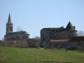
Circling the village of Sanvensa, this route will take you past seven crosses, a church, a castle and a chapel. The view over the Monteils valley is a highlight of this walk.
Le Cayla
 10.02 mi
+1,296 ft
-1,312 ft
5h 45
10.02 mi
+1,296 ft
-1,312 ft
5h 45
 Moderate
Departure from La Bastide-l'Évêque (Aveyron)
Moderate
Departure from La Bastide-l'Évêque (Aveyron)
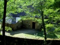
Passing by the Tower and the Roman bridge of Cayla, come and discover these wild valleys of the Aveyron and Lézert rivers.
Cabanes and Les Martinets du Lézert
 3.29 mi
+387 ft
-397 ft
1h 50
Easy
Departure from La Bastide-l'Évêque (Aveyron)
3.29 mi
+387 ft
-397 ft
1h 50
Easy
Departure from La Bastide-l'Évêque (Aveyron)
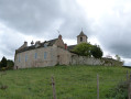
This route allows you to discover the rich heritage and natural beauty around La Bastide-l’Évêque: the episcopal bastide founded in the 13th century and its characteristic church, the 16th-century Château de Réquista, the traditional village of Cabanes, the typical landscapes and hamlets, as well as the remarkable heritage of the Martinets du Lézert copper forges.
Around La Bessière and Pont de Vézis
 4.43 mi
+791 ft
-817 ft
2h 45
Easy
Departure from La Bastide-l'Évêque (Aveyron)
4.43 mi
+791 ft
-817 ft
2h 45
Easy
Departure from La Bastide-l'Évêque (Aveyron)
A route to discover the diversity of the landscapes and architecture around La Bastide l’Évêque: the picturesque village of La Bessière; the Pont de Vézis, a bridge dating from the early 20th century built to support the commune’s mining industry; and the plateaus offering magnificent views over the Ségala and the unspoilt valleys of the Lézert and the Aveyron.
The Bardeliers Trail
 6.10 mi
+1,070 ft
-1,024 ft
3h 45
Moderate
Departure from La Bastide-l'Évêque (Aveyron)
6.10 mi
+1,070 ft
-1,024 ft
3h 45
Moderate
Departure from La Bastide-l'Évêque (Aveyron)
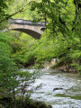
This route, running between the Lézert Valley, the Aveyron Gorges and the Ségala Plateau, allows you to explore the landscapes and villages that have been shaped over time around La Bastide l’Évêque.
Le Cheval du Roi and the Saint-Amans de Cadoule Chapel from Flauzins
 9.00 mi
+1,568 ft
-1,552 ft
5h 30
Moderate
Departure from Lescure-Jaoul (Aveyron)
9.00 mi
+1,568 ft
-1,552 ft
5h 30
Moderate
Departure from Lescure-Jaoul (Aveyron)
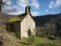
On the edge of the Viaur valley, this rural hike offers a variety of pleasures. History buffs will not be indifferent to the various sites visited: the Mégalithe du Cheval du Roi, the Chapelle Saint-Amans de Cadoule and, finally, the Roman bridge at Bergougnoux. Nature lovers, meanwhile, will be delighted by the many panoramic views stretching as far as the Monts du Cantal and the Pyrenees, a real treat for the eyes.
The Cayla Bridge circular from Cadour
 5.73 mi
+1,043 ft
-1,060 ft
3h 35
Moderate
Departure from La Bastide-l'Évêque (Aveyron)
5.73 mi
+1,043 ft
-1,060 ft
3h 35
Moderate
Departure from La Bastide-l'Évêque (Aveyron)
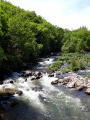
A beautiful hike in the heart of the wild gorges of the Aveyron, following in the footsteps of a distant past, of which the Pont du Cayla is a magnificent reminder. Panoramic views of the Aveyron valley and a walk along the riverbank.
Route of mills in Villefranche-de-Rouergue
3.03 mi
+453 ft
-453 ft
1h 45
Easy
Departure from Villefranche-de-Rouergue (Aveyron)
An easy family route along the banks of the Aveyron and the hills above Villefranche-de-Rouergue, where you’ll discover charming mills and a beautiful view of the town.
From Mauron to Pont de Vézis
 3.44 mi
+850 ft
-850 ft
2h 20
Moderate
Departure from Maleville (Aveyron)
3.44 mi
+850 ft
-850 ft
2h 20
Moderate
Departure from Maleville (Aveyron)
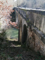
A beautiful hike through the side valleys of the Aveyron valley, taking you from the highest point of Le Mauron (at the water tower) to the lowest (along the Aveyron).
The Devil’s Bridge from Bor-et-Bar
 2.58 mi
+581 ft
-581 ft
1h 40
Moderate
Departure from Bor-et-Bar (Aveyron)
2.58 mi
+581 ft
-581 ft
1h 40
Moderate
Departure from Bor-et-Bar (Aveyron)
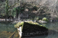
A short walk offering magnificent views of a little-visited part of the Viaur Valley. The path provides access, via a 100-metre detour, to the remains of the ancient Pont du Diable, which was swept away by a flood in 1786.
Planet trail on the Causse
 5.32 mi
+676 ft
-659 ft
3h 00
Easy
Departure from La Rouquette (Aveyron)
5.32 mi
+676 ft
-659 ft
3h 00
Easy
Departure from La Rouquette (Aveyron)
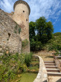
The loop first follows a model of the solar system on a scale of 1/2 billionth along the GR®36, then plunges into the Assou valley to discover the natural and vernacular heritage of the commune of La Rouquette. The route features numerous information panels describing the landscapes you will encounter, their history and the local heritage. The hike also passes through a wetland rich in plants and animals typical of these environments.
Viaur Valley
 12.20 mi
+1,493 ft
-1,447 ft
6h 55
Difficult
Departure from La Salvetat-Peyralès (Aveyron)
12.20 mi
+1,493 ft
-1,447 ft
6h 55
Difficult
Departure from La Salvetat-Peyralès (Aveyron)
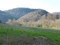
A walk along the Viaur, through rivers, woods and plateaus.
Loop around the village of Saint-André-de-Najac
3.72 mi
+525 ft
-528 ft
2h 10
Easy
Departure from Saint-André-de-Najac (Aveyron)
Short circular walk around the village of Saint-André-de-Najac through woods and countryside.
Hiking trail no. 2
From the Vicasse bridge to Laguarde Viaur
 7.01 mi
+479 ft
-479 ft
3h 40
Moderate
Departure from Montirat (Tarn) (Tarn)
7.01 mi
+479 ft
-479 ft
3h 40
Moderate
Departure from Montirat (Tarn) (Tarn)
Wild and secretive, the Viaur valley reveals its charms only to the most curious. The Viaur flows peacefully, surrounded by deep gorges and dotted with numerous mills and swimming areas.
Towards the Pontal and Bouscal mills in Saint-André-de-Najac
 5.28 mi
+781 ft
-801 ft
3h 05
Easy
Departure from Saint-André-de-Najac (Aveyron)
5.28 mi
+781 ft
-801 ft
3h 05
Easy
Departure from Saint-André-de-Najac (Aveyron)
A lovely walk that will take you past the old mills of Bouscal and Le Pontal through countryside and woodland.
Hiking trail no. 3
Discover hamlets from Saint-André-de-Najac via the Viaur river
5.57 mi
+906 ft
-912 ft
3h 20
Moderate
Departure from Saint-André-de-Najac (Aveyron)
Starting from the village of Saint-André-De-Najac, this lovely hike with a few steep climbs and beautiful views will take you through the hamlets of La Boucarie, Granouillet and La Séverie, through woods, along the Viaur River and across the countryside.
Hike signposting no. 1
Towards Notre-Dame de Laval from Saint-André-de-Najac
 9.94 mi
+1,447 ft
-1,437 ft
5h 50
Moderate
Departure from Saint-André-de-Najac (Aveyron)
9.94 mi
+1,447 ft
-1,437 ft
5h 50
Moderate
Departure from Saint-André-de-Najac (Aveyron)
Starting from Saint-André-de-Najac, an almost non-stop walk through the woods towards the small village of Laval, passing through the hamlets of La Capélanie, Laval, L’Herm, Fouloubal, La Boucarie, La Séverie and Le Combal.
Hiking trail 6 ( markings: white arrow numbered 6)
Jouqueviel trail and the Viaur valley
 7.37 mi
+1,093 ft
-1,063 ft
4h 20
Moderate
Departure from Jouqueviel (Tarn)
7.37 mi
+1,093 ft
-1,063 ft
4h 20
Moderate
Departure from Jouqueviel (Tarn)
Perched on its rocky outcrop, Jouqueviel Castle, from the Occitan "joc" meaning perch and "vielh" meaning old, lives up to its name. Its ruins remain a testament to feudal life, having valiantly resisted the ravages of time.
You will walk along the banks of the Viaur, which will take you to the 12th-century Chapelle des Infournats, and continue on through the pretty little hamlets of L'Ouradou and Lauretié.
Follow the signs for "sentiers de Lauretié L'ouradou".
Towards the banks of the Viaur and Lagarde Viaur from Saint-André-de-Najac
 11.22 mi
+1,434 ft
-1,404 ft
6h 25
Moderate
Departure from Saint-André-de-Najac (Aveyron)
11.22 mi
+1,434 ft
-1,404 ft
6h 25
Moderate
Departure from Saint-André-de-Najac (Aveyron)
Starting from the village of Saint-André de Najac, passing through woods, meadows and hamlets, this pleasant circular walk takes you along the banks of the Viaur to the village of Lagarde Viaur, which is well worth a visit.
Hiking trail no. 5
(!) PLEASE NOTE: The route has been altered from point (5) onwards and will follow the red and yellow markings of the GR® de Pays des Gorges du Viaur from 13/10/26 for 2.8 km.
Thank you
Aveyron Valley in Najac
 7.07 mi
+889 ft
-896 ft
4h 00
Moderate
Departure from Najac (Aveyron)
7.07 mi
+889 ft
-896 ft
4h 00
Moderate
Departure from Najac (Aveyron)
An excursion along the banks of the Aveyron river, dominated by the medieval village of Najac.
Below the village, the route is mostly shaded and runs peacefully along the river.
Najac from the VVF, walking along the Aveyron
4.06 mi
+958 ft
-965 ft
2h 40
Moderate
Departure from Najac (Aveyron)
A lovely walk of about 2 hours, with a shortcut to descend directly to the Aveyron from the VVF via a poorly maintained path – which is why I’d rate the difficulty as moderate – but we really enjoyed this section through the vegetation. The rest is easy and magnificent, whether along the banks of the Aveyron or through the village of Najac, of course.
Les karstic caves de Compolibat
 3.36 mi
+528 ft
-541 ft
2h 00
Easy
Departure from Compolibat (Aveyron)
3.36 mi
+528 ft
-541 ft
2h 00
Easy
Departure from Compolibat (Aveyron)
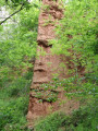
During this circuit, you will discover a geological curiosity, the karstic caves of Py and Rouffiès, composed of fairy chimneys. The village is picturesque with its 13th-century church and bell tower surrounded by four pinnacles. The second part of the circuit offers a view of the village and the crossing of the Aveyron on an old bridge, the Pont du Cambon.
More walks in Saint-Salvadou
Select a point of interest below: