


Refine your search for walks in Saint-Pierre-du-Chemin
Saint-Pierre-du-Chemin walks
 Chapelle de la Brossardière and the Tardière circular – the Rocher de Cheffois
 Visorando Member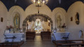
 7.89 mi
 +614 ft
 -607 ft
 4h 10
4h 10
 Moderate
 Departure from La Tardière (Vendée)
A long circular walk starting from La Tardière and ending at the Rocher de Cheffois. Discover some beautiful sites and monuments. Superb panoramic views. Paths, tracks and very narrow roads presenting no particular difficulty.
The path of the stars at La Chapelle aux Lys
 4.09 mi
+249 ft
-249 ft
2h 05
4.09 mi
+249 ft
-249 ft
2h 05
 Easy
Departure from La Chapelle-aux-Lys (Vendée)
Easy
Departure from La Chapelle-aux-Lys (Vendée)
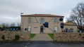
Short hike along the blue-marked Star Trail. Charming little village with everything to do with the universe, stars and planets.
La Chapelle aux Lys is a former commune that merged with two neighbouring communes on 1 January 2023 under the name of Terval.
Lys Trail starting from La Chapelle-aux-Lys
 10.91 mi
+827 ft
-846 ft
5h 45
Moderate
Departure from La Chapelle-aux-Lys (Vendée)
10.91 mi
+827 ft
-846 ft
5h 45
Moderate
Departure from La Chapelle-aux-Lys (Vendée)
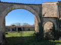
Along this route, you will discover a chapel and a wash house, and pass through the Bois des Baudonnières.
Puy-Thareau – Les Roches – Saint-Jean circular loop
 6.52 mi
+279 ft
-305 ft
3h 15
Moderate
Departure from Saint-André-sur-Sèvre (Deux-Sèvres)
6.52 mi
+279 ft
-305 ft
3h 15
Moderate
Departure from Saint-André-sur-Sèvre (Deux-Sèvres)
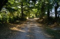
A discovery walk along the sunken paths of the bocage. These tracks and paths, once used to travel from one hamlet to another, were cleared some twenty years ago by local organisations and residents of the commune of Saint-André-sur-Sèvre. They have since been regularly maintained by these same people.
The Bois des Dortières via the Sentier des Boules in Loge-Fougereuse
 7.03 mi
+285 ft
-279 ft
3h 30
Moderate
Departure from Loge-Fougereuse (Vendée)
7.03 mi
+285 ft
-279 ft
3h 30
Moderate
Departure from Loge-Fougereuse (Vendée)
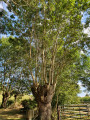
Starting from the church square, walkers will discover along the route a stunning view of the Monts de Gâtine, the Pont de la Rénardière, the Chemin de la Vigne des Boules, the Bois des Dortières, the Château de la Goujonnerie and the Chemin de l’Étang.
81 per cent of the route consists of unpaved paths or tracks.
The hill with the mills from Mouilleron-en-Pareds
 4.50 mi
+423 ft
-407 ft
2h 25
Easy
Departure from Mouilleron-en-Pareds (Vendée)
4.50 mi
+423 ft
-407 ft
2h 25
Easy
Departure from Mouilleron-en-Pareds (Vendée)
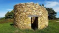
Take a walk on the hill of the mills to discover the remains of the windmills and beautiful views of the low bocage to the north as far as Pouzauges and Saint-Michel-Mont-Mercure and the plain to the south as far as the Forest of Mervent.
Forêt de l’Absie and Bois des Gâts
 Association / Club / Walk leader
 6.90 mi
+243 ft
-246 ft
3h 25
Moderate
Departure from L'Absie (Deux-Sèvres)
6.90 mi
+243 ft
-246 ft
3h 25
Moderate
Departure from L'Absie (Deux-Sèvres)
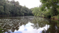
Despite a few sections on small tarmac roads, you’ll enjoy the shade and coolness of this route, which mostly follows paths and sunken lanes through forests of centuries-old trees.
The Claires Fontaines Trail
 5.84 mi
+213 ft
-217 ft
2h 50
Easy
Departure from Saint-Hilaire-de-Voust (Vendée)
5.84 mi
+213 ft
-217 ft
2h 50
Easy
Departure from Saint-Hilaire-de-Voust (Vendée)
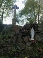
This walk along the banks of the Gâtine, amongst oak, ash and chestnut trees throughout the ‘Vendée’ valley – which at this stage is merely a stream fed by numerous springs – will also treat you, in its second half, to magnificent panoramic views of the bocage.
The Mervent Forest from Chevalement d'Épagne
 6.49 mi
+295 ft
-266 ft
3h 15
Moderate
Departure from Saint-Maurice-des-Noues (Vendée)
6.49 mi
+295 ft
-266 ft
3h 15
Moderate
Departure from Saint-Maurice-des-Noues (Vendée)
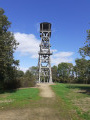
Circular route in the Mervent-Vouvant Forest starting from Chevalement Saint-Michel in Épagne.
En passant par le Bois de la Folie et le Lac de l'Espérance
 4.62 mi
+499 ft
-522 ft
2h 35
Easy
Departure from Pouzauges (Vendée)
4.62 mi
+499 ft
-522 ft
2h 35
Easy
Departure from Pouzauges (Vendée)
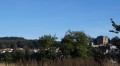
Promenade-découverte de Pouzauges de son centre ville, du Bois de la Folie et du Lac de l'Espérance.
The narrow streets of Pouzauges
 1.99 mi
+269 ft
-279 ft
1h 10
Easy
Departure from Pouzauges (Vendée)
1.99 mi
+269 ft
-279 ft
1h 10
Easy
Departure from Pouzauges (Vendée)
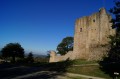
Take a stroll through the narrow streets and alleyways of Pouzauges. Take your time and don’t forget to look back to admire Pouzauges, known as ‘the Queen of the Haut Bocage’, and its surroundings.
La Cressonnière and the Chemin des Wagons
 6.07 mi
+128 ft
-112 ft
2h 55
Easy
Departure from Cezais (Vendée)
6.07 mi
+128 ft
-112 ft
2h 55
Easy
Departure from Cezais (Vendée)
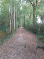
An 11th-century church, a stately home, a wash house, a communal lake, the ‘Chemin des Wagons’ and the Château de la Cressonnière… These are just some of the sights you’ll discover as you walk along paths that follow the route of old railway lines or hedgerow-lined tracks through the fields or deep within the Bois des Rochettes. An easy route that can be shortened, extended or altered as you wish. Ideal for families.
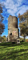
Vouvant, medieval town, listed as one of the 'most beautiful villages in France'
 10.25 mi
+696 ft
-712 ft
5h 20
Moderate
Departure from Vouvant (Vendée)
10.25 mi
+696 ft
-712 ft
5h 20
Moderate
Departure from Vouvant (Vendée)
A hike full of mystery... in the land of the fairy Melusine.
The Bois de la Folie, starting from Pouzauges
 9.24 mi
+974 ft
-965 ft
5h 05
Moderate
Departure from Pouzauges (Vendée)
9.24 mi
+974 ft
-965 ft
5h 05
Moderate
Departure from Pouzauges (Vendée)
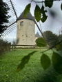
Two routes: the Meuniers Route (8 km) and the Abbey Route (7 km), starting from the Bois de la Folie in the Vendée town of Pouzauges.
You can complete them in one go (there is a bit of an uphill climb, though) and have a picnic in the Bois de la Folie (with plenty of tables in the shade) between the two walks. To do this, leave your picnic in the car.
Around the Ruisseau des Fougères
 6.36 mi
+377 ft
-377 ft
3h 15
Moderate
Departure from Le Busseau (Deux-Sèvres)
6.36 mi
+377 ft
-377 ft
3h 15
Moderate
Departure from Le Busseau (Deux-Sèvres)
A walk along the paths through the countryside around Le Busseau, a rural village situated on the Niort–Cholet road (D744) on the border with the Vendée department, equidistant from Niort, Parthenay and Bressuire.
La Cornelière
 6.50 mi
+102 ft
-131 ft
3h 05
Moderate
Departure from Mervent (Vendée)
6.50 mi
+102 ft
-131 ft
3h 05
Moderate
Departure from Mervent (Vendée)
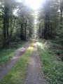
Covering an area of 5,518 hectares, the Mervent-Vouvant forest complex includes a 2,530-hectare state-owned forest. It is home to a rich variety of plant species. The most common species, the sessile oak, can reach a height of 35 metres at 200 years of age.
The suggested route follows paths and forest lanes in the north-eastern part of the forest.
The multitude of existing paths allows you to extend or shorten this walk as you wish.
Chemin de la Mine and Bas de Soie
 6.52 mi
+249 ft
-262 ft
3h 15
Easy
Departure from Faymoreau (Vendée)
6.52 mi
+249 ft
-262 ft
3h 15
Easy
Departure from Faymoreau (Vendée)
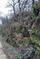
Starting from the Faymoreau Mining Centre, this route follows the mine path (an old railway line) and then continues through the countryside and orchards to reach the national forest (to be avoided during the hunting season).
The Faymoreau Glassworks
 3.06 mi
+115 ft
-98 ft
1h 30
Easy
Departure from Faymoreau (Vendée)
3.06 mi
+115 ft
-98 ft
1h 30
Easy
Departure from Faymoreau (Vendée)
Former mining basin, Faymoreau Petite Cité de Caractère in Vendée.
Worth visiting for its geological history, its mining museum, its miners' houses and its miners' chapel with its stained glass windows.
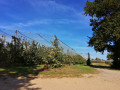
A walk through the countryside on an old railway line, along the banks of the river "La Vendée" and through orchards.