Puy-Thareau – Les Roches – Saint-Jean circular loop

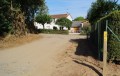
A discovery walk along the sunken paths of the bocage. These tracks and paths, once used to travel from one hamlet to another, were cleared some twenty years ago by local organisations and residents of the commune of Saint-André-sur-Sèvre. They have since been regularly maintained by these same people.

Details

353957
Creation:
Last update:
Last review:
  • Walking
    Activity: Walking
  • ↔
    Distance: 6.52 mi
  • ◔
    Average duration: 3h 15 
  • ▲
    Difficulty: Moderate

  • ⚐
    Back to start: Yes
  • ↗
    Ascent: + 279 ft
  • ↘
    Descent: - 305 ft

  • ▲
    Highest point: 682 ft
  • ▼
    Lowest point: 548 ft

Photos

Description of the walk

In Saint-André-sur-Sèvre, head to Puy-Thareau and park your car in the small car park on Rue de la Promenade.

(S/E) From the car park, turn right, heading east, onto Rue de la Promenade and continue to Rue des Forges.

(1) There, turn left and carry on straight ahead to join the path. At the fork after the house on the right, turn right and continue to the next crossroads of paths at a place called “la Combe”.

(2) Take the track on the left and follow it to La Bleure.

(3) Then take the path on the left which runs alongside the farm sheds, then carry on to the small tarmac road. Turn right onto it and continue to the Carrefour du Chêne Fin. At the stop sign, turn right onto the D33 for 200m.

(4) Turn left onto the C14 towards Saint-Mesmin. Follow the C14 for 800m to the hamlet of Les Noues.

(5) Take the farm track on the left. At the end of the farm track, the path narrows and enters the Bois des Roches. At the end of the path, turn left and follow the D328 for 300 metres to the hamlet of Le Marais.

(6) Turn right onto the farm track. Continue along this track for 200 metres, then turn off onto the small, shaded track on the left and rejoin the D328.

(7) Turn right onto the farm track for just over 300 metres, then carry on straight ahead along this narrow, shaded track, similar to some you’ve already taken earlier. Cross the small road (C13) and take the track opposite. 250 metres further on, cross another small road, then take the track on the left opposite and follow it to the end.

(8) Turn left onto the farm track, then immediately left onto the D33 and continue for 300m to reach Le Plessis.

(9) Turn right onto the small road C4 towards Saint-Marsault, follow it for about 500m to reach Saint-Jean.

(10) Turn left onto the farm track, which becomes narrower and shaded further on. Carry on straight ahead until you reach the D328. Follow the road to the left for 100 metres, then take the track opposite towards Puy Bouet. Then turn left onto the small track that goes uphill, then turn right.

(11) At the junction, go straight on along the track marked ‘No Through Road’ (signposted for vehicles) and continue for 300 metres.

(1) At the crossroads, turn left to return to your car at the starting car park (S/E).

Waypoints

  1. S/E : mi 0 - alt. 627 ft - Car park, Rue de la Promenade
  2. 1 : mi 0.05 - alt. 627 ft - Rue des Forges
  3. 2 : mi 0.31 - alt. 581 ft - La Combe
  4. 3 : mi 0.63 - alt. 600 ft - Turn left near the farm sheds
  5. 4 : mi 1.49 - alt. 646 ft - Follow the C14 to the left towards St Mesmin
  6. 5 : mi 2.01 - alt. 594 ft - At a place called “Les Noues”, take the path on the left
  7. 6 : mi 2.81 - alt. 591 ft - Take the farm track on the right
  8. 7 : mi 3.15 - alt. 591 ft - Turn right
  9. 8 : mi 4.26 - alt. 659 ft - Turn left onto the D33
  10. 9 : mi 4.47 - alt. 646 ft - Turn right onto the small C4 road
  11. 10 : mi 4.9 - alt. 558 ft - Take the farm track on the left
  12. 11 : mi 6.27 - alt. 636 ft - Le Puy Bouet, junction, take the path opposite
  13. S/E : mi 6.52 - alt. 627 ft - Car park on Rue de la Promenade

Reviews and comments

3.7 / 5
Based on 4 reviews

Reliability of the description
4 / 5
Ease of following the route
3.5 / 5
Route interest
3.7 / 5
Daniel Enond
Daniel Enond

A lovely, shaded route along narrow sunken lanes with very few tarmac sections

Suitable for all seasons

Machine-translated

Mel123
Mel123

Overall rating : 1.5 / 5

Date of your route : Apr 21, 2024
Reliability of the description : ★★☆☆☆ Disappointing
Ease of following the route : ★☆☆☆☆ Very disappointing
Route interest : Not used / Not applicable
Very busy route : No

Very poorly signposted

Machine-translated

Daniel Enond
Daniel Enond
• Edited:

Overall rating : 3.3 / 5

Date of your route : Jun 26, 2023
Reliability of the description : ★★★★☆ Good
Ease of following the route : ★★★☆☆ Average
Route interest : ★★★☆☆ Average
Very busy route : No

A pleasant, shaded route, perfect for any time of year

Machine-translated

babondla
babondla

Overall rating : 4.7 / 5

Date of your route : Nov 08, 2021
Reliability of the description : ★★★★★ Very good
Ease of following the route : ★★★★★ Very good
Route interest : ★★★★☆ Good
Very busy route : No

A lovely walk in peaceful, unspoilt surroundings along some magnificent paths. I highly recommend it!

Machine-translated

LOLOELIE
LOLOELIE

Overall rating : 4.7 / 5

Date of your route : Jan 22, 2017
Reliability of the description : ★★★★★ Very good
Ease of following the route : ★★★★★ Very good
Route interest : ★★★★☆ Good

A pleasant walk through the wooded countryside, which is likely to be even more interesting in the autumn when the chestnuts are in season.

Machine-translated

Other walks in the area

For more walks, use our search engine .

The GPS track and description are the property of this route's author. Please do not copy them without permission.