The Bois de la Folie, starting from Pouzauges

Two routes: the Meuniers Route (8 km) and the Abbey Route (7 km), starting from the Bois de la Folie in the Vendée town of Pouzauges.
You can complete them in one go (there is a bit of an uphill climb, though) and have a picnic in the Bois de la Folie (with plenty of tables in the shade) between the two walks. To do this, leave your picnic in the car.

Details

n°2529212
Creation:
Last update:
Last review:
  • Walking
    Activity: Walking
  • ↔
    Distance: 9.24 mi
  • ◔
    Average duration: 5h 05 
  • ▲
    Difficulty: Moderate

  • ⚐
    Back to start: Yes
  • ↗
    Ascent: + 974 ft
  • ↘
    Descent: - 965 ft

  • ▲
    Highest point: 909 ft
  • ▼
    Lowest point: 440 ft
  • ⚐ Country: France
  • ⚐ City: Pouzauges (85700)
  • ⚑
    Start/End: N 46.789734° / W 0.839852°
  • ❏
    IGN map(s): Ref. 1425E, 1426E
  • Hour-by-hour weather

Photos

Description of the walk

Park in one of the two car parks at Bois de la Folie.

(S/E) Follow the main path through the woods to the four-way junction.

(1) Continue straight ahead along the path to reach the viewpoint, which offers a lovely view of the Vendée countryside. Turn right and follow the path to a small road. Cross at the pedestrian crossings by the traffic lights, then follow the PouzaugesGRP® trail. You’ll reach a junction at Les Soriettes.

(2) Turn left onto Rue des Soriettes, then immediately right onto a picturesque footpath leading to Rue des Écluses. Walk down this street, then turn right onto a woodland path that leads to a road. Turn left and walk downhill to Lac de l’Espérance.

(3) Walk round the lake clockwise and, back on the small road, turn left onto Route du Val Rétif. Continue to the junction with the track leading to this hamlet.

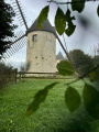
(4) Take a path on the right that winds through the fields. At a junction of paths, keep to the right onto the one that climbs back up to a road. Cross the road carefully as it is on a bend. Here you’ll rejoin theGRP®; continue climbing towards the Terrier Marteau mills, which can be visited but only by appointment.

(5) After the mills, there are two options:
- either continue along the road via a protected footpath,
- or keep to the right on theGRP® (the option shown on the map). Walk alongside the forest for a while and make sure you don’t miss the start of a path on the left leading up into the forest (follow the signposts carefully).
In both cases, you’ll return to the original junction.

(1) Turn left to reach the Bois de la Folie car park.

(S/E) Continue straight ahead on the abbey route, following the roadside path at Terrier Marteau. Then take the road on the left, followed by thefirst right towards La Bréjonnerie and Rambaud Abbey, then continue to the right to reach the hamlet of Champorté.

(6) Turn left after passing some old houses and follow the signposts along the sunken lane to La Cacaudière, turning right twice. Continue to the D43.

(7) Turn right onto the D43 and follow it along the verge until you reach the junction at the Château de la Cacaudière. Turn onto the small road on the left and continue to L’Angerie.

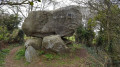
(8) After L’Angerie, leave the main road and turn right onto a very pretty sunken path leading to the D43; cross the road and, almost directly opposite, take the footpath which continues to climb. At the top of the hill, on the right near a large water tank, turn right to visit the Marchais dolmen.

(9) Return to the track and continue to the right.

(10) On reaching Pouzauges, turn right and follow the pavement, then turn left onto Rue Fortuné Parenteau, then right onto Rue du Bournigal and walk round the castle (you can visit the keep). Head back towards the Bois de la Folie by turning right onto Rue de la Ragoille.

(11) Turn left, following the pavement, and take a lane between the houses. Climb the steps and turn left to rejoin thefirst junction.

(1) Turn right back onto the original route to return to the Bois de la Folie car park (S/E).

Waypoints

  1. S/E : mi 0 - alt. 889 ft - Car parks at Bois de la Folie
  2. 1 : mi 0.15 - alt. 909 ft - Junction of the circular loops
  3. 2 : mi 0.78 - alt. 604 ft - Rue de la Soriette
  4. 3 : mi 1.73 - alt. 453 ft - Lac de l’Espérance
  5. 4 : mi 2.72 - alt. 518 ft - Trail junction
  6. 5 : mi 3.91 - alt. 833 ft - After the mills
  7. 6 : mi 5.46 - alt. 640 ft - Champorté
  8. 7 : mi 6.59 - alt. 620 ft - D43
  9. 8 : mi 7.05 - alt. 636 ft - L’Angerie
  10. 9 : mi 8.01 - alt. 889 ft - Marchais Dolmen
  11. 10 : mi 8.19 - alt. 827 ft - Return to Pouzauges
  12. 11 : mi 8.82 - alt. 797 ft - Path leading back up to the Bois de la Folie
  13. S/E : mi 9.24 - alt. 889 ft - Car parks at Bois de la Folie

Notes

(S/E) Bois de la Folie: picnic tables, toilets and a drinking fountain.
Sturdy footwear is required as 75 per cent of the routes consist of footpaths.
You can stop off at: Lac de l’Espérance, the mills, the dolmen and in the grounds of Pouzauges Castle.

Worth a visit

The Bois de la Folie and its viewpoint.
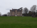
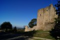
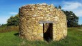
Lac de l’Espérance, the Terrier Marteau mills, the Château de la Cacaudière (hotel and restaurant), the Marchais dolmen, the wash house on Rue de la Folie, the12th-century feudal castle with its keep, and the recently restored Terrier Marteau windmills.
In Pouzauges, you can follow a ‘Green Trail’ which takes you from the castle car park to explore Old Pouzauges and its charming narrow streets.
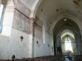
You can visit the Church of Notre Dame in Old Pouzauges (11th and12th centuries), which features magnificent murals highlighted by a sound-and-light show lasting around ten minutes.

Reviews and comments

3.6 / 5
Based on 3 reviews

Reliability of the description
3 / 5
Ease of following the route
3.3 / 5
Route interest
4.3 / 5
Jacky Dalançon
Jacky Dalançon

Hello,
Your comments surprise me; personally, I haven’t done the route for a year (I don’t live in the area), but a fellow hiker completed it without any problems last October.
For further information, please check with the town hall or the Pouzauges tourist office. I’m sorry, but it’s true that routes do change over the years and we should be able to update them in the app.

Machine-translated

Fredlily
Fredlily

Overall rating : 2.7 / 5

Date of your route : Nov 01, 2024
Reliability of the description : ★★☆☆☆ Disappointing
Ease of following the route : ★★☆☆☆ Disappointing
Route interest : ★★★★☆ Good
Very busy route : No

Your “route” is disrupted by numerous paths that have been “converted” into prohibited routes because they have become “private paths” and are off-limits, even though FFR signposts are in place…
What are we actually allowed to do and what aren’t we!?

Please do make sure to get in touch with the relevant parties – Com Com, Urba, etc. – to update your maps!

I look forward to a prompt response from you and some clarification on the regulations governing this situation!

Frédérique

Machine-translated

Uxel85
Uxel85

Overall rating : 4.3 / 5

Date of your route : Oct 26, 2024
Reliability of the description : ★★★★☆ Good
Ease of following the route : ★★★★☆ Good
Route interest : ★★★★★ Very good
Very busy route : No

A very pleasant route with beautiful views, easy to follow using the Visiorando GPS app; I completed it in just over 3 hours without any problems

Machine-translated

balou17
balou17

Overall rating : 3.7 / 5

Date of your route : Mar 04, 2021
Reliability of the description : ★★★☆☆ Average
Ease of following the route : ★★★★☆ Good
Route interest : ★★★★☆ Good
Very busy route : No

A lovely walk with a few panoramic views. The guide was far too haphazard.

Machine-translated

Other walks in the area

For more walks, use our search engine .

The GPS track and description are the property of this route's author. Please do not copy them without permission.