Chapelle de la Brossardière and the Tardière circular – the Rocher de Cheffois

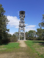
A long circular walk starting from La Tardière and ending at the Rocher de Cheffois. Discover some beautiful sites and monuments. Superb panoramic views. Paths, tracks and very narrow roads presenting no particular difficulty.

Details

30621369
Creation:
Last update:
Last review:
  • Walking
    Activity: Walking
  • ↔
    Distance: 7.89 mi
  • ◔
    Average duration: 4h 10 
  • ▲
    Difficulty: Moderate

  • ⚐
    Back to start: Yes
  • ↗
    Ascent: + 614 ft
  • ↘
    Descent: - 607 ft

  • ▲
    Highest point: 604 ft
  • ▼
    Lowest point: 354 ft
  • ⚐ Country: France
  • ⚐ City: La Tardière (85120)
  • ⚑
    Start/End: N 46.661094° / W 0.74106°
  • ❏
    IGN map(s): Ref. 1426E, 1526SB
  • Hour-by-hour weather

Photos

Description of the walk

Park at La Tardière, on Rue de la Brossardière, well past the village exit, in the small car park on the right just before the climb.

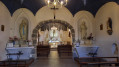
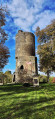
(S/E) Opposite the car park is the start of the path leading to the Chapelle de la Brossardière and back. Cross the road at the pedestrian crossing, take the path opposite and continue straight on to the magnificent little chapel.

(1) Retrace your steps.

(S/E) Back on the road, head up to the left and continue along it until you reach the first junction. Turn right towards La Morelière. Continue along this small road until you reach the houses and, immediately after the first houses, head up to the right. Pass in front of some more houses and continue uphill to the right. Carry on along the path which winds its way through the fields.

(2) At the junction, veer very, very slightly to the right to take the path opposite and carry on to the crossroads. Turn left and continue along this small road to the T-junction; opposite is a lake. Turn right. Carry on, keeping as far to the left as possible as you pass through the hamlet of Ronde Fougère.

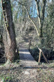
(3) Turn left. With the lake now on your left, carry on and take the first grassy path on the right. Cross the small wooden bridge and carry on to the X-junction. Turn left. At the next junction, take the path leading downhill opposite.

(4) Take the path on the right, ignoring the one opposite. Continue for about 200 m, then turn right at the entrance to the woods and follow the edge of the woods.

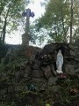
(5) Head left up into the woods at the signpost for Le Rocher de Cheffois. Take in the view and continue to the right along the narrow path that runs alongside the old quarry (on your left). Walk down to the little Miners’ Chapel and the Fountain of Fertility.

(6) Continue walking through the small landscaped green space that runs alongside Rue du Rocher until you reach a tiny car park. Leave this car park and head up Rue du Rocher on the left. This street continues as a path, which you should follow.

(7) Turn left onto the tree-lined path, then, at the X-junction, turn right. Follow the path as it winds through the woods and then along the edge of the woods. At the next crossroads, take the path on the right and continue uphill to the first house, which is on your right.

(8) Take the left-hand-most road. Then carry on straight ahead, staying on this small road, lined on both sides by nurseries, until you reach the next T-junction. Cross the road carefully and continue along the path opposite.

(9) Turn left just after the first building in the hamlet of Le Moulin Meilleraie and continue along this path. About 450 m further on, ignore a path branching off to the left. Continue to the next junction and turn left onto the small footpath.

(10) Carry on, keeping to the path furthest to the right. When you reach the hamlet of La Folie, continue along the small road furthest to the left and carry on until you reach the ‘Give Way’ sign. Turn left and head down the road towards La Brossardière.

(11) Turn right onto the small path at the bottom of the descent, just before the left-hand bend. Carry on to the lake. Walk along its left-hand side. When you reach the houses in the hamlet of Pareds, go up the road on the right and continue along this road (Rue de Pareds).

(12) At the ‘Give Way’ sign, carry on straight ahead to the end of the street, then, at the ‘Stop’ sign, turn left and head down Rue de La Brossardière to the car park (S/E).

Waypoints

  1. S/E : mi 0 - alt. 427 ft - Car park at the bottom of Rue de la Brossardière
  2. 1 : mi 0.24 - alt. 413 ft - Chapelle de la Brossardière
  3. 2 : mi 1.41 - alt. 531 ft - A very slight bend to the right
  4. 3 : mi 2.27 - alt. 509 ft - Turn left at the fork
  5. 4 : mi 3.45 - alt. 492 ft - Path on the right
  6. 5 : mi 4.07 - alt. 581 ft - Ascent through the woods
  7. 6 : mi 4.3 - alt. 492 ft - Chapelle des Mineurs and the Fountain of Fertility
  8. 7 : mi 4.99 - alt. 440 ft - On the left along the tree-lined path
  9. 8 : mi 5.6 - alt. 407 ft - The road furthest to the left
  10. 9 : mi 6.22 - alt. 381 ft - On the left, just after the first building
  11. 10 : mi 6.68 - alt. 400 ft - The path furthest to the right
  12. 11 : mi 7.23 - alt. 463 ft - Straight ahead on the path at the bottom of the slope
  13. 12 : mi 7.66 - alt. 466 ft - Go straight ahead at the ‘give way’ sign
  14. S/E : mi 7.89 - alt. 427 ft - Car park at the bottom of Rue de la Brossardière

Worth a visit

The Chapel of La Brossardière
One of La Tardière’s most iconic monuments.
With the Wars of Religion in France drawing to a close, on 13 August 1595, a massacre took place during a sermon. A troop of 45 Catholic horsemen burst into the congregation. They left 66 victims in their wake (35 wounded and 31 dead).
La Brossardière is part of the history of both Protestants and Catholics. It has become an ecumenical site. In 1995, the fourth centenary of the La Brossardière massacre was marked with a joint prayer service.
An open-air Mass is held near the chapel every 15 August. This pilgrimage attracts between four hundred and five hundred people each year.

The Rocher de Cheffois
A former quartzite quarry that remained in operation until 1953.
Today, nature has reclaimed the scar left in the landscape by the quarry.
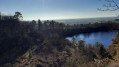
As well as a panoramic view of the surrounding countryside, you can admire the beauty of the rock faces that overlook this quarry, which has now been transformed into a lake.

The Miners’ Chapel
It is thought to date from 1863, though the purpose of its construction remains a mystery. Its name suggests that perhaps the workers used to come here to pray?

The Fountain of Fertility
Near the Miners’ Chapel, little remains of it today.
This small, Gothic-style monument is shrouded in legend. The spring has dried up for good, but it was reputed to cure female infertility and aid children’s walking.
As late as the 1930s, it was customary for newlyweds to come here to quench their thirst whilst praying to the Virgin Mary.

Reviews and comments

4.2 / 5
Based on 4 reviews

Reliability of the description
4.3 / 5
Ease of following the route
4 / 5
Route interest
4.3 / 5
User 18363174

Overall rating : 4.7 / 5

Date of your route : Mar 09, 2026
Reliability of the description : ★★★★☆ Good
Ease of following the route : ★★★★★ Very good
Route interest : ★★★★★ Very good
Very busy route : No

An excellent, well-balanced hike with varied landscapes and a few gentle inclines.

Machine-translated

User 20349717

Overall rating : 3.3 / 5

Date of your route : Nov 12, 2025
Reliability of the description : ★★★★☆ Good
Ease of following the route : ★★★☆☆ Average
Route interest : ★★★☆☆ Average
Very busy route : No

Thank you

Machine-translated

RAVARD
RAVARD

Overall rating : 4.7 / 5

Date of your route : Aug 14, 2023
Reliability of the description : ★★★★★ Very good
Ease of following the route : ★★★★☆ Good
Route interest : ★★★★★ Very good
Very busy route : No

We did the “Le Rocher de Cheffois” route—we really enjoyed the views, the vegetation, and discovering this old quarry and what it used to be used for… the view is truly stunning… It feels as though we’re
bit like being in Auvergne...! The variety of the landscape... hills, woodland, footpaths... The route is very well signposted... which isn’t always the case in other regions of France... Late July 2023

Machine-translated

maurpat
maurpat

Overall rating : 4 / 5

Date of your route : Feb 27, 2023
Reliability of the description : ★★★★☆ Good
Ease of following the route : ★★★★☆ Good
Route interest : ★★★★☆ Good
Very busy route : No

;

Machine-translated

Other walks in the area

For more walks, use our search engine .

The GPS track and description are the property of this route's author. Please do not copy them without permission.