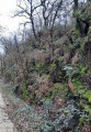
The Bois des Dortières via the Sentier des Boules in Loge-Fougereuse

Starting from the church square, walkers will discover along the route a stunning view of the Monts de Gâtine, the Pont de la Rénardière, the Chemin de la Vigne des Boules, the Bois des Dortières, the Château de la Goujonnerie and the Chemin de l’Étang.
81 per cent of the route consists of unpaved paths or tracks.

Details

n°12467587
Creation:
Last update:
Last review:
  • Walking
    Activity: Walking
  • ↔
    Distance: 7.03 mi
  • ◔
    Average duration: 3h 30 
  • ▲
    Difficulty: Moderate

  • ⚐
    Back to start: Yes
  • ↗
    Ascent: + 285 ft
  • ↘
    Descent: - 279 ft

  • ▲
    Highest point: 525 ft
  • ▼
    Lowest point: 348 ft

Photos

Description of the walk

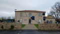
Park at Place de l’Église.

(S/E) Take Rue du Bois Priochet until you reach Rue de Gâtine, then turn left onto it.

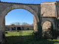
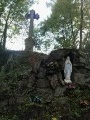
(1) At the foot of the wayside cross, take the Chemin de la Croix Bois. Continue straight on for 1.2 km until you reach the Pont de la Renardière.

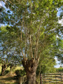
(2) At the foot of the bridge, on the left, head down towards the old railway line, passing through Gâte-Bourse, and join the Route de la Chapelle-aux-Lys, walking alongside a chestnut wood on your right.

(3) Cross the road and take the wide grassy path opposite. Follow the path until you reach the D30.

(4) Cross the road carefully and follow the Chemin de la vigne des Boules for 1.2 km. Pass under a power line and, when you reach the road, turn right towards La Barre.

(5) At the stop sign, take the wide sandy track opposite, then turn right at thefirst junction. Continue straight on, passing under the same power line, and take the first path on the left, which runs alongside a hedge for 300 m.

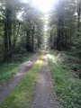
(6) Head left towards the Bois des Dortières, which you’ll reach by turning left again at thefirst junction, then right onto a narrow path. Cross the woodland via a wide avenue, then, at the bottom, turn left, following the edge of the woodland which overlooks the Ruisseau du Pont Boucher on the right, until you reach the picnic area.

(7) Continue along the small sunken path and, when you reach the road, turn left and carry on straight ahead until you reach the hamlet of La Barre once again.

(5) At the junction of the five paths, take thefirst on the right, which leads down to the village of La Motte. Continue to the chestnut woodland

(8) Turn left onto the path until you reach the D30 (hamlet of Treil-Bois).

(9) Turn right and head back to the wayside cross you passed on the way out.

(1) Turn onto Rue du Bois Priochet to return to the starting point (S/E).

Waypoints

  1. S/E : mi 0 - alt. 515 ft - Place de l’Église
  2. 1 : mi 0.24 - alt. 518 ft - Calvary
  3. 2 : mi 0.88 - alt. 430 ft - Pont de la Renardière
  4. 3 : mi 1.75 - alt. 492 ft - Grassy path opposite
  5. 4 : mi 2.27 - alt. 522 ft - Hamlet of La Barre
  6. 5 : mi 3.11 - alt. 502 ft - Stop
  7. 6 : mi 4.09 - alt. 453 ft - Junction towards the Bois des Dortières
  8. 7 : mi 4.72 - alt. 351 ft - Sunken path
  9. 8 : mi 6.23 - alt. 502 ft - Chestnut woodland
  10. 9 : mi 6.6 - alt. 495 ft - Hamlet of Treil-Bois
  11. S/E : mi 7.03 - alt. 518 ft - Place de l’Église

Notes

Markings: a yellow line on a blue background

Worth a visit

Picnics are possible at the Bois des Dortières: a designated area with two tables.

Reviews and comments

4 / 5
Based on 2 reviews

Reliability of the description
3 / 5
Ease of following the route
4.5 / 5
Route interest
4.5 / 5
jlfaure
jlfaure

Overall rating : 4.5 / 5

Date of your route : Oct 26, 2021
Reliability of the description : Not used / Not applicable
Ease of following the route : ★★★★★ Very good
Route interest : ★★★★☆ Good
Very busy route : No

A countryside route along wide, well-maintained grassy paths. Very little tarmac and a walk through a beautiful forest.
At the point (7), we continued along the signposted route through the sunken path, which climbs up following the dry bed of a small stream and joins the outbound path to the 145-metre-high hill. It’s a bit uneven with slippery stones, but very passable outside periods of heavy rain. Otherwise, it’s best to follow the route described.

Machine-translated

couicsilver
couicsilver

Thank you for your comment.
Yes, indeed, No. 5 is a key point that you pass through twice… you need to choose the right route on the way there; it’s easier after that.

Machine-translated

Mummm
Mummm

Overall rating : 4 / 5

Date of your route : Sep 12, 2021
Reliability of the description : ★★★☆☆ Average
Ease of following the route : ★★★★☆ Good
Route interest : ★★★★★ Very good
Very busy route : No

A very pleasant walk, alternating between wide grassy paths and narrow, sunken tracks.
But at point 5 we must have taken a wrong turn; we didn’t come back via the wayside cross.
We’ll have to do it again.

Machine-translated

Other walks in the area

For more walks, use our search engine .

The GPS track and description are the property of this route's author. Please do not copy them without permission.