


Refine your search for walks in Saint-Cassin
Saint-Cassin walks


 From Montagnole to Pas de la Fosse
 Visorando Member
 6.85 mi
 +1,017 ft
 -1,001 ft
 4h 00
4h 00
 Moderate
 Departure from Montagnole (Savoie)
This varied route, set in a picturesque countryside, offers magnificent views of the Montagne de l’Épine, Lac du Bourget (and the Dent du Chat), as well as the foothills of the Massif des Bauges, not to mention, to the south, the view towards the Pointe de la Gorgeat, the gateway to the Chartreuse.
The Jacob-Bellecombette Waterfalls
 4.42 mi
+869 ft
-883 ft
2h 45
Moderate
Departure from Jacob-Bellecombette (Savoie)
4.42 mi
+869 ft
-883 ft
2h 45
Moderate
Departure from Jacob-Bellecombette (Savoie)
On the outskirts of Chambéry, the Nant du Ruisseau du Pontet retains a wild course, hemmed in by urban development, with its waterfalls and gorges offering an interesting hike that continues up the Grobelle hillside for views over the Chambéry Basin. The return route naturally involves some sections along roads that are fairly unavoidable given the layout of the area.
From Jean-Jacques Rousseau’s house to the Jacob and Grobelle waterfalls
 6.41 mi
+1,329 ft
-1,352 ft
4h 05
Moderate
Departure from Jacob-Bellecombette (Savoie)
6.41 mi
+1,329 ft
-1,352 ft
4h 05
Moderate
Departure from Jacob-Bellecombette (Savoie)
A pleasant green walk in the hills, very close to the very centre of the Chambéry conurbation, allowing you to visit the home of the illustrious Jean-Jacques Rousseau and explore the Nant du Pontet streams. This walk takes you through the areas of Jacob-Bellecombette, Chambéry and Barberaz, and past the boundary of the municipality of Montagnole. Despite its proximity to the city, most of the route is through woods or across meadows.
From Jacob to Montagnole
4.57 mi
+856 ft
-833 ft
2h 50
 Easy
Departure from Jacob-Bellecombette (Savoie)
Easy
Departure from Jacob-Bellecombette (Savoie)
A short, easy walk on the outskirts of the town and at the foot of the Chartreuse Mountains. Panoramic views over the Chambéry Basin.
Dent du Corbeley from Les Chantres/Saint-Cassin
 6.80 mi
+2,533 ft
-2,552 ft
5h 20
6.80 mi
+2,533 ft
-2,552 ft
5h 20
 Difficult
Departure from Saint-Cassin (Savoie)
Difficult
Departure from Saint-Cassin (Savoie)
This is a beautiful hike with stunning views of the Chartreuse, the Chambéry valley as far as Lac du Bourget, Les Bauges, Belledonne and even Mont Blanc on a clear day.
Les Hauts de Chamoux
6.13 mi
+679 ft
-679 ft
3h 25
Moderate
Departure from Cognin (Savoie)
A walk above Bissy, towards the Côte de Chamoux, through forests and meadows offering lovely views of the Épine mountain range, the southern tip of Lake Bourget and La Motte Servolex, as well as the Chambéry conurbation and the iconic summit of the Croix du Nivolet.
Col du Crucifix and Col Saint-Michel from Cognin
 10.25 mi
+2,638 ft
-2,657 ft
7h 00
Moderate
Departure from Cognin (Savoie)
10.25 mi
+2,638 ft
-2,657 ft
7h 00
Moderate
Departure from Cognin (Savoie)
From the town to the mountains without a car. A long but gently sloping walk.
After leaving the last houses of Cognin, the first part takes you through fields, streams, cows, horses and apple trees; it is only after Saint-Sulpice that you will enter the forest via the ancient Sardinian Way, which, in the 16th century, replaced the Roman road from Vienne to Milan (50 BC) – a route you will follow in part on your return from the Col Saint-Michel.
Loop through historic Chambéry
 1.93 mi
+13 ft
-13 ft
0h 55
Easy
Departure from Chambéry (Savoie)
1.93 mi
+13 ft
-13 ft
0h 55
Easy
Departure from Chambéry (Savoie)
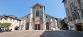
Visit the historic centre of Chambéry, passing by the Château des Ducs de Savoie, the Town Hall, Saint-François de Salles Cathedral, the Museum of Fine Arts... and charming little pedestrian passages. A very pleasant route.
La Grande Montagne
7.50 mi
+2,182 ft
-2,051 ft
5h 20
Moderate
Departure from Chambéry (Savoie)
This walk combines a variety of points of interest, starting from Les Éléphants, Chambéry’s iconic monument, before heading towards the Charmettes neighbourhood, dear to Jean-Jacques Rousseau. Further up lies the Grande Montagne, which, whilst nothing like high mountains, nevertheless offers panoramic views of distant mountain ranges.
The first section follows theGR®96route.
Towards Les Hauts de Chanaz
 4.23 mi
+942 ft
-935 ft
2h 45
Easy
Departure from Barberaz (Savoie)
4.23 mi
+942 ft
-935 ft
2h 45
Easy
Departure from Barberaz (Savoie)
This is a simple circular walk for a half-day excursion. It takes place in the foothills of the Chartreuse Mountains. Beautiful views of Les Bauges, Chartreuse, L'Épine and Lac du Bourget.
Mont Grelle on the Chambéry side
 4.95 mi
+2,664 ft
-2,664 ft
4h 35
Moderate
Departure from Vimines (Savoie)
4.95 mi
+2,664 ft
-2,664 ft
4h 35
Moderate
Departure from Vimines (Savoie)
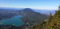
The Mont Grelle viewpoint offers breathtaking views of Lakes Aiguebelette and Bourget, Chambéry Airport and the Massif de l’Épine. A short walk with a respectable elevation gain, mostly in the shade. A steady climb with no easy stretches. This slope of Mont Grelle is a maze of forest tracks, EDF service roads and footpaths: please follow the directions in the on-site guide carefully.
Croix de la Coche loop
4.21 mi
+1,204 ft
-1,175 ft
3h 00
Easy
Departure from Barberaz (Savoie)
Coche or Cochette means a passage. The ancestral passage between the villages of Montagnole and Saint-Baldoph is marked by a solid, massive stone cross. Information panels along the way. Panoramic views at the summit and on the descent along the ridge.
On the heights of Bissy
 6.96 mi
+751 ft
-758 ft
3h 50
Moderate
Departure from Chambéry (Savoie)
6.96 mi
+751 ft
-758 ft
3h 50
Moderate
Departure from Chambéry (Savoie)
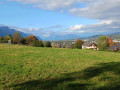
A short walk to discover the heritage of the Bissy neighbourhood.
This walk will soon leave the built-up area behind to wind its way along paths and small country lanes.
The Chemin du Bon Pas
4.16 mi
+712 ft
-705 ft
2h 30
Easy
Departure from Chambéry (Savoie)
A short walk to escape the city. Some clear views as soon as you climb.
Le Chemin de Coirat
 3.03 mi
+531 ft
-515 ft
1h 50
Easy
Departure from Chambéry (Savoie)
3.03 mi
+531 ft
-515 ft
1h 50
Easy
Departure from Chambéry (Savoie)
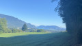
Peri-urban circuit to quickly escape the city. Views of Chartreuse and Bauges.
The Rocher du Corbeau, starting from Saint-Sulpice
5.84 mi
+1,870 ft
-1,867 ft
4h 20
Moderate
Departure from Saint-Sulpice (Savoie) (Savoie)
The Rocher du Corbeau is easily accessible from Aiguebelette-le-Lac. I suggest you get there without taking the car to cross the massif. I have deliberately extended the hike slightly by adding a bit of elevation gain and giving us the chance to walk through this massif and discover two passes and the François I Cave.
It’s a hike I particularly enjoy in winter (when it’s warm, I prefer to head for the higher peaks), but above all, as it’s mainly through woodland, the lack of vegetation means you can enjoy more views.
Mont Grelle from Saint Sulpice
 8.84 mi
+3,202 ft
-3,186 ft
6h 50
Moderate
Departure from Saint-Sulpice (Savoie) (Savoie)
8.84 mi
+3,202 ft
-3,186 ft
6h 50
Moderate
Departure from Saint-Sulpice (Savoie) (Savoie)
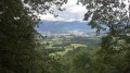
This hike takes place on the eastern flank of the Montagne de l'Épine towards a destination that is clearly visible from the entire Chambéry basin.
At the summit, there is a beautiful view of the Savoyard foothills and Lake Aiguebelette, and Lake Bourget is also visible.
The route does not present any orientation difficulties.
Saint-Sulpice - The three passes
 9.07 mi
+2,618 ft
-2,608 ft
6h 25
Easy
Departure from Saint-Sulpice (Savoie) (Savoie)
9.07 mi
+2,618 ft
-2,608 ft
6h 25
Easy
Departure from Saint-Sulpice (Savoie) (Savoie)
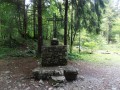
An easy hike on the eastern slope of the Épine mountain, taking the Roman road and the Sardinian road.
Mont Outhéran circular walk from Saint-Thibaud-de-Couz
 Tourism professional
 10.00 mi
+3,911 ft
-3,881 ft
7 hrs
10.00 mi
+3,911 ft
-3,881 ft
7 hrs
 Very difficult
Departure from Saint-Thibaud-de-Couz (Savoie)
Very difficult
Departure from Saint-Thibaud-de-Couz (Savoie)
A challenging and demanding route: a steep climb at the start, a 5 km track, the Pas du Cuert and the return via a ridge littered with tricky sharp limestone pavements. Plenty of shade throughout the entire route (phew!). I’d rate it as very difficult due to the Pas du Cuert, the length of the walk and the descent from the plateau whilst tired.
In the Monts de Bassens
4.82 mi
+1,060 ft
-1,060 ft
3h 10
Moderate
Departure from Bassens (Savoie) (Savoie)
A walk to discover the heritage around Bassens.
Just a stone’s throw from Chambéry, in the heart of the Alps, you can enjoy a half-day outing taking in a succession of panoramic views and insights into local history.
Route above La Motte-Servolex
6.19 mi
+1,578 ft
-1,555 ft
4h 15
Moderate
Departure from La Motte-Servolex (Savoie)
A circular route mainly through woodland in the Montagne de l’Épine above La Motte-Servolex. The path, which is quite steep for the first few kilometres, joins a forest track that descends towards the hamlet of Les Cattis, where there are views towards Lac du Bourget (to the north-east), the Massif des Bauges (to the east) and the Cluse de Chambéry. On the return journey, after a few sections along roads, you pass through the hamlets of Les Granges, Le Villard and Montaugier.
More walks in Saint-Cassin
Select a point of interest below: