Country:

 City:
City:


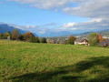
Start from the La Bisseraine community hall. You can also set off from the small car park just before Bissy church.
(S/E) From La Bisseraine, head towards Bissy Church, keeping the Stade Mager on your left, until you reach the Croix de Bissy roundabout. Cross the Route de la Labiaz at the pedestrian crossing leading to the École Jacques Prévert; pass the school car park on your right – the cemetery and the church are very close by. At the end of the street, turn left briefly to find the church car park and the large sign describing the walks along the paths of Bissy.
(1) Opposite, take Rue de la Bataillarde, which soon climbs steeply for a few hundred metres (23% gradient) – this is indicated on the sign at the top. When you reach the sign mentioned above, leave Rue du Mont d’Ambin on your right and continue up Rue de la Bataillarde until it reaches a junction with Chemin des Grandes Aules.
(2) Then turn right onto a small road, above a large meadow, which descends gently past the edge of a farm. Shortly after passing the farm, turn left onto the Chemin des Hauts de Chamoux.
(3) Another steep climb will take you near Square Lamartine (altitude 364m). Leave Rue de Châtillon, which descends to your right, and cross Allée d’Elvire towards Chemin de Coirat, where you’ll leave the tarmac for a few kilometres.
(4) Immediately turn left onto a track marked with a sign prohibiting various motorised vehicles. You’ll soon reach the junction with the Chemin de Coirat. Follow it until you reach another junction (altitude 411m).
(5) Take the track straight ahead (not shown on IGN maps), which will be joined by a track coming from the Bon Pas farm, then cross a junction shortly afterwards.
(6) Follow the path signposted for the Col du Crucifix. This path leads onto a small road with a sign reading ‘Les grands champs, altitude 440m’.
(7). Turn right as indicated by the signpost, then immediately turn left onto a path that winds its way through the fields. You’ll come across houses and farm buildings and eventually reach the D916 (cross) in the hamlet of Monfort (altitude 471m) in the commune of Saint-Sulpice.
(8) Head towards the road opposite, which is circular and goes round via Pravaut. At the end of the circular route, you’ll come out onto the D916 again.
(9) Turn right and proceed with caution for 500 m – the verges are narrow. Pass close to a stone cross and, just before a detached house, turn left
(10) Continue along the wide track; at the end of it, you’ll see a wood. Keep left onto the track as you reach the edge of the wood (not shown on IGN maps). You’ll soon recognise the route as you’ll be retracing a path you took in the opposite direction
(6). Return to the junction of the Chemin de Coirat and the Chemin du Bon Pas (signpost: altitude 411m).
(5) This time, turn right; a short climb and a descent along the road will take you to a small hamlet (altitude 402m). Immediately turn left onto the Chemin de la Côte de Bissy.
(11) The track quickly turns into a path through the woods. After a climb and a descent, you’ll come out onto a road which is none other than the Chemin des Grandes Aules. Follow it until you reach the Chemin de la Bataillarde.
(2) Turn right and follow the path downhill.
(12) Cross the Merderet stream. Return to the starting point (S/E).


 Visorando Member
 Easy
Easy