Mont Outhéran circular walk from Saint-Thibaud-de-Couz

A challenging and demanding route: a steep climb at the start, a 5 km track, the Pas du Cuert and the return via a ridge littered with tricky sharp limestone pavements. Plenty of shade throughout the entire route (phew!). I’d rate it as very difficult due to the Pas du Cuert, the length of the walk and the descent from the plateau whilst tired.

Details

22059096
Creation:
Last update:
Last review:
  • Walking
    Activity: Walking
  • ↔
    Distance: 10.00 mi
  • ◔
    Duration according to the author: 7 hrs 
  • ▲
    Difficulty: Very difficult

  • ⚐
    Back to start: Yes
  • ↗
    Ascent: + 3,911 ft
  • ↘
    Descent: - 3,881 ft

  • ▲
    Highest point: 5,495 ft
  • ▼
    Lowest point: 1,696 ft

Photos

Description of the walk

Park in the clearly visible car park at the start of the Route des Rat-Patron, near the church.

(S/E) Take the path between the first two houses. The slope is steep but the path is well shaded. A few yellow markings and cairns mark the route. You’ll reach a large scree slope.

(1) Here, at the foot of this large scree slope, do not take the track leading off to the right; instead, look out for the cairn opposite, which marks the continuation of the route heading due east towards the Col du Planet and on to the Granges du Planet.

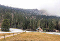
(2) Turn onto the track that branches off to the right, which slopes gently and runs for over 5 km towards the south-west. Admire the pretty, well-restored barn. Ignore the tracks branching off on either side until you reach the junction for the Col du Grapillon.

(3) Leave the track and head left towards the Col du Grapillon until you reach it.

(4) Turn left to reach the cliff. Follow it along to the Pas du Cuert.

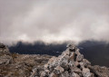
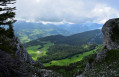
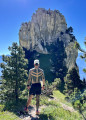
(5) It’s on the left. Follow the yellow markings carefully. The climb is very steep but there are good handholds. At the top, you’ll find a large cairn and catch sight of the summit cross.

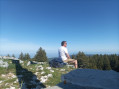
(6) Take in the view, then leave the cross behind and head down a little to rejoin the Col du Mollard path. Follow the eastern ridge; this is where the Visorando app comes in handy to get you back on track if you lose the path (which happened to me twice). Then cross the plateau to follow the western ridge. The route is full of pitfalls.
You’ll reach a hut.

(7) Turn left towards the Col du Planet. The ascents and descents follow one after the other, and I was wondering when I’d finally start losing altitude – well, it wasn’t going to happen just yet. The slope finally steepens – thank goodness. Throughout the route, the numerous yellow markings keep us on the right track. Take care on the descent along the western ridge. Finally reach the Col du Planet.

(8) Turn left towards Les Granges du Planet at a junction we’d already passed on the way there.

(2) Opposite, follow the route back in the opposite direction to the outward journey to reach the car park (S/E).

Waypoints

  1. S/E : mi 0 - alt. 1,696 ft - Route des Rat-Patron – Car park near the - Hyères (rivière)
  2. 1 : mi 0.5 - alt. 2,264 ft - Cairn and yellow markings (scree slope)
  3. 2 : mi 1.6 - alt. 3,832 ft - Les Granges du Planet. Junction of the circular loop
  4. 3 : mi 4.83 - alt. 4,705 ft - Junction
  5. 4 : mi 5.1 - alt. 4,944 ft - Col du Grapillon (1509m)
  6. 5 : mi 5.38 - alt. 5,312 ft - At the foot of the Pas du Cuert
  7. 6 : mi 5.47 - alt. 5,463 ft - The cross
  8. 7 : mi 6.97 - alt. 5,243 ft - The hut
  9. 8 : mi 8.29 - alt. 3,898 ft - Granges / Col du Planet
  10. S/E : mi 10 - alt. 1,713 ft - Car park on the Route des Rat-Patron, not far from the - Église Saint-Thibaud (Saint-Thibaud-de-Couz)

Notes

Make sure you wear good walking shoes for the Pas du Cuert and the sharp limestone pavement. There are a few streams and springs along the route, but none on the plateau.

Reviews and comments

4.6 / 5
Based on 3 reviews

Reliability of the description
4.7 / 5
Ease of following the route
5 / 5
Route interest
4 / 5
satou
satou

Overall rating : 4.3 / 5

Date of your route : Mar 18, 2023
Reliability of the description : ★★★★★ Very good
Ease of following the route : ★★★★★ Very good
Route interest : ★★★☆☆ Average
Very busy route : No

Winter’s just over – it’s the perfect time to go climbing in the Chartreuse!
The climb is steep and gets you straight into the thick of it. No technical difficulties.
Then (alas) it’s off for long kilometres of uninteresting forest tracks. It’s a bit of a bore, but we keep going until the final ascent to the summit. This involves a fixed rope and then a rocky outcrop to climb.
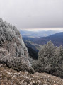
You’ve got to be careful, but everything goes smoothly. At the summit, the view is clear and superb. On the way back, with quite a lot of snow still lying, it’s chaos. I lost the trail and then the descent was a bit of a gamble… lots of slipping along the ridge.
In the end, I made it back safely. It wasn’t the hike of the year, but the Cuert pass and the view are well worth the detour.
Thanks for this route!

Machine-translated

Charlie 38
Charlie 38

Overall rating : 4.7 / 5

Date of your route : Feb 26, 2023
Reliability of the description : ★★★★★ Very good
Ease of following the route : ★★★★★ Very good
Route interest : ★★★★☆ Good
Very busy route : No

Nice walks, though the circular route takes a while to complete.

Doing them in the middle of winter made for some stunning scenery.
It was a bit of a struggle to find our way through the woods between sections 7 and 8, as the snow had covered some of the yellow markings.

I’d like to do it again in the high season.

Machine-translated

DUBOST Rodolphe
DUBOST Rodolphe

Overall rating : 4.7 / 5

Date of your route : Aug 10, 2022
Reliability of the description : ★★★★☆ Good
Ease of following the route : ★★★★★ Very good
Route interest : ★★★★★ Very good
Very busy route : No

A lovely walk with a very pleasant climb in the morning shade.
The view from the summit is magnificent!
However, the climb from the Col de Grapillon is dizzying; you have to scale a rock face with no safety cables (not for those with a fear of heights!!!)

Machine-translated

Other walks in the area

For more walks, use our search engine .

The GPS track and description are the property of this route's author. Please do not copy them without permission.