La Grande Montagne

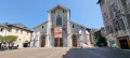
This walk combines a variety of points of interest, starting from Les Éléphants, Chambéry’s iconic monument, before heading towards the Charmettes neighbourhood, dear to Jean-Jacques Rousseau. Further up lies the Grande Montagne, which, whilst nothing like high mountains, nevertheless offers panoramic views of distant mountain ranges.
The first section follows theGR®96route.

Details

271044
Creation:
Last update:
Last review:
  • Walking
    Activity: Walking
  • ↔
    Distance: 7.50 mi
  • ◔
    Average duration: 5h 20 
  • ▲
    Difficulty: Moderate

  • ⚐
    Back to start: No
  • ↗
    Ascent: + 2,182 ft
  • ↘
    Descent: - 2,051 ft

  • ▲
    Highest point: 2,674 ft
  • ▼
    Lowest point: 892 ft
  • ⚐ Country: France
  • ⚐
    Areas: Alps, Chartreuse
  • ⚐ City: Chambéry (73000)
  • ⚑
    Start: N 45.566567° / E 5.922963°
  • ⚑
    End: N 45.530407° / E 5.955791°
  • ❏
    IGN map(s): Ref. 3332OT, 3333OT, 3333OTR
  • Hour-by-hour weather

Description of the walk

Departure from Place des Éléphants, in Chambéry city centre.

(S) From Place des Éléphants, also known as Les Quatre Sans Cul, cross the small square, then take Rue du Théâtre, which runs alongside the Charles Dullin Theatre. Continue along Rue Denfert Rochereau until you reach a large roundabout, opposite the Jean-Jacques Rousseau Media Centre. Go round the Carré Curial media centre complex on the right, cross Rue Michaud, then turn onto Rue Léon Ménabréa, which climbs gently towards Parc de la Calamine. Head for the information board at the park entrance.

(1) Head uphill through the park until you reach Avenue de la Grande Chartreuse; look out for a washhouse and fountain, then take the small road immediately on the left; follow it for 80 metres, then turn right.

(2) Head uphill along the stony path, rejoin the tarmac road and continue the climb. Pass a first junction, then a second, leaving the Chemin des Rendez-Vous on your right. Reach Parc de l’Étincelle (barrier restricting vehicle access).

(3) Walk up through the park, past the water tanks, and carry on along the path. Reach the edge of a large meadow, cross it and continue along the edge of a copse on the left. Then, head down the path which leads to a road junction.

(4) Walk down Chemin des Charmettes for a few dozen metres, then immediately turn right onto Chemin des Rochères, followed by Chemin de Jean-Jacques, before reaching Route de Chanaz.

(5) Turn right and start climbing again along this stony path. Head straight into the woodland, then begin the descent towards Chanaz, joining a small road. In Chanaz, turn right onto the main road and walk for about 150 metres.

(6) Follow the path to the left, pass a barn, then head downhill to cross the bridge over the river. Head back uphill to rejoin a road and continue climbing until you reach a fountain near a house.

(7) Leave the road and take the path on the left; turn sharply right onto a steep climb and reach a crossroads near the Croix de la Coche.

(8) Follow the wide path to the right, with your back to the cross; climb, keeping well on the main path, and pass a junction leading to the Belvédère du Bec du Corbeau. The path continues uphill before beginning the descent to the Grande Montagne junction.

(9) Take the stony path leading uphill to the right, emerge onto a plateau and continue along the small road, before reaching the D12A.

(10) Turn round and head back to the Grande Montagne junction.

(9) Head down the path opposite. Further on, ignore a track on the right, continue downhill and rejoin the D12A (Route de Chartreuse).

(11) Walk down the road for about 200 metres, then take a path on the right. You’ll reach the houses in Saint-Baldoph (Quartier des Lamettes) and continue to a hairpin bend on the D12A.

(12) Turn right onto the Chemin du Château and, shortly afterwards, take a path on the left which descends through the vineyard, cross the Route des Lamettes and continue down to the Route de Fontaine Lamée (Musselin district).

(13) At the crossroads, turn right, then left at the wash house to join the Chemin de la Cornaz. At the roundabout, turn left to reach the bus stop (E).

Waypoints

  1. S : mi 0 - alt. 892 ft - Place des Eléphants
  2. 1 : mi 0.42 - alt. 928 ft - Parc de la Calamine
  3. 2 : mi 0.68 - alt. 1,125 ft - Stony path
  4. 3 : mi 1.05 - alt. 1,394 ft - Parc de l’Étincelle
  5. 4 : mi 1.66 - alt. 1,365 ft - Road junction
  6. 5 : mi 2.04 - alt. 1,355 ft - Chemin de Jean-Jacques
  7. 6 : mi 2.58 - alt. 1,401 ft - Route de Chanaz
  8. 7 : mi 3.04 - alt. 1,591 ft - Fontaine
  9. 8 : mi 3.41 - alt. 2,031 ft - Croix de la Coche
  10. 9 : mi 4.76 - alt. 2,434 ft - Grande Montagne
  11. 10 : mi 5.17 - alt. 2,585 ft - D12A road
  12. 11 : mi 5.95 - alt. 2,090 ft - Route de Chartreuse
  13. 12 : mi 6.75 - alt. 1,476 ft - Les Lamettes
  14. 13 : mi 7.23 - alt. 1,047 ft - Musselin
  15. E : mi 7.5 - alt. 1,004 ft - Espinier bus stop

Notes

Return by bus available from:
(12) Line 5, Haut des Lamettes.
(E) Line 3 Espinier.

In both cases, change at Barberaz to Line C, which takes you back to the centre of Chambéry.

Worth a visit

The Musée des Charmettes is less than 500 metres from (4)

Always be cautious and plan ahead when you're outdoors. Visorando and the author of this route cannot be held responsible for any accidents occurring on this route.

The GR® and PR® markings are the intellectual property of the Fédération Française de Randonnée Pédestre.

Reviews and comments

3.8 / 5
Based on 3 reviews

Reliability of the description
3.7 / 5
Ease of following the route
3.7 / 5
Route interest
4 / 5
amalan
amalan

Overall rating : 4.3 / 5

Date of your route : Feb 20, 2023
Reliability of the description : ★★★★★ Very good
Ease of following the route : ★★★★☆ Good
Route interest : ★★★★☆ Good
Very busy route : No

All clear

Machine-translated

jupicecle
jupicecle

Overall rating : 2.7 / 5

Date of your route : Oct 03, 2019
Reliability of the description : ★★☆☆☆ Disappointing
Ease of following the route : ★★☆☆☆ Disappointing
Route interest : ★★★★☆ Good

Hello,
The difficulties began as soon as I crossed Calamine Park, as the signposts weren’t visible. I eventually found the stony path again, looked for the junctions, left the Chemin du Rendez-Vous on my right and, after a detour and some help from a local, I took the Chemin du Rendez-Vous. I found the reservoirs and then wondered what ‘reach a large meadow, cross it;;;;;;;;;’ meant. IN SHORT, I walked a long way; after numerous detours, I found the signpost marked ‘Croix de la Coche’. I climbed up to it and, pressed for time, headed back down. It was a good day all the same, and I’ll do it again with my daughter, who might be able to tell me where I went wrong.

Machine-translated

dandesavoie
dandesavoie

Overall rating : 4.3 / 5

Date of your route : Nov 07, 2017
Reliability of the description : ★★★★☆ Good
Ease of following the route : ★★★★★ Very good
Route interest : ★★★★☆ Good

The description on the map differs from that on the signposts, particularly regarding place names, which can sometimes cause confusion about which way to go.
A family-friendly, enjoyable walk on the outskirts of Chambéry, with lovely views

Machine-translated

Other walks in the area

For more walks, use our search engine .

The GPS track and description are the property of this route's author. Please do not copy them without permission.