Country:

 City:
City:


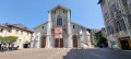
Park in the car park by the church in Jacob-Bellecombette.
(S/E) A few steps lead down to Rue Jean-Baptiste Richard; walk up this street and, at the next junction, turn right onto Route de la Waterfall. Follow this main road towards Route de Sécheron. Cross a bridge; the gradient will steepen and the road will leave the built-up area.
(1) Leave this road and turn left onto Chemin de la Bellecombette. This track leads onto Route des Championnats du Monde; follow it for 80 metres.
(2) Turn right onto the very steep Route de Fourches.
Follow this road uphill until you reach a junction with a massive cross, then turn right onto the track.
The church at Montagnole will soon come into view on the left, perched on its promontory.
(3) Take the path on the left leading to the church square. Continue southwards, passing above the town hall.
(4) Head out via the Route de Montagnole, then leave this road at the junction marked by a cross.
(5) Take a circular route through the village of Maistre. Return to the Route de Montagnole.
(6) Turn left, with a riding centre on one side and the playground on the other, and carry on until you reach a large Y-junction.
(7) At the junction, ignore the sign for Saint-Cassin and turn left towards Chambéry. Head down the Route de la Plaine and join the D912.
(8) At the junction, continue down the long descent by turning left.
After passing the houses at Le Pontet, rejoin the Route des Championnats du Monde.
(9) Turn left and return to a junction you passed on the way there.
(2) Head down to the right to the car park (S/E) via the reverse route of the outward journey.

 Visorando Member
 Moderate