Country:

 City:
City:


Park at a place called Les Pierre Rouge in one of the many spaces running alongside the holiday camp and the military base.
(S/E) Take the path that continues from the road.
(1) After the stream, turn right onto the path leading uphill.
(2) Pass under the high-voltage power line for thefirst time, after crossing the unpaved service track. Walk downhill for about a hundred metres and rejoin the path on the right.
(3) At the junction, turn right and head uphill to the clearing without entering the fence; go round it on the right until you reach a barrier made of two horizontal tree trunks.
(4) Go through the barrier and cross the clearing to take the rutted path opposite.
(5) Cross the service track and take the path opposite, which enters the forest; it is marked by a pile of stones that bears no resemblance to a cairn and is somewhat hidden beneath the vegetation. From this point onwards, the path is marked by yellow markings on the stones, which may be covered by leaves in autumn.
(6) Cross the service track again: the rest of the path lies ahead of you, marked by a stone staircase leading up the embankment. Walk beneath the high-voltage power line and cross the service track once more.
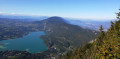
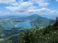
(7) You’ll come out onto the path leading from Col Saint-Michel; follow it to the left for about 100 m and take the track for 300 m. After a short descent, turn right and head for the Mont Grelle viewpoint along a wide, clearly marked path.
(8) Follow the same route back to the car park (S/E).


 Visorando Member

 Difficult
 Tourism professional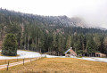
 Very difficult