In the Monts de Bassens

A walk to discover the heritage around Bassens.
Just a stone’s throw from Chambéry, in the heart of the Alps, you can enjoy a half-day outing taking in a succession of panoramic views and insights into local history.

Details

243761
Creation:
Last update:
Last review:
  • Walking
    Activity: Walking
  • ↔
    Distance: 4.82 mi
  • ◔
    Average duration: 3h 10 
  • ▲
    Difficulty: Moderate

  • ⚐
    Back to start: Yes
  • ↗
    Ascent: + 1,060 ft
  • ↘
    Descent: - 1,060 ft

  • ▲
    Highest point: 1,834 ft
  • ▼
    Lowest point: 1,027 ft

Description of the walk

Park near the Bassens community hall.

(S/E) Opposite the hall, take the pedestrian lane immediately to its right. It leads onto Rue Georges Lamarque, which you follow briefly to the left before turning right onto Chemin de la Rivière, which ends with a short steep slope before joining another road. Turn right until the next bend.

(1) Just before the bend, follow the path to the right, which winds its way between contemporary villas. Pass under a power line, cross theGR®96and continue until you reach a tarmac road. Carry on to the next junction.

(2) Turn slightly to the right to head down to a nearby junction. Head back up to the left via the Chemin des Genêts. You’ll come out onto the Route des Monts; follow it to the right for 200 m.

(3) Turn left onto a path; leave this 50 m further up to take a track on the right. Follow this track, ignoring a path on the left that climbs directly up to the Monts; you’ll come out onto the Route du Col de Saint-Saturnin and follow this road to the left as far as the Chapelle Saint-Saturnin.

Leave the road and take the path that climbs left up the Monts. Walk first westwards then southwards along the edge of the cliff to reach the Croix Saint-Concors (signpost 535 m).

Follow the signs for “parking le Relais”, crossing a power line several times.

(4) At the next sign, “Chemin des Pélerins 475 m”, follow the signs opposite for “parking le Relais” and “Parc Piot” car park.

(5) At the next sign, “La Source 450m”, turn right and follow the signs for “Parc Piot – Circular Trail of Belvèdères”.
You’ll come out onto a meadow; as you head downhill, pass by the viewing points along the way.

After the last of these, the “Racine” viewpoint, walk back a short way then turn right towards Parc Piot and the reservoirs. Then take the path adapted for people with reduced mobility. Cross a small car park and head uphill towards a building with a radio mast. Go past this building and join the Chemin des Monts.

(6) Turn right, going round the modern blocks of flats.

(7) At the second junction, turn sharply left and carry on.

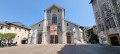
(8) Just before the tarmac ends, turn down a path on the right. Join Rue de L’Église and head down to the left towards the church. Go straight on at the roundabout. Once you reach the church, the car park is opposite it, on the left (S/E).

Waypoints

  1. S/E : mi 0 - alt. 1,027 ft - Car park at the community hall
  2. 1 : mi 0.43 - alt. 1,207 ft - Path on the right
  3. 2 : mi 0.81 - alt. 1,220 ft - Turn right
  4. 3 : mi 1.17 - alt. 1,339 ft - Path to the left
  5. 4 : mi 2.82 - alt. 1,539 ft - Pilgrims’ Path
  6. 5 : mi 3.22 - alt. 1,470 ft - The spring
  7. 6 : mi 4.02 - alt. 1,421 ft - Chemin des Monts
  8. 7 : mi 4.1 - alt. 1,378 ft - Turn left
  9. 8 : mi 4.28 - alt. 1,427 ft - Head down to the right
  10. S/E : mi 4.82 - alt. 1,027 ft - Car park at the community hall

Worth a visit

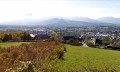
Between (1) and (2), take in the view to the east, which is dominated in the distance by the Sept Laux massif, whose highest peak, the Rocher Blanc, rises to 2,927 metres.
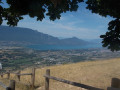
Panoramic view to the west after the steep climb following the Chapelle Saint-Saturnin.

Always be cautious and plan ahead when you're outdoors. Visorando and the author of this route cannot be held responsible for any accidents occurring on this route.

The GR® and PR® markings are the intellectual property of the Fédération Française de Randonnée Pédestre.

Reviews and comments

3.5 / 5
Based on 4 reviews

Reliability of the description
3.7 / 5
Ease of following the route
3.3 / 5
Route interest
3.5 / 5
Dominique Coudreau
Dominique Coudreau

Overall rating : 3 / 5

Date of your route : Sep 09, 2025
Reliability of the description : ★★★☆☆ Average
Ease of following the route : ★★★☆☆ Average
Route interest : ★★★☆☆ Average
Very busy route : Yes

You can't do this hike without keeping your eye on your phone screen almost constantly.
There is a new route being mapped out, and this has also led us astray.

Machine-translated

daboloz
daboloz

Overall rating : 5 / 5

Date of your route : Sep 02, 2025
Reliability of the description : Not used / Not applicable
Ease of following the route : ★★★★★ Very good
Route interest : ★★★★★ Very good
Very busy route : No

I used the GPX track.
Between 3 and 5, the vegetation has grown; in places you have to push it aside to get through...
Be aware that there is a difficult climb after the chapel of St Saturnin.
Very nice route, thanks to the author!

Machine-translated

Brig73
Brig73

Overall rating : 2.7 / 5

Date of your route : Sep 04, 2023
Reliability of the description : ★★★☆☆ Average
Ease of following the route : ★☆☆☆☆ Very disappointing
Route interest : ★★★★☆ Good
Very busy route : Yes

The directions are useless; it’s impossible to follow the route

Machine-translated

Louis M
Louis M

Overall rating : 3.7 / 5

Date of your route : Jul 24, 2023
Reliability of the description : ★★★★★ Very good
Ease of following the route : ★★★★☆ Good
Route interest : ★★☆☆☆ Disappointing
Very busy route : Yes

An easy walk starting from Bassens town centre
The views aren’t anything to write home about, and you stay very close to the town

Machine-translated

Other walks in the area

For more walks, use our search engine .

The GPS track and description are the property of this route's author. Please do not copy them without permission.