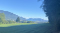
Les Hauts de Chamoux

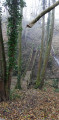
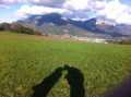
A walk above Bissy, towards the Côte de Chamoux, through forests and meadows offering lovely views of the Épine mountain range, the southern tip of Lake Bourget and La Motte Servolex, as well as the Chambéry conurbation and the iconic summit of the Croix du Nivolet.

Details

n°108420623
Creation:
Last update:
Last review:
–
  • Walking
    Activity: Walking
  • ↔
    Distance: 6.13 mi
  • ◔
    Average duration: 3h 25 
  • ▲
    Difficulty: Average

  • ⚐
    Back to start: Yes
  • ↗
    Ascent: + 679 ft
  • ↘
    Descent: - 679 ft

  • ▲
    Highest point: 1,496 ft
  • ▼
    Lowest point: 955 ft
  • ⚐ Country: France
  • ⚐
    Area: Alps
  • ⚐ City: Cognin (73160)
  • ⚑
    Start/End: N 45.561877° / E 5.896441°
  • ❏
    IGN map(s): Ref. 3332OT, 3333OT, 3333OTR
  • Hour-by-hour weather

Description of the walk

Park in Cognin at the town hall car park.

(S/E) Head north-west along Rue de l’Épine. At the roundabout, follow signs for the Col de l’Épine via the D916.

(1) Turn right onto Chemin de la Thiolère and follow it to the junction with Route de Chaloz.

(2) Turn left onto it and follow it as far as Chalou.

(3) Turn right and continue along the Chemin de Bon Pas.

(4) Turn right, and as the road curves, follow the path that veers left and leads out into pastures.

(5) Head down, turning left across the meadows towards the Chemin de Coirat, and follow it to the left.

(6) At the junction, carry on straight ahead and you’ll reach a crossroads.

(7) Carry on straight ahead along the path which winds through the forest and crosses meadows before reaching the D916.

(8) Follow it to the right and, before the recycling bins, head onto the Mollasses plateau, which offers a 360° view.

(9) At the junction with the Montée des Mollasses, follow the road to the left and head towards the sign for “Le Forèzan”.

(10) Head down towards the park and cross it on the left until you reach the car park.

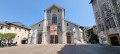
(11) After passing under the railway line, continue towards La Forgerie and its buildings with their colourful balconies.

(12) Cross the D14 carefully and return to the car park via the shopping area (S/E).

Waypoints

  1. S/E : mi 0 - alt. 955 ft - Cognin Town Hall car park
  2. 1 : mi 0.6 - alt. 1,070 ft - Junction with Chemin de la Thiolière
  3. 2 : mi 1.23 - alt. 1,129 ft - Junction with the Route de Chalou
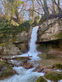
  4. 3 : mi 1.69 - alt. 1,312 ft - Crossroads (stone cross) - Merderet (ruisseau) - Affluent du Nant Bruyant
  5. 4 : mi 2.09 - alt. 1,414 ft - Junction (forest track)
  6. 5 : mi 2.69 - alt. 1,421 ft - Meadows
  7. 6 : mi 3.47 - alt. 1,348 ft - Junction with the Chemin de Bon Pas
  8. 7 : mi 3.81 - alt. 1,398 ft - Crossroads in the forest
  9. 8 : mi 4.3 - alt. 1,437 ft - D916, Mollasses Plateau
  10. 9 : mi 4.66 - alt. 1,447 ft - Ascent of Les Mollasses
  11. 10 : mi 5.06 - alt. 1,207 ft - Junction at Parc du Forèzan
  12. 11 : mi 5.64 - alt. 988 ft - Railway tunnel
  13. 12 : mi 5.95 - alt. 971 ft - Pyramides roundabout
  14. S/E : mi 6.13 - alt. 955 ft - Car park at Cognin Town Hall

Notes

A few sections along roads; water point at Parc du Forèzan.

Worth a visit

Ruins of a Gallo-Roman villa. Panoramic views of the Épine mountain range, the Croix du Nivolet and Lake Bourget. Educational farm, park, stream and Forèzan Castle,

Other walks in the area

For more walks, use our search engine .

The GPS track and description are the property of this route's author. Please do not copy them without permission.