


Refine your search for walks in Sain-Bel
Sain-Bel walks


 From Saint-Bel to Lentilly via the Chapelle de Fouillet
 Visorando Member
 5.43 mi
 +1,089 ft
 -879 ft
 3h 25
3h 25
 Easy
Easy
 Departure from Sain-Bel (Rhône)
A lovely walk connecting the TER station at Saint-Bel to the one at Lentilly, via the chapel at Sourcieux-les-Mines. Beautiful views of the Alps.
Autour de Savigny
3.76 mi
+482 ft
-466 ft
2h 20
Easy
Departure from Savigny (Rhône) (Rhône)
Découvrez une agréable randonnée autour de Savigny ; un circuit, d'environ 8 km, offrant de points de vue sur les paysages vallonnés environnants.
Classé avec un indice IBP de 40 HKG, vous emprunterez des chemins variés, et bénéficierez, notamment, d'une vue panoramique sur le Château de Montbloy et la Villa Mangini. Attendez-vous à un mélange de sentiers, de chemins en terre, et de passages longeant les vignes et la campagne locale.
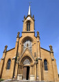
On the Savigny - Lanay trails
 4.44 mi
+587 ft
-591 ft
2h 35
Easy
Departure from Savigny (Rhône) (Rhône)
4.44 mi
+587 ft
-591 ft
2h 35
Easy
Departure from Savigny (Rhône) (Rhône)
A very pretty walk to discover the rolling countryside around Savigny, alternating between dirt tracks and little-used roads, valley bottoms (Trésoncle) and hilltops (viewpoints).
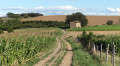
Les Balcons de Sain-Bel: Savigny and Tour du Crét d'Arjoux
 10.12 mi
+1,719 ft
-1,706 ft
6h 10
10.12 mi
+1,719 ft
-1,706 ft
6h 10
 Average
Departure from Savigny (Rhône) (Rhône)
Average
Departure from Savigny (Rhône) (Rhône)
A short trip to the Monts du Lyonnais from Savigny, above Sain-Bel. A very beautiful walk through orchards with magnificent views of the Turdine, Azergues, Saône and Brévenne valleys and the surrounding mountains.
Sourcieux-les-Mines circular
 4.15 mi
+699 ft
-719 ft
2h 30
Easy
Departure from Sourcieux-les-Mines (Rhône)
4.15 mi
+699 ft
-719 ft
2h 30
Easy
Departure from Sourcieux-les-Mines (Rhône)
A pleasant walk with lots of dirt tracks.
On the slopes of the Monts du Lyonnais
10.23 mi
+1,942 ft
-1,965 ft
6h 25
Average
Departure from Sourcieux-les-Mines (Rhône)
An introduction to the Monts du Lyonnais through its hillsides with a few châteaux and religious buildings.
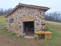
The Trésoncle Balconies circular loop starting from Savigny
 14.67 mi
+2,277 ft
-2,293 ft
8h 45
14.67 mi
+2,277 ft
-2,293 ft
8h 45
 Very difficult
Departure from Savigny (Rhône) (Rhône)
Very difficult
Departure from Savigny (Rhône) (Rhône)
A beautiful, long hike in the hills above Savigny, alternating between orchards, mountain pastures and wild countryside, with walkers, mountain bikers and paragliders all sharing the terrain harmoniously. The first, uphill section follows mainly the ridge line separating La Turdine from Le Trésocle to the paragliders’ launch site, whilst the second section is relatively flat as far as Le Crêt d’Arjoux. The third section consists mainly of the descent back to Savigny.The route takes you up to higher ground, offering magnificent views over the entire Ain plain, the Beaujolais region and, in fine weather, the Alpine range.Furthermore, you’ll discover an area that offers plenty of hiking opportunities.At the start or finish, you can also take the opportunity to visit the beautiful village of Savigny with its yellow-stone church or its dovecote, located at the starting point of the hike.
On the way to the chapel of Sourcieux-Les-Mines
 7.08 mi
+974 ft
-965 ft
4h 05
Average
Departure from L'Arbresle (Rhône)
7.08 mi
+974 ft
-965 ft
4h 05
Average
Departure from L'Arbresle (Rhône)
Discover the sights and pleasant paths around L'Arbresle, an introduction to the Beaujolais and the Monts du Lyonnais.
Longer walk to the chapel of Sourcieux-les-Mines
9.28 mi
+1,348 ft
-1,339 ft
5h 25
Average
Departure from L'Arbresle (Rhône)
Discover the sights and pleasant paths around L'Arbresle, an introduction to the Beaujolais and the Monts du Lyonnais.
Circular route starting from L'Arbresle Hospital
10.70 mi
+630 ft
-614 ft
5h 30
Average
Departure from L'Arbresle (Rhône)
Get away from it all for a walk along the country lanes.
Ménerets route
 2.73 mi
+397 ft
-390 ft
1h 35
Easy
Departure from Bully (Rhône) (Rhône)
2.73 mi
+397 ft
-390 ft
1h 35
Easy
Departure from Bully (Rhône) (Rhône)
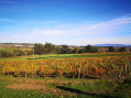
A walk starting from the typical golden stone village of Bully, offering superb views of the Monts du Lyonnais and the Monts d'Or.
Le Crêt du Chat from Bully
 4.00 mi
+381 ft
-407 ft
2h 10
Easy
Departure from Bully (Rhône) (Rhône)
4.00 mi
+381 ft
-407 ft
2h 10
Easy
Departure from Bully (Rhône) (Rhône)
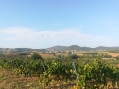
A short, gentle walk along the valley floor in the heart of the Beaujolais des Pierres Dorées, with several views of the Monts du Lyonnais and the Monts Popey and Arjoux.
Loop between the Col de la Croix du Ban and the Col de la Luère
 5.08 mi
+1,142 ft
-1,138 ft
3h 20
Easy
Departure from Pollionnay (Rhône)
5.08 mi
+1,142 ft
-1,138 ft
3h 20
Easy
Departure from Pollionnay (Rhône)
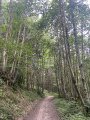
A lovely circular route through the forest between two of the main passes of the Monts du Lyonnais.A breath of fresh air and a gentle warm-up just a stone’s throw from the city of Lyon.
The Three Passes Traverse (Monts du Lyonnais)
 5.91 mi
+1,043 ft
-1,027 ft
3h 35
Average
Departure from Pollionnay (Rhône)
5.91 mi
+1,043 ft
-1,027 ft
3h 35
Average
Departure from Pollionnay (Rhône)
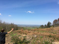
A classic and accessible route through the Monts du Lyonnais, mainly through woodland, with occasional views of the Lyon conurbation and the Alps in good weather. Views also extend to the Monts du Lyonnais and the Val de Saône.Also popular with mountain bikers, the route takes you over three passes, starting either from Fontrijole (where there is a small car park for the recommended start point) or from La Luère (better known to locals), via the Col de la Croix du Ban.
Route improved between points (3) and (4) following comments regarding private property.
Route des cerisiers à Bessenay
 8.86 mi
+1,572 ft
-1,572 ft
5h 25
Average
Departure from Bessenay (Rhône)
8.86 mi
+1,572 ft
-1,572 ft
5h 25
Average
Departure from Bessenay (Rhône)
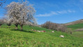
Circular route around Bessenay alternating between orchards, streams and hillsides. In spring, the white blossoms of the cherry trees brighten the rolling meadows. The streams you cross add to the charm of this typical route through the Monts du Lyonnais.
Col de la Luère, Col de Malval and Col de Saint-Bonnet-le-Froid
 6.10 mi
+1,030 ft
-1,030 ft
3h 40
Average
Departure from Pollionnay (Rhône)
6.10 mi
+1,030 ft
-1,030 ft
3h 40
Average
Departure from Pollionnay (Rhône)
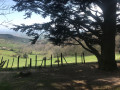
100% trail route.From (2) to (7), a route with absolutely no traffic; a GPS is recommended, although in this steep-sided valley there is a slight discrepancy with the actual route.Due to fallen trees, the park area is tricky, and you’ll need to use GPS and common sense to make your way through.Although this is not a mountain hike, do not attempt this route if you only hike on well-marked paths, as this is an area with no marked trails. I have removed a small, wild section of the hike that had become almost impassable.
Walk in the forest at the Col de la Luère
 3.46 mi
+732 ft
-728 ft
2h 15
Easy
Departure from Pollionnay (Rhône)
3.46 mi
+732 ft
-728 ft
2h 15
Easy
Departure from Pollionnay (Rhône)
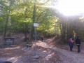
A short loop for an afternoon stroll from the Col de la Luère.
A very pleasant route, entirely in the forest, on easy paths and trails.
Col de la Luère and Col de la Croix du Ban starting from Pollionnay
 5.30 mi
+1,115 ft
-1,129 ft
3h 25
Average
Departure from Pollionnay (Rhône)
5.30 mi
+1,115 ft
-1,129 ft
3h 25
Average
Departure from Pollionnay (Rhône)
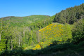
This route, which runs entirely through woodland, is pleasant in all seasons. Of moderate difficulty, it is the ideal route for a half-day hike. It is possible to start from the Col de la Croix du Ban, but parking spaces are limited.
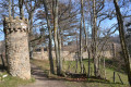
Saint-Bonnet-le-Froid Castle and Vaugneray from Pollionnay
 6.87 mi
+1,526 ft
-1,516 ft
4h 30
Average
Departure from Pollionnay (Rhône)
6.87 mi
+1,526 ft
-1,516 ft
4h 30
Average
Departure from Pollionnay (Rhône)
A lovely walk in the sunshine – perfect outside the summer months! Superb views in three directions. Numerous paths, but also small tarmac roads with very little traffic. A lovely 3-hour walk in the Monts du Lyonnais (estimated time for regular walkers).