From Saint-Bel to Lentilly via the Chapelle de Fouillet

A lovely walk connecting the TER station at Saint-Bel to the one at Lentilly, via the chapel at Sourcieux-les-Mines. Beautiful views of the Alps.

Details

n°7589771
Creation:
Last update:
Last review:
  • Walking
    Activity: Walking
  • ↔
    Distance: 5.43 mi
  • ◔
    Average duration: 3h 25 
  • ▲
    Difficulty: Easy

  • ⚐
    Back to start: No
  • ↗
    Ascent: + 1,089 ft
  • ↘
    Descent: - 879 ft

  • ▲
    Highest point: 1,650 ft
  • ▼
    Lowest point: 781 ft

Description of the walk

(S) From Sain-Bel station, cross the road and take the street opposite leading to the D7 (Route de Lyon). Head right towards the bridge over the Brévenne.

(1) Just before the bridge over the Brévenne, take the road on the right; at the junction, turn right onto the Montée de la Delaine and continue past the railway underpass until you reach a right-hand bend.

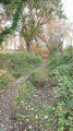
(2) At the right-hand bend, take a track on the left which curves to the right and descends into the woods, then turn left to follow the river. You’ll reach a crossroads

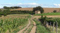
(3) Turn right at the end of the farm track. Head south towards Sourcieux-les-Mines. Cross the Route de Chassignol, then at the junction near a cross, continue straight ahead along the Route de Gervais for about 200 m.

(4) A small footpath, protected by a gate, leads up towards the village on the left. The paths are more or less visible from here, but your destination is the church, which is clearly visible.
After a right-hand bend followed by a left-hand bend, walk past the tennis courts, cross Rue des Sources and take the steps in front of the school which lead up to Route du Bourg near the town hall.

(5) Walk between the church and the town hall and go up Rue de l’Église; then, at the junction near a cross, continue towards the chapel via the Montée de Fouillet.

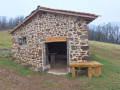
(6) Take a short detour to the chapel on the left, admire the view, then continue along the path to the end, where you’ll reach a T-junction.

(7) Leave the road on your left (it leads to Arbresle station) and turn right onto a farm track, continuing straight on until you reach the Route d’Éveux.

(8) Take care when crossing this busy road. The path continues opposite and leads to Lentilly

(9) On entering Lentilly, cross the junction and head up the Chemin du Bricollet opposite, which continues as the Rue du Joly, until you reach the large roundabout. The station is about a hundred metres to the left (E).

Waypoints

  1. S : mi 0 - alt. 791 ft - Gare de Sain-Bel
  2. 1 : mi 0.05 - alt. 791 ft - Crossroads - Brévenne(rivière) - Affluent de l'Azergues
  3. 2 : mi 0.44 - alt. 883 ft - Farm track
  4. 3 : mi 1.04 - alt. 1,161 ft - Exit from the fields
  5. 4 : mi 1.64 - alt. 1,181 ft - Footpath on the left
  6. 5 : mi 2.02 - alt. 1,309 ft - Sourcieux-les-Mines Town Hall
  7. 6 : mi 2.58 - alt. 1,650 ft - Panorama - Chapelle de Fouillet
  8. 7 : mi 3.32 - alt. 1,378 ft - Farm track
  9. 8 : mi 3.86 - alt. 1,302 ft - Crossing the road
  10. 9 : mi 4.73 - alt. 1,086 ft - Entrance to Lentilly
  11. E : mi 5.43 - alt. 991 ft - Gare de Lentilly

Notes

There are two places where you can eat:
- In Sourcieux-les-Mines, picnic tables are set up between (5) and (6).
- At La Chapelle de Sourcieux, there are also tables at point (7).

Reviews and comments

4.3 / 5
Based on 2 reviews

Reliability of the description
4.5 / 5
Ease of following the route
4.5 / 5
Route interest
4 / 5
Xerian
Xerian

Overall rating : 4.7 / 5

Date of your route : Oct 02, 2022
Reliability of the description : ★★★★★ Very good
Ease of following the route : ★★★★★ Very good
Route interest : ★★★★☆ Good
Very busy route : No

A lovely walk, particularly in the first section, where you walk sometimes through the forest and sometimes along the edge of meadows. It offers some stunning views of the western mountains of the Monts du Lyonnais (it must be said that the weather was perfect that day). As far as the guidebook is concerned, everything went very smoothly and the path is easy to follow right up to points 6 and 7. There, you can certainly make out a T-junction, but you reach this junction via the small branch (at the top) and to the right of the T; this isn’t really a farm track as it’s a small tarmac road, which doesn’t branch off to the right but which you continue to follow straight on. Fortunately, it does indeed lead quickly to the Eveux road. Directly ahead of you is the path leading to Lentilly, and everything falls into place.

Machine-translated

DimoDim
DimoDim

Overall rating : 4 / 5

Date of your route : Oct 02, 2022
Reliability of the description : ★★★★☆ Good
Ease of following the route : ★★★★☆ Good
Route interest : ★★★★☆ Good
Very busy route : No

A lovely little walk.
The information was accurate and we didn’t get lost, apart from once right at the very start.
I should point out that the first half of the walk is uphill. So I’d rate it as medium difficulty.
Thanks for everything

Machine-translated

Other walks in the area

For more walks, use our search engine .

The GPS track and description are the property of this route's author. Please do not copy them without permission.