Country:

 City:
City:


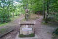
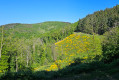

The car park at the Lionel Daudet Climbing Wall in Pollionnay is a convenient starting point for hiking in the surrounding forests.
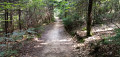
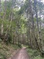
(S/E) From the car park, take the path leading into the forest to the left of the climbing hall. Follow this path, which climbs gently until it reaches a small tarmac road.
(1) Turn left and follow the tarmac road until you reach the main road. Cross it and follow the path opposite. The path soon splits into two. Don’t worry, they join up again. The one on the right is usually a bit easier to walk on. The path turns to the right. After about 300m, a path appears on the left, on the edge of a large cleared area. Ignore it and continue uphill.
(2) Follow the new path on the left at the end of the large cleared area. Pass over the cleared area and, after skirting it, a fairly steep path climbs up to your right.
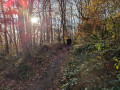
(3) Take this and climb steadily for about 500 metres. You will reach the main hiking trail, which is well marked and relatively flat.
(4) Follow it to the left for about 1 km, ignoring the paths branching off to the left and right.
(5) Before reaching the main road, take a path on your right that starts by running alongside the road. It turns into a wide track that descends into the valley. Stay on this track for nearly 2 km, ignoring the side paths branching off to the left and right. You will reach the end of a tarmac road.
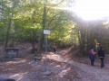
(6) An information board explains the surrounding landscape. Take the path that runs to the right of a small water tower. After about 600 m, having passed a house (on your right), you will come to another stretch of tarmac road.
(7) Do not follow this path down towards the main road; ignore the first path leading uphill on your right and continue along the path that passes over a cleared area, then, re-entering the forest, leads you gently to the Croix du Ban.
(8) Take the path leading down to your left. Pass by a house and arrive at the Col de la Croix du Ban.
(9) Follow the D610 to the right for just under 50 m. Head down to the left into the forest, along a narrow, fairly steep path. After just over 500 m, you’ll reach another path.
(10) Take this to the right and rejoin the small tarmac road you encountered at the start of the walk.
(1) Ignore the road leading uphill to the right that you took on the way up, and continue straight ahead. After 500 m, you will arrive back at your car park (S/E).
 Visorando Member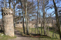

 Easy
Easy