


Refine your search for walks in Sahún
Sahún walks


 Angel Orus Mountain Hut – Estos car park
 Visorando Member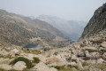
 8.41 mi
 +2,159 ft
 -4,738 ft
 5h 45
5h 45
 Difficult
 Departure from Sahún (Huesca)
The final stage of the Tour du Posets starts from the Angel Orus refuge and leads to the car park in the Estos Valley. The first part of the day takes place over very stony terrain before moving into a more wooded area for the second half of the descent. The route offers further stunning views of the eastern slope of the Posets and of several lakes dotted along the way.
The three waterfalls towards Cerier
4.21 mi
+1,106 ft
-1,099 ft
2h 55
 Easy
Departure from Benasque/Benás (Huesca)
Easy
Departure from Benasque/Benás (Huesca)
A very beautiful hike.
There is a tricky 10-metre section at the waterfall, but there is a safety line to help you.
The outward journey is a little more difficult than the return journey, but it's worth it. And it's good to do it in this direction.
The return route crosses fields.
Estos Valley with the Batisielles and Escarpinosa mountain lakes
9.99 mi
+3,497 ft
-3,530 ft
7h 40
Difficult
Departure from Benasque/Benás (Huesca)
Park at the free car park in Estos. Follow the GR® as it climbs gradually, passing close to the Embiase and then the Ana hut. Then turn left towards the Batisielles ibonet. We choose to continue towards the upper lakes: a steep and demanding climb to the Gran de Batisielles ibon, followed by a gentler slope to the Aigüeta ibon. Lunch break by the lake after a short scrambling section. Return via the Ibon d’Escarpinosa: a more technical route with numerous scree slopes, where you must follow the cairns closely and remain vigilant, even in the forest. Once in Escarpinosa, we take a circular route to explore the two ibons, where a few locals are swimming in August. The descent alternates between steep slopes and more gentle trails before rejoining the GR®, the perfect way to round off this beautiful, long day.
Ibón de Batisielles
9.67 mi
+3,494 ft
-3,461 ft
7h 30
Difficult
Departure from Benasque/Benás (Huesca)
A very pleasant walk that goes as far as the Batisielles tarns and takes in a section of the path to the Estos mountain hut. The walk passes a small hut – the Santa Ana hut – which is very charming. You can make an initial stop at the Batisielles tarn, where you can take the path leading directly to the pass between the two tarns to avoid the following sections. You can also head to the second ibon, the Aigulla de Batisielles, but this adds an extra 100 metres of elevation gain. You can turn back and take a path to avoid the avalanche couloirs. There is also a very difficult and very long section through the middle of the avalanche couloirs and over rocky ground. The rest of the route through the avalanche couloirs continues to feature dangerous sections. To see the paths more clearly, switch the map to OSM Rando. Please stay on the paths and respect the mountain environment.
Estos car park – Estos mountain hut
 5.17 mi
+2,011 ft
-115 ft
4h 10
5.17 mi
+2,011 ft
-115 ft
4h 10
 Moderate
Departure from Benasque/Benás (Huesca)
Moderate
Departure from Benasque/Benás (Huesca)
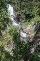
The first day of the Tour des Posets, which offers a gentle start with a steady climb to the Estos Mountain Hut. Initially through woodland, partly alongside the Rio Estos, the path follows the GR®11 route and takes you close to the Gorgues Galantes (waterfalls) before reaching thefirst mountain hut on this tour.
Estos Mountain Hut – Viados Mountain Hut
 6.80 mi
+2,487 ft
-3,028 ft
5h 20
Moderate
Departure from Benasque/Benás (Huesca)
6.80 mi
+2,487 ft
-3,028 ft
5h 20
Moderate
Departure from Benasque/Benás (Huesca)
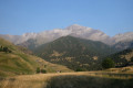
The second day of the Tour du Posets begins with a steady climb along the GR®11 to reach the Col d’Estos. The second part of the day is a long descent leading to the Refuge de Viados. There are stunning views of the valleys, followed by views of the summit of Posets and its neighbouring peaks during the second part of the day.
Tour of Aneto
24.52 mi
+9,741 ft
-9,744 ft
4 days
Difficult
Departure from Benasque/Benás (Huesca)
The walk starts from Fuente de la Pubiya, which is easily accessible by car and has a car park nearby. This walk allows you to reach your first peak at over 3,000 metres whilst enjoying magnificent high-mountain scenery, including glacial lakes, ridges and panoramic views of the Maladeta massif. However, the route remains challenging due to its length and elevation gain: it is advisable to be reasonably fit and to have experience of mountain walking before attempting it.
Fuente de la Pubiya – Prados de Llosás
5.63 mi
+3,074 ft
-476 ft
5h 15
Difficult
Departure from Benasque/Benás (Huesca)
Starting from Fuente de la Pubiya and ending at Prados de Llosás. The first day covers around 10 km with a climb of nearly 1,000 m. A lovely, gradual climb through the heart of the valley, with superb scenery and a finish in a magnificent setting.
Viados Mountain Hut – Angel Orus Mountain Hut
 6.95 mi
+3,947 ft
-2,707 ft
6h 40
Difficult
Departure from Gistaín/Chistén (Huesca)
6.95 mi
+3,947 ft
-2,707 ft
6h 40
Difficult
Departure from Gistaín/Chistén (Huesca)
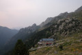
Day three of the Tour du Posets with a long day ahead: a long climb to reach the Collado de Eriste at an altitude of 2,862 metres before descending to the Angel Orus Refuge. Varied landscapes, starting with woodland before moving onto more open terrain that becomes increasingly rocky. The day ends with a section of boulders that makes you really appreciate arriving at the refuge!
Pic Perdiguère
 3.30 mi
+2,329 ft
-2,329 ft
3 hrs
3.30 mi
+2,329 ft
-2,329 ft
3 hrs
 Very difficult
Departure from Oô (Haute-Garonne)
Very difficult
Departure from Oô (Haute-Garonne)
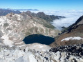
Pic Perdiguère, the highest peak in the Luchon area, is a magnificent viewpoint easily reached from the mountain hut. You can therefore enjoy the relatively uncrowded summit and, on the way back, the exceptional scenery of Lac du Portillon. After the very exposed traverse of the north-west shoulder of Pic Royo, the ascent up the Vallon de Litérole is steep but presents no technical difficulties. Once you reach the Col Supérieur de Litérole, you will need to use your hands to reach the long ridge that forms the summit.
Tour of Tozal d'Escoubillons
6.72 mi
+1,624 ft
-1,594 ft
4h 30
Moderate
Departure from Tella-Sin (Huesca)
Hike in the heart of the pastures of the Sierra de los Fubillons (Aragon), with splendid views of the meadows and peaks of Aragon and the border.
Remuné Valley and Ibon
4.70 mi
+2,165 ft
-2,093 ft
4h 05
Difficult
Departure from Benasque/Benás (Huesca)
A hike following the Remuné ravine, classified as ‘moderate’ by the Tourist Office, but we found the route to be more technical due to the numerous scree slopes and small streams, which made the rocks slippery. Some of the climbs are steep but over short distances; you climb whilst enjoying views of the various surrounding peaks and the sound of the waterfalls. The upper Ibons were almost dry, but the plateau then allows you to climb up to the Ibon de Remuné, which offers a little haven of tranquillity. A pleasant outing, though longer than expected.
Prados de Llosás – Cap de Llauset mountain hut
3.65 mi
+3,156 ft
-2,257 ft
4h 25
Difficult
Departure from Benasque/Benás (Huesca)
The route runs from Prados de Llosás to the Cap de Llauset mountain hut. This is a day during which you’ll have the chance to climb a peak over 3,000 metres high, the Tuca de Culebres. From there, you’ll be able to enjoy a magnificent view of the Aneto. You’ll then continue on a gentle descent to the mountain hut.
Refuge du Maupas – Pic de Maupas – Lys Valley
8.09 mi
+2,457 ft
-6,703 ft
6 hrs
Very difficult
Departure from Castillon-de-Larboust (Haute-Garonne)
On this day’s hike, you’ll need to find your own way up to the Pic de Maupas over rounded boulders, where the numerous cairns mean you’ll have to locate the next one each time to continue the ascent to the ‘Mal Pas’, which gave the peak its name. This is the only pass – difficult to access – allowing you to cross over to the western slope and complete the ascent with a few easy climbing moves. The return will follow the same route as the ascent, with a pleasant alternative route via Lac Vert.
Lake Espingo - Granges d'Astau
 3.84 mi
+72 ft
-2,746 ft
1h 50
Easy
Departure from Oô (Haute-Garonne)
3.84 mi
+72 ft
-2,746 ft
1h 50
Easy
Departure from Oô (Haute-Garonne)
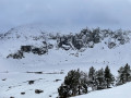
A gentle descent after the exertions of the previous days. From the Col d’Espingo, the Lac d’Oô below accompanies us for a long while. Once at the stone bridge, don’t hesitate to make a short detour to the Auberge du Lac d’Oô, where you can enjoy the view of the great waterfall, which will help you forget, if only for a moment, the increasingly obvious and cruel shortage of water. The return to Les Granges d’Astau brings this getaway in one of the most beautiful spots in the Luchon area to a pleasant close.
Aiguallut Waterfall and Forau d’Aiguallut
9.62 mi
+1,942 ft
-1,962 ft
6h 05
Difficult
Departure from Benasque/Benás (Huesca)
A beautiful succession of landscapes including a plateau, a mountain refuge, a pass and a waterfall…
Park in the car park accessible to tourists. Alternatively, there is a paid shuttle bus from Bénasque to La Besurta.
Water is available at the La Besurta car park, at the refreshment bar and at the mountain refuge.
Gouffre and Ru d'Enfer
 4.64 mi
+2,057 ft
-2,031 ft
3h 55
Moderate
Departure from Castillon-de-Larboust (Haute-Garonne)
4.64 mi
+2,057 ft
-2,031 ft
3h 55
Moderate
Departure from Castillon-de-Larboust (Haute-Garonne)
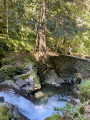
A shady walk that takes in a splendid canyon and wonderful waterfalls.
Lake Caillauas
 10.57 mi
+3,517 ft
-3,497 ft
7 hrs
Very difficult
Departure from Génos (Hautes-Pyrénées) (Hautes-Pyrénées)
10.57 mi
+3,517 ft
-3,497 ft
7 hrs
Very difficult
Departure from Génos (Hautes-Pyrénées) (Hautes-Pyrénées)
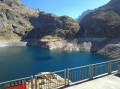
A very beautiful hike which, initially through the woods with explanatory panels, allows you to cover the elevation gain without even noticing. Then the Clarabide Gorges with the balcony path carved into the rock are magnificent. From the refuge to the lake, the landscape becomes more rocky. On arrival, there is a splendid view of the 3,000 m mountain range. I would say it is more difficult than very difficult, as recommended by Visorando
Clarabide Gorges - Upper lakes of the Louron Valley
 14.52 mi
+4,573 ft
-4,554 ft
More than 12 hrs
Very difficult
Departure from Génos (Hautes-Pyrénées) (Hautes-Pyrénées)
14.52 mi
+4,573 ft
-4,554 ft
More than 12 hrs
Very difficult
Departure from Génos (Hautes-Pyrénées) (Hautes-Pyrénées)
Long circular loop for very good walkers.
Pont du Prat - Clarabide Gorges - Refuge de la Soula - Lac de Caillauas and Lac de Pouchergues.
Soula refuge
 6.05 mi
+1,886 ft
-1,867 ft
4h 25
Difficult
Departure from Génos (Hautes-Pyrénées) (Hautes-Pyrénées)
6.05 mi
+1,886 ft
-1,867 ft
4h 25
Difficult
Departure from Génos (Hautes-Pyrénées) (Hautes-Pyrénées)
A very beautiful hike which, initially through the woods with informative signs, allows you to cover the elevation gain without even noticing. Ideal for children. Then the Clarabide Gorges with the path carved into the rock are magnificent and the reward is not far away.I would like to point out that, having done this hike again, the altitude figures given by the Visorando software are incorrect. The elevation gain is around 550 m.
Lake Pouchergue
 11.68 mi
+4,646 ft
-4,646 ft
More than 12 hrs
Very difficult
Departure from Génos (Hautes-Pyrénées) (Hautes-Pyrénées)
11.68 mi
+4,646 ft
-4,646 ft
More than 12 hrs
Very difficult
Departure from Génos (Hautes-Pyrénées) (Hautes-Pyrénées)
A beautiful, long hike starting from Pont du Prat in Val Louron. For those who enjoy exercise and endurance, the variety of views along the route is sure to impress!
Lac Vert, the Cirque de la Glère and the Hospice de France
 11.08 mi
+4,682 ft
-3,858 ft
7 hrs
Very difficult
Departure from Castillon-de-Larboust (Haute-Garonne)
11.08 mi
+4,682 ft
-3,858 ft
7 hrs
Very difficult
Departure from Castillon-de-Larboust (Haute-Garonne)
A truly beautiful walk leading from the Vallée du Lys to the Hospice de France via the Lac Vert. The route is varied and the elevation gain is certainly significant, but this is more than made up for by the magnificent views over the Haut-Luchonnais and the ridge marking the border with Spain.
Mont du Lys via the Serre des Cabales ridge
 7.87 mi
+3,796 ft
-3,776 ft
6h 55
Difficult
Departure from Cazeaux-de-Larboust (Haute-Garonne)
7.87 mi
+3,796 ft
-3,776 ft
6h 55
Difficult
Departure from Cazeaux-de-Larboust (Haute-Garonne)
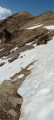
A very beautiful, quiet hike offering views of several waterfalls and a magnificent vista of the Cirque des Crabioules and its peaks over 3,000 m. However, the largely unmarked path and the significant gradient require a fair bit of fitness.
Lac Vert loop via the Coume hut
 Association / Club / Walk leader
 7.47 mi
+3,251 ft
-3,232 ft
6h 15
Difficult
Departure from Cazeaux-de-Larboust (Haute-Garonne)
7.47 mi
+3,251 ft
-3,232 ft
6h 15
Difficult
Departure from Cazeaux-de-Larboust (Haute-Garonne)
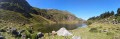
This is a beautiful hike during which you will discover stunning waterfalls, a beautiful view of the Luchonnais region and, the highlight of the show, the green waters of the lake of the same name. However, due to its elevation, length and a few tricky sections, this route requires a good level of fitness.
Lys Valley - Maupas Refuge
4.62 mi
+4,245 ft
-3 ft
5h 50
Difficult
Departure from Cazeaux-de-Larboust (Haute-Garonne)
This first stage, which serves as an approach walk, is difficult. The climb is steep and sustained along the Torrent de Houradade up to the junction at the Cabane de la Coume. Continuing the route to reach the Cabane de Pratlong allows you to catch your breath a little before tackling the final stretch via the numerous tight hairpin bends leading to the pumping station and then to the Refuge du Maupas, where the warm welcome will quickly make you forget the day’s exertions.
Pic du Maupas
12.72 mi
+6,713 ft
-6,703 ft
2 days
Very difficult
Departure from Cazeaux-de-Larboust (Haute-Garonne)
A fairly demanding two-day hike. The ascent to the Refuge du Maupas, whilst steep, presents no difficulties apart from the elevation gain. The same cannot be said for the ascent of the Pic du Maupas, which is intended for experienced hikers who know how to navigate off-trail and are capable of tackling a few short sections of easy climbing and descending. However, the 360° panorama covering almost all of the 3,000-metre peaks of the Luchon region is well worth the effort.
Plan d’Abaixo – Fuente de la Pubiya
6.17 mi
+630 ft
-2,231 ft
3h 25
Moderate
Departure from Benasque/Benás (Huesca)
The route runs from Plan d’Abaixo to Fuente de la Pubiya. This final stage, approximately 10 km long, will take you back to the starting point of the route. You’ll follow mountain paths offering beautiful views of the valley before finishing with a gentle descent to Fuente de la Pubiya, thus completing this circular walk.
Maupas Mountain Hut via the Cirque des Crabioules
 6.12 mi
+4,839 ft
-581 ft
6 hrs
Very difficult
Departure from Cazeaux-de-Larboust (Haute-Garonne)
6.12 mi
+4,839 ft
-581 ft
6 hrs
Very difficult
Departure from Cazeaux-de-Larboust (Haute-Garonne)
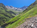
An alternative route to climb up and spend the night at the Refuge du Maupas: this is longer than the standard ascent but less busy, offering splendid views over the Lys Valley and the 3,000-metre peaks overlooking the Cirque des Crabioules. Best undertaken in good weather, as the path is sometimes poorly marked after the Anciennes Mines des Crabioules.
Pics de Batoua (or Culfreda)
9.23 mi
+5,082 ft
-5,082 ft
7 hrs
Very difficult
Departure from Saint-Lary-Soulan (Hautes-Pyrénées)
Three 3,000-metre peaks for the price of one! That’s what this hike offers, taking in the three Pic de Batoua peaks from Rioumajou, through a wild and magnificent valley. The route between the Port de Cauarère and the three peaks follows a superb ridge along the French-Spanish border, offering stunning views of the 3,000-metre peaks of the Pyrenees.
From the Hospice de Rioumajou to Saint-Lary-Soulan
 10.85 mi
+1,063 ft
-3,478 ft
5h 55
Moderate
Departure from Saint-Lary-Soulan (Hautes-Pyrénées)
10.85 mi
+1,063 ft
-3,478 ft
5h 55
Moderate
Departure from Saint-Lary-Soulan (Hautes-Pyrénées)
The first stage starts at the Hospice du Rioumajou. You are at the start of the summer pastures, one of the arrival points of the Ténarèze. This ancient path, first traced in prehistoric times and then developed by the Romans, linked the Adour and Garonne basins, avoiding fords and tolls. A major transhumance route, it allowed herds to move between the plains and the mountains, while serving as a commercial and cultural link between Gascony and Spain, notably via passes such as the Ourdissétou.
Col de la Glère – Lac des Gourgoutes
9.51 mi
+4,715 ft
-4,685 ft
8h 30
Difficult
Departure from Bagnères-de-Luchon (Haute-Garonne)
Starting from the Jouéou valley, this high-mountain hike takes you to the magnificent Cirque de la Glère, whose slopes, furrowed by numerous small streams, are dominated by the ridge marking the border with Spain and the Pic du Sacroux. Once at the Col de la Glère, an easy descent on the Spanish side leads to the Lac des Gourgoutes. A little further on, on the shoulder of the Pic de la Glère, the view over the Aneto and the Maladeta massif is a wonderful reward.
Campsaure Hut via the Hospice de France
 9.22 mi
+2,861 ft
-2,861 ft
6h 45
Difficult
Departure from Bagnères-de-Luchon (Haute-Garonne)
9.22 mi
+2,861 ft
-2,861 ft
6h 45
Difficult
Departure from Bagnères-de-Luchon (Haute-Garonne)
Starting from Pont de Ravi, near Bagnères-de-Luchon, this circular walk takes you past the Hospice de France and the Cabane du Campsaure on the plateau of the same name, and ends with a walk through a splendid beech forest.
From Rioumajou to the Cortail de Batoua hut
 6.61 mi
+2,080 ft
-2,073 ft
4h 50
Moderate
Departure from Saint-Lary-Soulan (Hautes-Pyrénées)
6.61 mi
+2,080 ft
-2,073 ft
4h 50
Moderate
Departure from Saint-Lary-Soulan (Hautes-Pyrénées)
A superb hike to enjoy in both winter and summer! Far from being monotonous, this hike, with its varied scenery, is easy to follow and offers different views of the beautiful Rioumajou Valley and the surrounding peaks. The first section, up to the Cabane du Cortail de Batoua, follows a stream before heading into the forest and climbing up to the cirque where the hut is located – perfect for the sweltering summer heat! The second section is very pleasant to walk and, above all, magnificent; the path is quite fun to follow, with a few sections where you need to use your hands, but nothing too complicated. It’s accessible to everyone! You’ll see several waterfalls and wildlife along the way, before returning to the valley by following the stream.
Péguère Trail
 2.68 mi
+436 ft
-436 ft
1h 35
Easy
Departure from Saint-Lary-Soulan (Hautes-Pyrénées)
2.68 mi
+436 ft
-436 ft
1h 35
Easy
Departure from Saint-Lary-Soulan (Hautes-Pyrénées)
This hike is accessible to everyone, even young children. It offers beautiful scenery and a pleasant walk along the river.
The route of the Péguère, Niscoude and Batoua huts
 6.34 mi
+2,746 ft
-2,743 ft
5h 20
Difficult
Departure from Saint-Lary-Soulan (Hautes-Pyrénées)
6.34 mi
+2,746 ft
-2,743 ft
5h 20
Difficult
Departure from Saint-Lary-Soulan (Hautes-Pyrénées)
Magnificent scenery, forests, mountain pastures, waterfalls, streams, torrents and huts.
Few visitors at higher altitudes, although the start point is very busy at the Fredancon car park.
Please note: after the hut (5), there are two secured sections which cannot be crossed in bad weather.
Pic de Lustou
 7.55 mi
+5,338 ft
-5,341 ft
8 hrs
Very difficult
Departure from Saint-Lary-Soulan (Hautes-Pyrénées)
7.55 mi
+5,338 ft
-5,341 ft
8 hrs
Very difficult
Departure from Saint-Lary-Soulan (Hautes-Pyrénées)
A beautiful, little-used round trip hike to climb the Pic de Lustou, at over 3,000 metres, offering a 360° panorama of the most beautiful peaks in the Pyrenees.
Please note: after the point (7), you will need to be extra careful.
The Baricave Tower, Rioumajou Valley
 4.36 mi
+1,788 ft
-1,791 ft
3h 35
Moderate
Departure from Saint-Lary-Soulan (Hautes-Pyrénées)
4.36 mi
+1,788 ft
-1,791 ft
3h 35
Moderate
Departure from Saint-Lary-Soulan (Hautes-Pyrénées)
A pretty mid-mountain circular, straddling two valleys, Baricave and Rioumajou, which allows those who wish to do a little climbing to reach the summit, but without obligation.