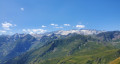
Campsaure Hut via the Hospice de France

Starting from Pont de Ravi, near Bagnères-de-Luchon, this circular walk takes you past the Hospice de France and the Cabane du Campsaure on the plateau of the same name, and ends with a walk through a splendid beech forest.

Details

1058746
Creation:
Last update:
Last review:
  • Walking
    Activity: Walking
  • ↔
    Distance: 9.22 mi
  • ◔
    Average duration: 6h 45 
  • ▲
    Difficulty: Difficult

  • ⚐
    Back to start: Yes
  • ↗
    Ascent: + 2,861 ft
  • ↘
    Descent: - 2,861 ft

  • ▲
    Highest point: 5,443 ft
  • ▼
    Lowest point: 2,707 ft

Photos

Description of the walk

In Bagnères-de-Luchon, head towards Superbagnères. After 5 km, follow signs for Hospice de France (D125). Park about 100 metres to the right.

(S/E) Start the walk on the Route de l’Hospice de France for about 250m.

(1) Turn left onto the old Route de l’Hospice de France, which is closed to traffic but remains tarmacked for a further 2 km. Cross the Pont de Charruga.

(2) Carry on straight ahead, ignoring the path on your left. Go over a small earth mound (the end of the road for vehicles) and follow the main track.

(3) At the junction, leave the forest track (Chemin Louise) on your left and carry on straight on to the Hospice de France.

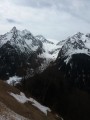
(4) Take a short break to admire the Pic de la Pique, Bec de Corbeau, Pic de la Mine and the climb up to the Boums du Port lakes.
To the left of the refuge, take the Sentier des Chèvres. Cross the Roumingou stream – this is straightforward, except in winter when there is a lot of snow; be careful as there may be a steep snow slope. Sometimes it is better to turn back. Continue along the path through the forest.

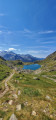
(5) On emerging from the forest, follow the track across the grassy area to the Cabane du Campsaure.

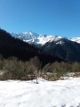
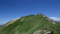
(6) Enjoy the south-westerly view of the Pic de la Pique and the peaks of the Cirque de la Glère.
Continue along the forest track (Chemin de Louise) and leave the path leading to the Col de Barège on your right.

(7) Leave the forest track and turn right onto the path through the forest

(8) When you reach a fairly flat clearing, do not continue straight on, but look out for the path that loops back (hairpin bend) and follow it towards the Cabane des Barguères.

(9) As you pass the Cabane des Barguères, stop for a moment to admire the top of the Cirque de la Glère, then carry on to the end of the forest track.

(10) Carry on straight ahead along the narrow path that descends into the forest. (Mountain bike markings).

(11) Ignore the paths to the right and left and carry on straight ahead. Keep following the mountain bike markings. The path will become increasingly narrow.

(12) Keep going straight on, ignoring the small paths to the right and left, until you reach the D125.

(13) At the road, turn left and continue along it until you reach the starting point (S/E).

Waypoints

  1. S/E : mi 0 - alt. 2,917 ft - Park after the D46/D125 junction. Confluence Pique/ - Lis (cours d'eau) - Affluent de la Pique
  2. 1 : mi 0.14 - alt. 2,966 ft - Path on the left
  3. 2 : mi 1.29 - alt. 3,583 ft - Summer car park
  4. 3 : mi 2.55 - alt. 4,262 ft - Track straight ahead
  5. 4 : mi 3.04 - alt. 4,518 ft - Hospice de France. Passage near the - Pique (rivière)
  6. 5 : mi 3.7 - alt. 5,367 ft - Campsaure (exit from the forest)
  7. 6 : mi 4.14 - alt. 5,420 ft - Campsaure Hut
  8. 7 : mi 5.37 - alt. 4,810 ft - Path on the right
  9. 8 : mi 6.02 - alt. 4,564 ft - Cockpit
  10. 9 : mi 6.29 - alt. 4,459 ft - Cabane des Barguères
  11. 10 : mi 6.79 - alt. 4,295 ft - End of the forest track
  12. 11 : mi 7.04 - alt. 4,134 ft - Straight on (mountain bike signposts)
  13. 12 : mi 7.65 - alt. 3,658 ft - Straight on towards the D125
  14. 13 : mi 8.63 - alt. 2,707 ft - Turn left onto the D125
  15. S/E : mi 9.22 - alt. 2,917 ft - Car park after the D46/D125 junction

Notes

The road to the Hospice de France is closed from Pont de Ravi from 15 November to 15 April.
And from 1 December to 15 April, the old road is impassable and closed from (2) all year round.
Outside these dates, it is possible to drive as far as (2) and park there.
The Hospice de France mountain refuge is staffed during the road’s opening period.

Shortcut:
(3) If you wish to shorten the walk, take the Chemin Louise to (7) and continue slightly to the left, leaving the track on your right.

At (7), if you wish to shorten the walk here too, carry on straight ahead along the track to (3) and return to the starting point.

Worth a visit

From the Hospice de France, from May and June until the end of October only, you can go on walks to:
Le Port de Venasque, Le Sauvegarde, via Les Boums du Port, La Montagnette, the Cirque de la Glère and the whole of Campsaure.

Reviews and comments

4.3 / 5
Based on 3 reviews

Reliability of the description
4.7 / 5
Ease of following the route
4.7 / 5
Route interest
3.7 / 5
Nenel2781
Nenel2781
• Edited:

Overall rating : 3.7 / 5

Date of your route : Sep 13, 2023
Reliability of the description : ★★★★☆ Good
Ease of following the route : ★★★★☆ Good
Route interest : ★★★☆☆ Average
Very busy route : No

A lovely walk with some stunning scenery, even though much of it is along roads or wide tracks...
It doesn’t deserve to be classified as difficult as nothing is really challenging... There’s 1,000 metres of elevation gain, but it’s manageable and the descents are really very easy.
In early autumn, it’s ideal for foraging for porcini mushrooms.

Machine-translated

jp300646
jp300646

Overall rating : 4.7 / 5

Date of your route : Aug 27, 2018
Reliability of the description : ★★★★★ Very good
Ease of following the route : ★★★★★ Very good
Route interest : ★★★★☆ Good

A pleasant walk, even in hot weather, as it’s mainly through the woods – but make sure you wear sturdy shoes all the same. It’s quite busy at the start, but much less so further on.

Machine-translated

km55
km55

Overall rating : 4.7 / 5

Date of your route : Aug 17, 2018
Reliability of the description : ★★★★★ Very good
Ease of following the route : ★★★★★ Very good
Route interest : ★★★★☆ Good

I’d say this walk is of moderate difficulty – not difficult. There’s barely 100 metres of challenging terrain just after the Hospices de France. The rest is easy. The scenery is very pretty around the Hospices and further up, but a bit disappointing in the forest. This walk is particularly ideal on very hot days, as there’s quite a lot of forest.

Machine-translated

Other walks in the area

For more walks, use our search engine .

The GPS track and description are the property of this route's author. Please do not copy them without permission.