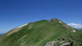
Lac Vert, the Cirque de la Glère and the Hospice de France

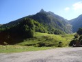
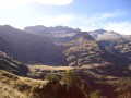
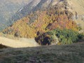
A truly beautiful walk leading from the Vallée du Lys to the Hospice de France via the Lac Vert. The route is varied and the elevation gain is certainly significant, but this is more than made up for by the magnificent views over the Haut-Luchonnais and the ridge marking the border with Spain.

Details

98500
Creation:
Last update:
Last review:
  • Walking
    Activity: Walking
  • ↔
    Distance: 11.08 mi
  • ◔
    Duration according to the author: 7 hrs 
  • ▲
    Difficulty: Very difficult

  • ⚐
    Back to start: No
  • ↗
    Ascent: + 4,682 ft
  • ↘
    Descent: - 3,858 ft

  • ▲
    Highest point: 6,982 ft
  • ▼
    Lowest point: 3,704 ft

Photos

Description of the walk

From Bagnères-de-Luchon, take the D125 towards Superbagnères. At the hairpin bend at a place called l’Ourson, head straight on to reach the bottom of the Vallée du Lys and park your car in the car park by the stream, near the inn.

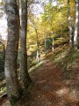
(S) Cross the stream via the footbridge and follow the wide path southwards, which first crosses a meadow before quickly turning into the forest.

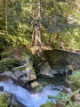
After a series of hairpin bends, the path straightens out. Take a moment to admire the Cascade du Cœur, below on the right, then you’ll reach a junction at the foot of the large Artigue meadow.

(1) Turn left across this meadow. The steeply ascending path approaches the stream at the Houradade waterfall and reaches a second junction.

(2) Leave the path leading to the Pratlong hut on your right and turn left. You’ll pass the Cabane de la Coume on your left, along with its spring and enclosure. The path, heading south-east, enters a steep-sided valley and the climb is steep.

(3) At the junction, leave the Col de Pinata path on your left – which you’ll take on the way back – and continue climbing to the right. The path, which is very well marked and stoned in places, winds its way up through several hairpin bends, heads south-west and finally levels out a little before reaching the tiny Lac des Graouès.

(4) Continue west-north-west and you’ll soon reach a rocky outcrop directly below the Pic de Graves.

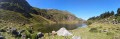
(5) You’ll finally come upon Lac Vert and its distinctive peninsula. Head down and you’ll soon reach the lakeshore, which you follow to the outlet. This is the ideal spot for a picnic.

(6) Retrace your steps along the ascent route in the opposite direction until you reach point (3). Turn right onto the path, which levels out, winds through several hairpin bends and then turns south to reach the Col de Pinata.

(7) After the pass, follow a virtually flat, balcony-like path above the small Bounèu valley. This section is at times quite exposed, so take care where you step, particularly on the rocky sections. You’ll soon reach the Col de Sacroux, at the foot of the peak of the same name.

(8) Ignore a path on the left and continue straight on, descending to the junction with the path leading to the Port de la Glère.

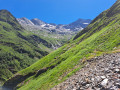
(9) Turn left. Enjoy the magnificent view down into the Cirque de la Glère straight ahead. There is a significant descent to reach the next junction.

(10) Ignore the path on the right which goes round the cirque and turn left to reach a Fork in the road at the break in the slope.

(11) Turn right, cross the small Glère stream and join the clearly visible path opposite.

(12) Turn left onto this flat path, which heads first north and then east, following the contours of the terrain. This is the Chemin de l’Impératrice, which leads without too much effort to the Pont de Penjat.

(13) From the bridge, enjoy the view of the Hospice de France, which has finally been restored and looks splendid. Turn left onto the wide track.

(14) Leave this track after about 500 metres and take the path slightly to the left, which leads in a few minutes to the Hospice de France, the end of the walk (E).

Waypoints

  1. S : mi 0 - alt. 3,714 ft - Vallée du car park - Lis (cours d'eau) - Affluent de la Pique
  2. 1 : mi 0.99 - alt. 4,593 ft - Junction. Prairie de l’Artigue. Turn left.
  3. 2 : mi 1.89 - alt. 5,600 ft - Junction. Turn left.
  4. 3 : mi 2.53 - alt. 6,309 ft - Start of the Col de Pinata path. On the right.
  5. 4 : mi 2.95 - alt. 6,621 ft - Flat section. Lac des Graouès.
  6. 5 : mi 3.3 - alt. 6,726 ft - Cliff. View of the - Lac Vert
  7. 6 : mi 3.65 - alt. 6,565 ft - Outlet of Lac Vert.
  8. 7 : mi 5.35 - alt. 6,982 ft - Col de Pinata (2152m)
  9. 8 : mi 6.41 - alt. 6,673 ft - Col de Sacroux (2034m)
  10. 9 : mi 6.96 - alt. 5,994 ft - Junction with the Chemin du Port de la Glère. Turn left
  11. 10 : mi 7.46 - alt. 5,410 ft - At the junction, turn left
  12. 11 : mi 7.71 - alt. 5,102 ft - Change in gradient. Turn right.
  13. 12 : mi 7.88 - alt. 5,180 ft - Junction with the Chemin de l’Impératrice. Turn left
  14. 13 : mi 10.63 - alt. 4,731 ft - Pont de Penjat. On the left.
  15. 14 : mi 10.92 - alt. 4,616 ft - Leave the track. Turn left.
  16. E : mi 11.08 - alt. 4,551 ft - Hospice de France. After the - Pique (rivière)

Notes

There is plenty of water along the route, but also plenty of wildlife. It is therefore essential to take a good supply with you. However, you can top up your supplies at the Coume hut.

You can stay overnight at this hut when the shepherd is not there.

Please note: this hike is not a route. You will therefore need to arrange transport from the Hospice de France to be taken back to the Vallée du Lys, if you have parked your car there.

This hike is demanding due to its significant elevation gain. You should take regular breaks. Good walking boots are recommended, as well as walking poles for the downhill sections, such as the one after the Col de Sacroux.

Worth a visit

The lakes route takes you round Lac Bleu, Lac Saint-Charles and finally Lac Célinda, which is often graced by a late snowfield.

The Pic de Maupas, via the Pratlong hut.

The waterfall, the chasm and the Rue d’Enfer.

Reviews and comments

4.8 / 5
Based on 2 reviews

Reliability of the description
5 / 5
Ease of following the route
4.5 / 5
Route interest
5 / 5
Nanou8182
Nanou8182

Overall rating : 4.7 / 5

Date of your route : Jun 26, 2023
Reliability of the description : ★★★★★ Very good
Ease of following the route : ★★★★☆ Good
Route interest : ★★★★★ Very good
Very busy route : Yes

It’s a bit of a tough hike for a beginner like me. But once you get to Lac Vert, it’s absolutely stunning.

Machine-translated

Idh-Yaa
Idh-Yaa

Overall rating : 5 / 5

Date of your route : Jul 11, 2013
Reliability of the description : ★★★★★ Very good
Ease of following the route : ★★★★★ Very good
Route interest : ★★★★★ Very good

Given the elevation gain, I prefer to do it the other way round. Between Sacroux and Pinata it’s a wasteland; the slightest slip could be your last. The view is unrivalled. I much prefer climbing up the scree slope of the Cirque de la Glère towards Sacroux than descending it (trekking poles are of little use; a sledge would be better).

Machine-translated

Other walks in the area

For more walks, use our search engine .

The GPS track and description are the property of this route's author. Please do not copy them without permission.