Refuge du Maupas – Pic de Maupas – Lys Valley

On this day’s hike, you’ll need to find your own way up to the Pic de Maupas over rounded boulders, where the numerous cairns mean you’ll have to locate the next one each time to continue the ascent to the ‘Mal Pas’, which gave the peak its name. This is the only pass – difficult to access – allowing you to cross over to the western slope and complete the ascent with a few easy climbing moves. The return will follow the same route as the ascent, with a pleasant alternative route via Lac Vert.

This walk is part of a multi-day hike: Pic du Maupas

Details

3129752
Creation:
Last update:
Last review:
  • Walking
    Activity: Walking
  • ↔
    Distance: 8.09 mi
  • ◔
    Duration according to the author: 6 hrs 
  • ▲
    Difficulty: Very difficult

  • ⚐
    Back to start: No
  • ↗
    Ascent: + 2,457 ft
  • ↘
    Descent: - 6,703 ft

  • ▲
    Highest point: 9,902 ft
  • ▼
    Lowest point: 3,684 ft

Description of the walk

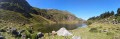
(S) Leave the refuge heading south-east, heading for the small lake which you follow on the right-hand side. Climb southwards up a rocky outcrop formed of glacier-polished, rounded boulders, leading to a small plateau.

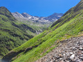
(1) Continue southwards, skirting a small rocky cirque enclosed by the Pic de Maupas–Pic de Boum ridge, at the foot of which the small Boum glacier struggles to survive. Head for the base of the secondary peak, the Tusse de Maupas.

(2) Go round this peak to the left and veer off to the right (south-west) to climb diagonally up rocky slabs. The cairns help you stay on the right track.

(3) A rocky barrier makes access to the ridge impossible. Continue up the eastern slope, then join the ridge a little further up at a small gap, also known as the ‘Mal Pas’, which you reach by using your hands. It is absolutely essential to find this passage. If you are unsure or in bad weather, do not hesitate to turn back.

(4) Continue to the left, more or less following the line of the ridge, then complete the ascent through the large scree of the summit scree slope with a few steps of easy climbing. Those prone to vertigo may feel uncomfortable on this final section. Reach the summit, marked by a large cairn.

(5) Pic du Maupas: exceptional 360° views. To the west, the Pic des Crabioules, Pic Lézat and Grand Quayrat. To the south-west, the Pic Perdiguère unfolds its long, easily recognisable rocky summit. To the south-east, the Aneto and the Maladeta. Finally, to the east, the Pic de Boum and the Pic de Sacroux, to name the nearest.

After taking in the view, descend carefully via the same route. It is equally important to find the “Mal Pas” to avoid the more direct descent via the Tusse de Maupas, which is much more exposed. Head back to the Refuge du Maupas.

(S) Follow the previous day’s route back to the junction with the Lac Vert path.

(6) Turn right and, following an easy path, reach the shores of Lac Vert with its picturesque peninsula.

(7) Ford the outlet stream, walk along the lake and then head up to the small pass leading into the Cirque des Graouès. Continue straight on, beginning the descent along the path which becomes stony and heads north.

(8) Ignore the path on the right leading to the Col de Pinata and carry on straight ahead along the valley floor towards the Cabane de la Coume, nestled at the foot of a small rocky outcrop. Leave the hut on your left and continue to the junction with the path to the Cabane de Prat Long, which you took the day before.

(9) Carry on straight ahead and begin the descent down the Torrent de Houradade valley, which is just as gruelling as the climb. You’ll reach the foot of the Pré de l’Artigue.

(10) Turn right and head into the forest. Further down, join the track and follow it to the right.

(11) Cross the bridge over the stream and head back to the Bourdalès car park (E).
Waypoints

  1. S : mi 0 - alt. 7,953 ft - Refuge du Maupas
  2. 1 : mi 0.33 - alt. 8,524 ft - Small plateau
  3. 2 : mi 0.65 - alt. 9,154 ft - Base of the Tusse de Maupas
  4. 3 : mi 0.84 - alt. 9,482 ft - Rocky outcrop
  5. 4 : mi 0.92 - alt. 9,613 ft - Brèche Nord, Mal Pas
  6. 5 : mi 1.04 - alt. 9,826 ft - Pic du Maupas (3109m)
  7. 6 : mi 3.59 - alt. 6,391 ft - Start of the Lac Vert trail
  8. 7 : mi 4.42 - alt. 6,565 ft - Fording - Lac Vert
  9. 8 : mi 5.55 - alt. 6,316 ft - Start of the Col de Pinata trail
  10. 9 : mi 6.27 - alt. 5,545 ft - Junction with the Prat Long path, on the right
  11. 10 : mi 7.06 - alt. 4,600 ft - Pré d’Artigue
  12. 11 : mi 7.98 - alt. 3,701 ft - Lis (cours d'eau) - Affluent de la Pique
  13. E : mi 8.09 - alt. 3,684 ft - parking des gorges de bourdolés

Notes

Difficulty: this hike is only suitable for those accustomed to a high-mountain environment and walking off-trail. There are a few easy climbing sections between (2) and (3) and on the scree slope at the summit. The same applies to the descent.

It is essential to clearly identify the “Mal Pas”, a gap in the ridge linking the Maupas and the Tusse de Maupas, which is the only passage allowing you to cross over to the other side to reach the summit.

Between the Refuge du Maupas and the gap, cairns help with navigation, but they are scattered everywhere and there are numerous ascent routes, which can be confusing. It is therefore important not to veer too far to the left whilst heading for the eastern base of the Tusse de Maupas.

This hike should be avoided in stormy or foggy weather. Navigation is very difficult after the (1)

Meals and accommodation available at the Refuge du Maupas.

High-top walking boots. Walking poles are recommended for the descent.

Take care on the descent, which is very long and comes at the end of the route. Be particularly careful between (9) and (10).

Worth a visit

Reviews and comments

4.2 / 5
Based on 3 reviews

Reliability of the description
4.3 / 5
Ease of following the route
3.5 / 5
Route interest
4.7 / 5
User 9461068

Overall rating : 3.3 / 5

Date of your route : Jul 19, 2025
Reliability of the description : ★★★☆☆ Average
Ease of following the route : ★★☆☆☆ Disappointing
Route interest : ★★★★★ Very good
Very busy route : No

No problems or difficulties up to the refuge, apart from the length and the elevation gain. However, the climb to the peak is very rugged – even the cairns seem to be fleeing ahead of you!! The very direct GPX track doesn’t match the actual route; in fact, it stops well before the summit! Otherwise, it’s a lovely hike best left to those experienced in climbing and off-trail walking. It’s very difficult to find the path leading up to the summit; the route description doesn’t seem precise enough for this section of the walk.

Machine-translated

lougris
lougris

Overall rating : 4.7 / 5

Date of your route : Aug 04, 2022
Reliability of the description : ★★★★★ Very good
Ease of following the route : ★★★★★ Very good
Route interest : ★★★★☆ Good
Very busy route : Yes

I went up to the mountain hut early the previous morning, planning to climb Maupas. I started the ascent but gave up because I was daunted by the thought of the descent back down. Instead, I walked to and from the Bleu, Charles and Célinda lakes from the mountain hut.
The next day, I simply made the descent via Lac Vert. A lovely route. There were lots of tourists from Lac Vert onwards.
As I hadn’t done the ascent and had time to spare, I returned via the Waterfall d’Enfer (accessed from the Prairie d’Artigue)
Thanks for this route

Machine-translated

lili_py
lili_py

Overall rating : 5 / 5

Date of your route : May 21, 2022
Reliability of the description : ★★★★★ Very good
Ease of following the route : Not used / Not applicable
Route interest : ★★★★★ Very good
Very busy route : No

The refuge is inaccessible without the right kit due to snow from the pumping station onwards (a few snowfields and plenty of water before that, but nothing insurmountable!)

Machine-translated

Other walks in the area

For more walks, use our search engine .

The GPS track and description are the property of this route's author. Please do not copy them without permission.