Maupas Mountain Hut via the Cirque des Crabioules

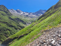
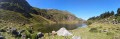
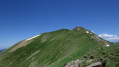
An alternative route to climb up and spend the night at the Refuge du Maupas: this is longer than the standard ascent but less busy, offering splendid views over the Lys Valley and the 3,000-metre peaks overlooking the Cirque des Crabioules. Best undertaken in good weather, as the path is sometimes poorly marked after the Anciennes Mines des Crabioules.

Details

23819802
Creation:
Last update:
Last review:
  • Walking
    Activity: Walking
  • ↔
    Distance: 6.12 mi
  • ◔
    Duration according to the author: 6 hrs 
  • ▲
    Difficulty: Very difficult

  • ⚐
    Back to start: No
  • ↗
    Ascent: + 4,839 ft
  • ↘
    Descent: - 581 ft

  • ▲
    Highest point: 7,936 ft
  • ▼
    Lowest point: 3,678 ft

Photos

Description of the walk

Starting point: Bourdalès, about 10 km past Bagnères-de-Luchon on the road to Superbagnères (D46A). There are two car parks at the bottom of the valley along the road: the route shown on the map starts at the lower car park, situated on the left just past the first houses in Bourdalès.

(S) At the far end of the car park, take a path heading south. Join the D46A at the upper car park and follow it to the left, towards the power station.

(1) Just before the power station, take the path leading off to the right through the hazel bushes, towards Gouffre d’Enfer, Ru d’Enfer and Mines des Crabioules. Climb the well-marked path as it winds upwards. Then head due south across the terrain. Cross the Ruisseau d’Enfer via a footbridge and continue climbing the winding path.

(2) At the junction, continue straight on towards the Gouffre d’Enfer.

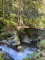
(3) Cross the torrent via the bridge spanning the chasm. The path continues in switchbacks towards the Anciennes Mines des Crabioules.

(4) At the fork, if you wish, carry on straight on to the Ru d’Enfer with its impressive gorges.

(5) Retrace your steps.

(4) Then take the path that climbs towards the Anciennes Mines de Crabioules (on the left if you’re returning from the Ru d’Enfer, on the right if you skipped that detour). Climb the winding path, then head south-south-west. Follow the path as it winds again to pass above the old mine.

(6) Continue westwards, where the path is less clearly marked. Head for the southern flank of the Pic de Sarnès and then the Cabane de Sarnès. A few cairns indicate the direction.

(7) From the Cabane de Sarnès, join a small path from behind, marked by slightly faded red markings and cairns. The path turns south-east, then south. At the bottom of the cirque, you’ll reach an open gully.

(8) Follow the gully, which runs almost horizontally, heading south-east. After the gully, the path climbs north-east.

(9) Descend a small metal ladder (about 2 m) to get past a rocky outcrop. Shortly afterwards, a sign points to the Refuge du Maupas to the right. Head east and climb up a scree slope (steep and difficult), keeping as far to the right of the grassy slope as possible. You’ll arrive beneath a rocky ridge.

(10) Turn left and follow the base of the rock outcrop on your right-hand side. You’ll reach a gap marked by a white post. A chain helps you cross the final rocky gully in the gap. This brings you to the foot of the Refuge du Maupas (panoramic terrace) (E).
Waypoints

  1. S : mi 0 - alt. 3,678 ft - parking des gorges de bourdolés
  2. 1 : mi 0.37 - alt. 3,776 ft - Start of the trail - Lis (cours d'eau) - Affluent de la Pique
  3. 2 : mi 1.15 - alt. 4,491 ft - Junction
  4. 3 : mi 1.32 - alt. 4,577 ft - Bridge overlooking the Gouffre d’Enfer
  5. 4 : mi 1.93 - alt. 5,131 ft - Junction
  6. 5 : mi 2.13 - alt. 5,154 ft - Ru d’Enfer
  7. 6 : mi 3.51 - alt. 6,529 ft - Former Crabioules mine
  8. 7 : mi 4.07 - alt. 7,326 ft - Cabane de Sarnès
  9. 8 : mi 4.93 - alt. 7,526 ft - Prat Loung Canal – Pique des Graou
  10. 9 : mi 5.88 - alt. 7,470 ft - Ladder
  11. 10 : mi 6.02 - alt. 7,785 ft - Rocky ridge
  12. E : mi 6.12 - alt. 7,936 ft - Refuge du Maupas

Notes

There are plenty of spots with running, fresh water to top up your supplies.

After a night at the refuge (remember to book), there are several options:
- Return via the same route.
- Return via the Cabane de la Coume, passing by Lac Noir or Lac Vert.
- Climb Pic Maupas before the descent.

Reviews and comments

4.5 / 5
Based on 2 reviews

Reliability of the description
4 / 5
Ease of following the route
4.5 / 5
Route interest
5 / 5
Clo
Clo

Overall rating : 4.3 / 5

Date of your route : Aug 18, 2026
Reliability of the description : ★★★★☆ Good
Ease of following the route : ★★★★☆ Good
Route interest : ★★★★★ Very good
Very busy route : No

Route taken along the Lys Valley section to the Maupas mountain hut. A useful description, particularly for the final stretch with the shortcut to the hut. Duration: 6 hours 15 minutes. A magnificent hike!

Machine-translated

lougris
lougris

Overall rating : 5 / 5

Date of your route : Jul 22, 2026
Reliability of the description : Not used / Not applicable
Ease of following the route : ★★★★★ Very good
Route interest : ★★★★★ Very good
Very busy route : No

Thank you for this magnificent route – wild and very quiet; I only came across one other walker!
Be careful – there are a few tricky sections where you mustn’t slip.
At the fork, I left the refuge on my right and carried on along the ledge as far as the water pipe.
A brilliant hike!

Machine-translated

Other walks in the area

For more walks, use our search engine .

The GPS track and description are the property of this route's author. Please do not copy them without permission.