The route of the Péguère, Niscoude and Batoua huts

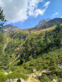
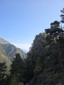
Magnificent scenery, forests, mountain pastures, waterfalls, streams, torrents and huts.
Few visitors at higher altitudes, although the start point is very busy at the Fredancon car park.
Please note: after the hut (5), there are two secured sections which cannot be crossed in bad weather.

Details

59671337
Creation:
Last update:
Last review:
  • Walking
    Activity: Walking
  • ↔
    Distance: 6.34 mi
  • ◔
    Average duration: 5h 20 
  • ▲
    Difficulty: Difficult

  • ⚐
    Back to start: Yes
  • ↗
    Ascent: + 2,746 ft
  • ↘
    Descent: - 2,743 ft

  • ▲
    Highest point: 7,185 ft
  • ▼
    Lowest point: 4,498 ft

Photos

Description of the walk

Park in the Frédancon car park, the starting point for numerous walks and very busy during the season.

(S/E) From the car park, head south and turn left.

(1) Cross the bridge over the Neste de Rioumajou and take the wide track (south-east). Cross another bridge over the Ruisseau de Péguère and you’ll immediately come to a fork in the path.

(2) At this junction, the route is signposted to the right and left. Turn left towards the small wooden bridge, following the stream.

(3) Turn left and cross the wooden bridge. From this point, the path becomes a much less-used track.

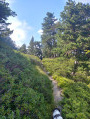
(4) At the next fork, turn left (north-east) and pass close to the Cabane de Péguère (alt. 1,560 m) in the summer pasture to the north.
The climb is steep, particularly over the first three kilometres, but presents no technical difficulties (allow plenty of time for breaks in hot weather). Follow the yellow markings.
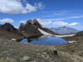
On emerging from the forest, you’ll reach the mountain pastures and the Cabane de Niscoude (alt. 2,030 m), which serves as a refuge. This hike can (and should) end at this hut in the event of rain or bad weather.

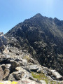
(5) Beyond this hut, some sections are much more technical and dangerous:
- a first tricky section involving climbing a rock face of at least 15 m using a lifeline (with a drop behind you); this section is not feasible in wet weather or with young children.
- Once the descent has begun, a second section with a 2-metre-long lifeline requires careful attention and should not be attempted in wet weather.

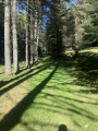
(6) Once past this point, the descent follows narrow paths, mostly through woodland.

(7) Pass the Cabane du Cortail de Batoua (alt. 1,905 m).

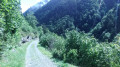
(8) At the next fork, turn right (north) and join a track suitable for vehicles (Sentier de Gerbelongue).

(9) Follow it to the right and return to the fork you took on the way out at the wooden bridge.

(3) Without crossing the bridge, turn left, heading in the opposite direction to the outward journey, and head back to the car park (S/E).


Waypoints

  1. S/E : mi 0 - alt. 4,505 ft - Frédancon car park
  2. 1 : mi 0.07 - alt. 4,501 ft - 1st bridge over the - Neste de Rioumajou (ruisseau) - Affluent de la Neste d'Aure
  3. 2 : mi 1.02 - alt. 4,928 ft - Junction shared with the out-and-back route. Out-and-back
  4. 3 : mi 1.14 - alt. 4,997 ft - Junction of the circular loop. Wooden bridge
  5. 4 : mi 1.35 - alt. 5,148 ft - Péguère Hut
  6. 5 : mi 2.18 - alt. 6,644 ft - Niscoude Hut
  7. 6 : mi 2.92 - alt. 7,169 ft - Descent
  8. 7 : mi 3.93 - alt. 6,240 ft - Cortail de Batoua hut
  9. 8 : mi 4.12 - alt. 6,243 ft - Junction
  10. 9 : mi 4.71 - alt. 5,410 ft - Junction. Track suitable for vehicles
  11. S/E : mi 6.34 - alt. 4,505 ft - Frédancon car park

Reviews and comments

5 / 5
Based on 2 reviews

Reliability of the description
5 / 5
Ease of following the route
5 / 5
Route interest
5 / 5
sosovroum16
sosovroum16

Overall rating : 5 / 5

Date of your route : Jul 03, 2026
Reliability of the description : ★★★★★ Very good
Ease of following the route : ★★★★★ Very good
Route interest : ★★★★★ Very good
Very busy route : No

A magnificent hike that takes you past three mountain huts, summer pastures and waterfalls. The climb through the forest is steep, but the view from the Niscoude hut is well worth it. The two sections beyond this hut, which require you to use your hands (a safety line is provided), are not for everyone (those with a fear of heights and children), as there is a distinct sense of exposure at these points
In the event of rain or bad weather, do not continue beyond the Niscoude hut; the sections with a safety line, on wet rocks, could prove slippery and dangerous!!!
The descent back to the Batoua hut and the car park is less technical!!

Machine-translated

User 2275366

Overall rating : 5 / 5

Date of your route : Oct 06, 2025
Reliability of the description : ★★★★★ Very good
Ease of following the route : ★★★★★ Very good
Route interest : ★★★★★ Very good
Very busy route : No

A very beautiful autumn walk!

Machine-translated

Other walks in the area

For more walks, use our search engine .

The GPS track and description are the property of this route's author. Please do not copy them without permission.