Viados Mountain Hut – Angel Orus Mountain Hut

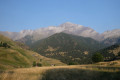
Day three of the Tour du Posets with a long day ahead: a long climb to reach the Collado de Eriste at an altitude of 2,862 metres before descending to the Angel Orus Refuge. Varied landscapes, starting with woodland before moving onto more open terrain that becomes increasingly rocky. The day ends with a section of boulders that makes you really appreciate arriving at the refuge!

Details

107704031
Creation:
Last update:
Last review:
  • Walking
    Activity: Walking
  • ↔
    Distance: 6.95 mi
  • ◔
    Average duration: 6h 40 
  • ▲
    Difficulty: Difficult

  • ⚐
    Back to start: No
  • ↗
    Ascent: + 3,947 ft
  • ↘
    Descent: - 2,707 ft

  • ▲
    Highest point: 9,403 ft
  • ▼
    Lowest point: 5,597 ft

Photos

Description of the walk

Start from the Viados Mountain Hut.

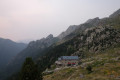
(S) Head down from the refuge and keep left to reach Bordas de Viados, below the refuge.

(1) Turn right at the junction.

(2) Cross the stream and begin the climb through the forest towards Collado de Eriste (also known as Collado de la Forqueta).

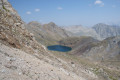
(3) The route leaves the main path and the ‘Ruta de los 3 refugios’ signposting to take a short detour to the right towards Lake Ibon de Millares (steep climb before reaching the lake)

(4) Begin the only section of the route where the path is rather poorly signposted and not always easy to follow. The climb takes you between boulders to a small pass before descending again to rejoin the main path.

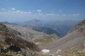
(5) Continue the ascent, which ends at the pass reached after a final stretch over rocky ground (the highest point of the route).

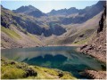
(6) Carry on down the other side, starting with a winding descent that levels out near Lake Ibon de Llardaneta. Continue the descent, following the ‘Ruta de Los 3 Refugios’ signposts.

(7) At the junction, leave the GR®11.2 and take a path that branches off to the right, crosses the stream and winds its way between boulders before emerging into greener terrain and leading to the Angel Orus Refuge (E).

Waypoints

  1. S : mi 0 - alt. 5,679 ft - Viados Refuge
  2. 1 : mi 0.47 - alt. 5,715 ft - Junction
  3. 2 : mi 0.58 - alt. 5,659 ft - Junction and stream
  4. 3 : mi 3.09 - alt. 7,451 ft - End of signposted route
  5. 4 : mi 3.43 - alt. 7,720 ft - Lake
  6. 5 : mi 3.9 - alt. 8,369 ft - Main path
  7. 6 : mi 4.57 - alt. 9,403 ft - Pass
  8. 7 : mi 5.92 - alt. 8,120 ft - Junction
  9. E : mi 6.95 - alt. 6,919 ft - Angel Orus Refuge

Notes

There are no water sources along the route.

The detour to Ibon de Millares can be avoided by staying on the main path between points (3) and (5).

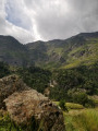
The end of the descent is quite strenuous, with quite a few rocks.

Angel Orus Refuge

Worth a visit

Both lakes offer very pleasant views.

The rocky landscape and the panoramic view from the pass are well worth the day’s effort.

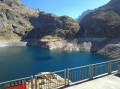
There’s also a superb panorama from the Angel Orus Refuge with its lovely terrace

Always be cautious and plan ahead when you're outdoors. Visorando and the author of this route cannot be held responsible for any accidents occurring on this route.

The GR® and PR® markings are the intellectual property of the Fédération Française de Randonnée Pédestre.

Other walks in the area

For more walks, use our search engine .

The GPS track and description are the property of this route's author. Please do not copy them without permission.