Jean Arlaud Mountain Hut – Pic des Spijeoles – Espingo Lake and Mountain Hut

From the ascent route, the east face of the Pic des Spijeoles immediately catches the eye. The ‘miners’ path’ route suggested here includes an exposed and dangerous section where there is no room for error. After Lac du Port d’Oo, the route continues over large, smooth slabs and scree, involving the crossing of two chimneys to reach the summit. The descent follows the standard route via the Coume de l’Abesque before reaching the Espingo Mountain Hut.

This walk is part of a multi-day hike: Haute vallée d'Oô - Pic Perdiguère et Pic des Spijeoles

Details

n°3149228
Creation:
Last update:
Last review:
  • Walking
    Activity: Walking
  • ↔
    Distance: 4.86 mi
  • ◔
    Duration according to the author: 4 hrs 
  • ▲
    Difficulty: Very difficult

  • ⚐
    Back to start: No
  • ↗
    Ascent: + 2,113 ft
  • ↘
    Descent: - 4,091 ft

  • ▲
    Highest point: 9,856 ft
  • ▼
    Lowest point: 6,302 ft

Description of the walk

(S) Leave the Jean Arlaud Refuge and follow the route taken on the ascent on the first day. Continue to the end of the plateau, before the first hairpin bends of the descent towards the Coume de l’Abesque.

(1) Turn left (west) onto a narrow, inconspicuous path marked by a few cairns, which quickly leads to the start of the miners’ path. This path, initially heading south-south-west, veers to the right and begins to climb towards the northern ridge of the Tusse de Montarqué.

(2) At the top of the first ledge, cross the ridge via an exposed and dangerous passage where you must be very careful. Then continue climbing along the slope, skirting the base of the west face of the Tusse, before ascending the rocky barrier that encloses the Lac Glacé or Lac du Port d’Oô.

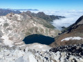
(3) Follow the northern shore of the lake, beginning a new ascent up a ridge of weathered rock interspersed with grassy patches. Approach a small lake nestled in a hollow in the Vallon des Spijeoles, where the route joins the standard ascent route from the Refuge d’Espingo.

(4) Continue across flat rocks and scree, heading for the lowest point of the ridge linking Pic Gourdon to Pic des Spijeoles. Then veer slightly to the right towards a clearly visible chimney, recognisable by its brown rocks.

(5) Climb this chimney, preferably on its left-hand side, which is more accessible. You’ll need to use your hands, but no climbing experience is required. Once at the summit, do not attempt to cross a particularly dangerous overhanging rock; instead, veer left (cairn) to avoid this difficulty.

The ascent continues over scree, which you should cross whilst keeping the summit in your sights.

(6) Facing the final rocky outcrop blocking access to the peak, veer slightly to the left and cross the second chimney, where you’ll need to use your hands again to reach the summit ridge. Then press on to the summit.

(7) Summit of the Pic des Spijeoles (3,065 m): your efforts are rewarded. An exceptional 360° view of the 3,000-metre peaks of the Luchonnais, the Aneto, the Posets, the Pic des Gourgs Blancs and so many others. Not to mention the Lacs des Gourgs Blancs, nestled to the west in a rocky valley.

Descend carefully along the same route, taking extra care when climbing down the two chimneys. Make your way to the small lake in the Spijeoles valley.

(4) Turn left and begin the long descent over scree that is generally stable but gruelling, occasionally interspersed with welcome grassy sections. Further down, the north-facing path veers sharply to the right to cross a rocky barrier marking the western slope of the Cirque de la Coume de l’Abesque: another steep section to negotiate with care.

You look down on the small Lac de la Coume de l’Abesque, with Lac Saussat visible further to the north. You reach the path taken on the ascent on the first day, near the footbridge.

(8) Turn left and descend to Lac Saussat.

(9) Walk along the lake.

(10) Cross the footbridge, then head back up to the Refuge d’Espingo on the left (E).
Waypoints

  1. S : mi 0 - alt. 8,402 ft - Refuge du Portillon (Jean Arlaud)
  2. 1 : mi 0.49 - alt. 8,176 ft - Start of the path on the left
  3. 2 : mi 0.9 - alt. 8,225 ft - North Ridge, dangerous section
  4. 3 : mi 1.34 - alt. 8,734 ft - Port d’Oô Lake or - Lac Glacé d'Oô (2664 m)
  5. 4 : mi 1.7 - alt. 9,029 ft - Junction with the standard route
  6. 5 : mi 1.98 - alt. 9,698 ft - 1st chimney
  7. 6 : mi 2.07 - alt. 9,843 ft - 2°°e°° chimney
  8. 7 : mi 2.1 - alt. 9,793 ft - Pic des Spijeoles (3065 m)
  9. 8 : mi 3.52 - alt. 6,854 ft - Coume de l’Abesque footbridge
  10. 9 : mi 4.1 - alt. 6,339 ft - Lac Saussat
  11. 10 : mi 4.42 - alt. 6,312 ft - Neste d'Oô (rivière) - Affluent de l'One
  12. E : mi 4.86 - alt. 6,411 ft - Refuge d'Espingo

Notes

Warning: whilst this ascent does not require any climbing skills, it is intended for hikers accustomed to high-altitude mountain terrain and off-trail walking, and who do not suffer from vertigo.
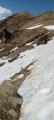
The section at (2) is exposed and dangerous, even in ideal conditions, and is strongly discouraged in the event of late snow.
The two chimneys to be climbed to complete the ascent of Pic des Spijeoles are accessible to any experienced hiker.

Ensure you carry a sufficient supply of water.

In the event of bad weather, cancel the trip and do not hesitate to descend safely via the route taken on the first day.

The choice arises after reaching the summit. You can either descend directly to Les Granges d’Astau, thereby avoiding an extra night in a mountain hut, or – and this is the option suggested here – make the most of the late afternoon and evening at the Espingo mountain hut in a remarkable setting.

Espingo Mountain Hut

Worth a visit

360° panorama from the summit of the Pic des Spijeoles.

During the descent, after the ‘4 ’, take in the exceptional view of the Cirque d’Espingo and Lac Saussat.

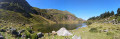
The Espingo Lake area.

Reviews and comments

4 / 5
Based on 2 reviews

Reliability of the description
3.5 / 5
Ease of following the route
3.5 / 5
Route interest
5 / 5
CG2513
CG2513

Overall rating : 2 / 5

Date of your route : Aug 10, 2022
Reliability of the description : ★★☆☆☆ Disappointing
Ease of following the route : ★★☆☆☆ Disappointing
Route interest : Not used / Not applicable
Very busy route : No

We wanted to do this walk. At least from point 1 to point 2 for the view, as we were told at the Portillon refuge that this route wasn’t particularly interesting. The main attraction is the view from the Tusse de Montarqué.
Heading from Espingo to Portillon, we couldn’t find the start of the path.
Point 2 is also accessible from the Portillon refuge, but there were no signposts there either. We set off, but we didn’t end up in the right place, so we turned back, feeling unsafe (there was too much open space around us). Oh well, it just wasn’t for us!

Machine-translated

randocaronello
randocaronello

Overall rating : 5 / 5

Date of your route : Sep 04, 2020
Reliability of the description : ★★★★★ Very good
Ease of following the route : ★★★★★ Very good
Route interest : ★★★★★ Very good
Very busy route : No

Setting off from the Portillon refuge on your way back, when you reach the end of the plateau, look out for two rusty iron posts on the left – this is the start of the miners’ path and the beginning of the circular walk. When you reach the chimneys, take great care not to dislodge any stones onto any walkers who may be following behind.

Machine-translated

Other walks in the area

For more walks, use our search engine .

The GPS track and description are the property of this route's author. Please do not copy them without permission.