


Refine your search for walks in Romenay
Romenay walks


 Romenay's ponds
 Visorando Member
 6.30 mi
 +102 ft
 -118 ft
 3h 00
3h 00
 Easy
Easy
 Departure from Romenay (Saône-et-Loire)
A route along easy paths in the Bresse region, starting from the traditional village of Romenay.
La Truchère-Ratenelle Nature Reserve and Site des Charmes
 7.26 mi
+69 ft
-66 ft
3h 25
7.26 mi
+69 ft
-66 ft
3h 25
 Moderate
Departure from Sermoyer (Ain)
Moderate
Departure from Sermoyer (Ain)
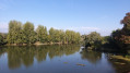
It is undoubtedly the sand dunes that represent the most striking feature of the Nature Reserve. Shaped 5,000 years ago by the wind, these shifting sands are partially covered in mosses and lichens. Only species adapted to arid environments manage to colonise them. Just a few metres from this desert-like environment lies a waterlogged area stretching over 5 to 6 hectares: a wooded peat bog, the presence of which at an altitude of just 200 metres is surprising. A third, very different environment can be seen not far from there: Étang Fouget, whose surrounding marsh takes the form of a vegetative labyrinth and attracts numerous birds.
Route de Fontaine Couverte via the aerodrome
5.11 mi
+66 ft
-69 ft
2h 25
Easy
Departure from Cuisery (Saône-et-Loire)
This circular route allows you to discover all that Cuisery has to offer: the village centre, the aerodrome, the countryside (pond, woods, fields), including wildlife: Bresse poultry farms, horses in the meadows or at the riding school, birds by the pond, and occasionally hares or roe deer in the fields.
From Cuisery to Loisy along the banks of the Seille
5.38 mi
+13 ft
-13 ft
2h 30
Easy
Departure from Cuisery (Saône-et-Loire)
A path linking the Cuisery Water Sports Centre to the Loisy Water Sports Centre along the banks of the Seille. It’s a very pleasant round trip through the countryside and along the riverbank.
The Fougères Route in Montpont-en-Bresse
 Tourist office
 5.17 mi
+66 ft
-66 ft
2h 25
Easy
Departure from Montpont-en-Bresse (Saône-et-Loire)
5.17 mi
+66 ft
-66 ft
2h 25
Easy
Departure from Montpont-en-Bresse (Saône-et-Loire)
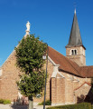
Before being renamed Montpont-en-Bresse in 1961, the town was first known as “Mons Pavonis” and then “Montpaon”.
Dotted with ponds, streams and rivers, it also boasts a large area of woodland. The charm of this countryside lies in the diversity of its heritage, fine examples of which can be found in the village centre, with its brick church, its town hall housed in a former manor house, and its library set in a traditional Bresse-style building.
The Three Mills Route, starting from the church at Chavannes-sur-Reyssouze
8.82 mi
+190 ft
-190 ft
4h 15
Moderate
Departure from Chavannes-sur-Reyssouze (Ain)
A route with little elevation gain, offering the chance to explore part of the Reyssouze Valley near Chavannes.
A lush cattle-rearing region in the heart of the Bresse.
Île de la Motte in Saint-Bénigne
 Local authority9.23 mi
+112 ft
-112 ft
4h 20
Moderate
Departure from Saint-Bénigne (Ain)
Local authority9.23 mi
+112 ft
-112 ft
4h 20
Moderate
Departure from Saint-Bénigne (Ain)
On this route, you’ll discover the vast floodplain of the Saône, stretching as far as the eye can see. Once you reach the banks of the Saône, you can see Île de la Motte, which has been designated a Sensitive Natural Area.
Île de la Motte is home to colonies of herons: the little bittern, the little egret and the cattle egret, which can sometimes be sensitive to disturbance during the breeding season. The island’s presence on the river also helps to maintain fish diversity. Sediments carried by the Saône have been deposited and accumulated at La Motte, gradually creating small islets and secondary channels. Together, these form a mosaic of natural habitats that is home to an exceptional diversity of species.Beavers are present on the site and, indeed, contribute to its management by cutting branches from willows and poplars to eat their bark.
From mill to mill in Saint-Étienne-sur-Reyssouze
8.53 mi
+299 ft
-299 ft
4h 10
Moderate
Departure from Saint-Étienne-sur-Reyssouze (Ain)
A pleasant walk taking you along a variety of paths – tarmac, stony and grassy – with sections crossing small streams and passing through small hamlets.
Walk along the canals of Pont-de-Vaux
5.19 mi
+13 ft
-13 ft
2h 25
Easy
Departure from Pont-de-Vaux (Ain)
A lovely walk along the canals of Pont-de-Vaux, partly to reach the lock near the campsite, from where you can return to the village via tarmac and stony paths.
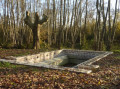
Simandre's three washhouses
 3.94 mi
+43 ft
-43 ft
1h 50
Easy
Departure from Simandre (Saône-et-Loire)
3.94 mi
+43 ft
-43 ft
1h 50
Easy
Departure from Simandre (Saône-et-Loire)
Simandre, on the banks of the Saône and close to Cuisery, is a lively village with many shops. Its Romanesque church and lava stone roof are listed in the Bâtiments de France inventory. You can observe the flora and fauna at the various ponds along the way.
Moulin du Roy trail at Simandre
 3.99 mi
+36 ft
-36 ft
1h 50
Easy
Departure from Simandre (Saône-et-Loire)
3.99 mi
+36 ft
-36 ft
1h 50
Easy
Departure from Simandre (Saône-et-Loire)
Simandre, on the banks of the Saône and close to Cuisery, is a lively village with many shops. Its Romanesque church and lava stone roof are listed in the Bâtiments de France inventory. You can observe the flora and fauna at the various ponds along the route.
The meadow and banks of the Seille at Sornay
 4.60 mi
+20 ft
-20 ft
2h 10
Easy
Departure from Sornay (Saône-et-Loire) (Saône-et-Loire)
4.60 mi
+20 ft
-20 ft
2h 10
Easy
Departure from Sornay (Saône-et-Loire) (Saône-et-Loire)
Sornay, a rural village of 2,000 inhabitants situated near Louhans-Châteaurenaud and Branges, is bordered by two rivers: the Sâne Morte and the Seille. The latter, popular with anglers and boaters, features a towpath perfect for exploring the wetlands and their characteristic flora and fauna.
History and nature themed trail in Sornay
 3.03 mi
+16 ft
-16 ft
1h 25
Easy
Departure from Sornay (Saône-et-Loire) (Saône-et-Loire)
3.03 mi
+16 ft
-16 ft
1h 25
Easy
Departure from Sornay (Saône-et-Loire) (Saône-et-Loire)
Sornay, a village situated near Louhans-Châteaurenaud and Branges, is bordered by two rivers: the Sâne-Morte and the Seille. The latter, popular with anglers and boaters, features a towpath that’s perfect for exploring the wetlands and their characteristic flora and fauna.
The Ponds Trail in Louhans
 1.31 mi
+7 ft
-7 ft
0h 35
Easy
Departure from Louhans (Saône-et-Loire)
1.31 mi
+7 ft
-7 ft
0h 35
Easy
Departure from Louhans (Saône-et-Loire)
This walk in the heart of the town offers a real breath of fresh air and allows you to discover the flora and fauna that have found a suitable environment in which to thrive. It’s the perfect family walk to enjoy after exploring the old medieval town and its main street, lined with 157 arcades – one of the longest in France. On Monday mornings, there’s a large market, including a poultry market, situated just on the other side of the railway line.
Sentier des Grands Bois in Louhans
 5.17 mi
+105 ft
-98 ft
2h 30
Easy
Departure from Louhans (Saône-et-Loire)
5.17 mi
+105 ft
-98 ft
2h 30
Easy
Departure from Louhans (Saône-et-Loire)
Surrounded by waterways, Louhans, of Burgundian origin, means "pleasant place by the water". Over the centuries, the town has developed thanks to trade. The medieval town has preserved its main street with 157 arcades, one of the longest in France. On Monday mornings, there is a large market, including a poultry market.