A route through the woodland around Sennecey-le-Grand

A route through the woodland around Sennecey-le-Grand.

Details

9891
Creation:
Last update:
Last review:
  • Walking
    Activity: Walking
  • ↔
    Distance: 10.83 mi
  • ◔
    Average duration: 6h 05 
  • ▲
    Difficulty: Easy

  • ⚐
    Back to start: Yes
  • ↗
    Ascent: + 1,293 ft
  • ↘
    Descent: - 1,283 ft

  • ▲
    Highest point: 1,631 ft
  • ▼
    Lowest point: 755 ft

Photos

Description of the walk

On leaving Sennecey-le-Grand from the direction of Châlon, follow the signs on the right for Ruffey, Château de Ruffey and Montceau Ragny.
As you pass through Ruffey, park in the car park by the “very obvious” memorial.

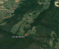
(S/E) From the memorial, join and follow theGR®76aon the left as far as the Col du Navois.

(1) Cross the road and continue towards the Col des Chêvres. After about 1 km, the path becomes stony and steep.

(2) There, take a shortcut to the right and follow it to the cliff. Turn right again and follow the cliff. Pass by the Roche d’Aujoux and the orientation table.

(3) Follow the well-marked path to the Col du Navois.

(4) Before the pass, a path descends to the left; follow it. Ignore a path branching off to the left and continue to the next junction.

(5) Turn right, then after about 400m, turn left. About 300m further on, turn right – “do not go down into the valley” – this path runs alongside the fields. When you reach the road, follow it to the right as far as the “Corlay Haut” farm.

(6) Turn left, and ignore the first path on the right. Continue straight on for about 1.5 km, then turn left for 500 m.

(7) At the crossroads, turn right and continue for about 1 km. When you reach a T-junction, go straight ahead for 300 metres.

(8) Continue to the right along the obvious path. When you reach a wide track, follow it uphill and take a well-marked path on the right. Follow this to the Croix de Ruffey.

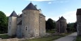
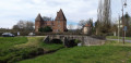
(9) Turn left, walk past the castle and return to the car park (S/E).

Waypoints

  1. S/E : mi 0 - alt. 755 ft - Memorial car park
  2. 1 : mi 3.49 - alt. 1,467 ft - Col de Navois
  3. 2 : mi 4.67 - alt. 1,483 ft - Cross-cut on the right
  4. 3 : mi 4.94 - alt. 1,585 ft - Roche d’Aujoux and the orientation table
  5. 4 : mi 5.89 - alt. 1,496 ft - Path on the left before the pass
  6. 5 : mi 6.26 - alt. 1,362 ft - To the right
  7. 6 : mi 7.59 - alt. 1,122 ft - Corlay Haut Farm
  8. 7 : mi 8.9 - alt. 1,086 ft - Crossroads, turn right
  9. 8 : mi 9.53 - alt. 912 ft - Crossroads, turn right
  10. 9 : mi 10.51 - alt. 820 ft - Croix de Ruffey.
  11. S/E : mi 10.83 - alt. 755 ft - Memorial car park

Always be cautious and plan ahead when you're outdoors. Visorando and the author of this route cannot be held responsible for any accidents occurring on this route.

The GR® and PR® markings are the intellectual property of the Fédération Française de Randonnée Pédestre.

Reviews and comments

3.2 / 5
Based on 8 reviews

Reliability of the description
3 / 5
Ease of following the route
2.8 / 5
Route interest
3.8 / 5
User 173004

Overall rating : 3.7 / 5

Date of your route : Jun 30, 2025
Reliability of the description : ★★★★☆ Good
Ease of following the route : ★★★★☆ Good
Route interest : ★★★☆☆ Average
Very busy route : No

Hike without any particular difficulty. Lots of passages through woodland (very pleasant in hot weather).

Machine-translated

Randomayer
Randomayer

Hmm, hello,
Taken in summer, with lots of paths overgrown with wild vegetation – and to top it all off, if you’re having to fight your way through the undergrowth, you need to watch out for ticks. And there are plenty of them.

Machine-translated

phil du 01
phil du 01

Not detailed enough; the route is difficult to find

Machine-translated

crazy_veggie
crazy_veggie

Overall rating : 2.3 / 5

Date of your route : Aug 10, 2020
Reliability of the description : ★★☆☆☆ Disappointing
Ease of following the route : ★☆☆☆☆ Very disappointing
Route interest : ★★★★☆ Good
Very busy route : No

We chose this trail because we saw it went through the woods, and in that respect, it was perfect. The trail climbs steeply right from the start; there are quite a few lovely views, but apart from that, there’s nothing else to see. The biggest problem is that there were no indications of the difficulty level; this route isn’t suitable for children or people with mobility issues. There’s a point where you have to climb; the paths aren’t cleared or maintained, some sections are littered with rocks and steep slopes, and there’s a stretch on tarmac. The GPX track often deviates from the actual route to such an extent that there were certain sections where we had to use a compass, even whilst following the map on our watches. So, a lovely route, but only for people who are fit and reasonably well-trained.

Machine-translated

steffens
steffens

Overall rating : 3.3 / 5

Date of your route : Feb 25, 2019
Reliability of the description : ★★★☆☆ Average
Ease of following the route : ★★★★☆ Good
Route interest : ★★★☆☆ Average

A lovely walk, especially with this lovely weather in February

Machine-translated

aventurier71
aventurier71
• Edited:

Hello
Just so you know, I’d advise against doing this walk before autumn, because of the box tree moth – ‘all the box trees are dead’. It’s absolutely impassable given the caterpillar webs and the caterpillars, which move at ‘an average of 1.8 km/h’ at best.
Thank you for your understanding.

Machine-translated

gazok54
gazok54 ★

Hello aventurier71
Tell me, a machete is a bladed weapon that you’re not allowed to carry without a licence, aren’t you? Personally, I’ve never dared to take mine out of the house

Machine-translated

aventurier71
aventurier71

Recently, I bought a machete so that I could use the paths marked on the IGN map – “Not exactly legal, but essential in Saône-et-Loire”...

Machine-translated

bibi
bibi ★

It’s true that when the vegetation grows, you have to be a bit more careful when changing direction...

Machine-translated

aventurier71
aventurier71

There’s nothing to check on the route itself; just learn to read maps or download the Visorando app.
In some areas, the paths aren’t maintained – this is obvious in winter, but not so obvious in summer due to ‘tall grass or brambles’.
In Saône-et-Loire, a very large number of paths have disappeared or are in the process of disappearing – “I’d say three out of four in the Mont Beuvrais area, for example”. For any route information, consult the IGN.

Machine-translated

bibi
bibi ★

Thank you for your feedback; please feel free to suggest a route and any changes to the description to improve it.
Kind regards

Machine-translated

hugo$01
hugo$01

Overall rating : 3 / 5

Date of your route : Jun 18, 2017
Reliability of the description : ★★★☆☆ Average
Ease of following the route : ★★★☆☆ Average
Route interest : ★★★☆☆ Average

A pleasant walk in sweltering heat… which was certainly the case this weekend (+30°).
The paths have disappeared in some parts of the forest, but with a bit of common sense and a compass, you can find your way.
Perhaps the route through this final section could be reviewed.

Machine-translated

bibi
bibi ★

Thank you for your feedback. It’s true that in spring, vegetation can sometimes obscure the start of a path; don’t hesitate to follow your instincts and look a little further afield for signs indicating a path hidden by vegetation.
Thank you in any case for bringing this to our attention
Kind regards

Machine-translated

Lechad
Lechad

Overall rating : 3.7 / 5

Date of your route : May 28, 2017
Reliability of the description : ★★★☆☆ Average
Ease of following the route : ★★★☆☆ Average
Route interest : ★★★★★ Very good

Please note: on the way back, at marker 3, there is no longer a path; you have to go through the woods. And we couldn’t find the rest of the route. After three attempts to find a way through, as it was very hot, we didn’t persevere any further. So we turned back along the same route we’d taken on the way there.
It’s a shame, as the woodland is lovely in the warm sunshine.

Machine-translated

gazok54
gazok54 ★
• Edited:

Thank you, aventurier71, for your reply.
However, would you be able to expand on your walk a little by adding more detail to the description and including a few waypoints so that walkers can get a better sense of where they are?

Machine-translated

Other walks in the area

For more walks, use our search engine .

The GPS track and description are the property of this route's author. Please do not copy them without permission.