


Refine your search for walks in Rimboval
Rimboval walks


 Along the Embrienne
 Visorando Member

 9.55 mi
 +873 ft
 -863 ft
 5h 10
 Moderate
 Departure from Rimboval (Pas-de-Calais)
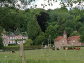
A very hilly route (undoubtedly over 300 metres of elevation gain; the Visorando software has probably underestimated this) which combines two signposted trails: the Mont Caudron trail to Rimboval and the Neuvaine trail to Embry.
After starting in the forest, the route ends on the plateau amongst the crops.
5 woods and some steep slopes
 9.42 mi
+1,004 ft
-1,017 ft
5h 10
 Difficult
Departure from Saint-Michel-sous-Bois (Pas-de-Calais)
A very hilly route over the Artois heights.
A great sporting outing with beautiful scenery.
From Bras de Bronne to L’Embrienne
15.06 mi
+1,555 ft
-1,532 ft
8h 15
Difficult
Departure from Saint-Michel-sous-Bois (Pas-de-Calais)
Same starting point as for the “5-bois-et-quelques-raidillons” hike, but this route is a bit longer, with a decent climb, and avoids walking along the D129.
I think the app is essential, especially as the GR® markings are very faint (you might even wonder if this legendary GR® still exists?).
The Créquy Woods
 13.09 mi
+745 ft
-732 ft
6h 40
Difficult
Departure from Créquy (Pas-de-Calais)
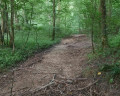
A long route with virtually no roads, making use of three short-distance hiking trails: the Maury, the Têtards and the Fréniaux.It’s best to go during a dry spell, as the paths can be quite poor in wet weather.Three-quarters of the walk takes place on the edge of or within the woods.
Les coteaux de la Créquoise
 10.53 mi
+709 ft
-719 ft
5h 30
Moderate
Departure from Créquy (Pas-de-Calais)
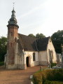
Another option, slightly shorter but still quite challenging, offers views of the Créquoise valley.
The route through the Bois de Créquy is the same as on the other walk: ‘The Bois de Créquy’, but the return journey takes you down the other side, offering a lovely view of the valley.
From Verchocq to the Vallon de Beaussart
 11.65 mi
+633 ft
-636 ft
5h 55
Moderate
Departure from Verchocq (Pas-de-Calais)
Exploring the Vallon de Beaussart and passing close to the Bois de Renty, always in the hope of spotting some wildlife: on 16 October, there were only a few pheasants, but they practically let you stroke them. A real treat for hunters!
There are practically no roads on this route.
The Bois Capelle
8.23 mi
+299 ft
-299 ft
4h 05
Moderate
Departure from Coupelle-Vieille (Pas-de-Calais)
A route amongst the wind turbines with very little tarmac.
I’ve tried to stick to the ‘wildest’ paths, which may make the walk a little trickier in wet weather.
It’s easy to combine this walk with the one from Fruges to the Bois de Radinghem to make a 28 km route.
Let’s explore La Planquette
15.30 mi
+1,053 ft
-1,053 ft
7h 55
Difficult
Departure from Fressin (Pas-de-Calais)
A long walk around the Planquette Valley, culminating in a traverse of the Hesdin Forest.
Not to mention the lovely paths around Cavron-Saint-Martin.
And, of course, I made sure not to skip the lovely climb up the Bois de Fressin, which is a real treat for the calves.
When I went there in early September 2023, the paths were in excellent condition, but the first rains will quickly wear them down and the walk will become very difficult.
Using the app makes finding your way much easier!
From La Planquette to Bois de Fressin
 13.20 mi
+958 ft
-942 ft
6h 55
Difficult
Departure from Fressin (Pas-de-Calais)
A succession of small roads and paths for a day in the great outdoors.The icing on the cake: a good elevation gain with a superb climb in the Bois de Fressin.
For very experienced hikers, I highly recommend the alternative route described in the practical information section.
The Chevrette Trail in Fressin
6.31 mi
+443 ft
-430 ft
3h 15
Moderate
Departure from Fressin (Pas-de-Calais)
A short walk around Fressin with a few climbs through lovely scenery. Head up through the Fressin woods, cross the Planquette, and walk across the plateau where you’ll find great photo opportunities of Fressin Castle – a castle you’ll get to see up close on the way back.The path is well signposted in yellow. Some might say there’s no point in detailing signposted paths, but for me it’s important to share them with the community.
The Artois Hills to Assonval
 8.11 mi
+335 ft
-318 ft
4h 00
Moderate
Departure from Renty (Pas-de-Calais)
Return to Assonval for a relatively easy walk (apart from the climb at the start) through the Artois hills.
Three-quarters of the walk takes place at an altitude of over 150 m (dizzying!) and follows good paths.
From Turkey to Fond Breton (in less than 10 km!)
5.80 mi
+358 ft
-354 ft
3h 00
Moderate
Departure from Renty (Pas-de-Calais)
A short but fairly strenuous route with a steep hill and some very grassy paths.
On 12/08/2025: the start of the trail is once again very overgrown (brambles and nettles). It's passable but it's best to wear trousers or good gaiters and, of course, bring a walking stick or even a pair of secateurs.
Renty Wood
10.46 mi
+492 ft
-479 ft
5h 15
Moderate
Departure from Renty (Pas-de-Calais)
This route, with very little tarmac, follows the Charles Quint trail, to which a short circular loop through unspoilt countryside with lovely views has been added.
The Belrem in Beaurainville
 Association / Club / Walk leader6.51 mi
+246 ft
-246 ft
3h 10
Moderate
Departure from Beaurainville (Pas-de-Calais)
A lovely walk along the banks of the Canche, through marshes and with a view over Beaurainville
An uphill battle
 15.98 mi
+1,371 ft
-1,365 ft
8h 35
Difficult
Departure from Fauquembergues (Pas-de-Calais)
It's a route that will delight altitude enthusiasts (Carto exploreur and the Visorando app suggest it's as high as 500m). What's more, the views are stunning.
Route slightly modified in November 2019.
All trails are very good as of May 14, 2020 (even if some are very grassy).