Along the Embrienne

A very hilly route (undoubtedly over 300 metres of elevation gain; the Visorando software has probably underestimated this) which combines two signposted trails: the Mont Caudron trail to Rimboval and the Neuvaine trail to Embry.
After starting in the forest, the route ends on the plateau amongst the crops.

Details

n°1089443
Creation:
Last update:
Last review:
  • Walking
    Activity: Walking
  • ↔
    Distance: 9.55 mi
  • ◔
    Average duration: 5h 10 
  • ▲
    Difficulty: Moderate

  • ⚐
    Back to start: Yes
  • ↗
    Ascent: + 873 ft
  • ↘
    Descent: - 863 ft

  • ▲
    Highest point: 571 ft
  • ▼
    Lowest point: 217 ft
  • ⚐ Country: France
  • ⚐ City: Rimboval (62990)
  • ⚑
    Start/End: N 50.507257° / E 1.986118°
  • ❏
    IGN map(s): Ref. 2205E
  • Hour-by-hour weather

Photos

Description of the walk

Parking at Rimboval Town Hall.

(S/E) Set off along the D149 towards Maisoncelle. At the three-way junction, leave the D149 and take Rue de la Chapelle opposite (start of the yellow signposting).

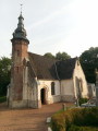
(1) At the crossroads (chapel), leave the tarmac and take the grassy path opposite. A little further on, turn right onto a track running alongside the fields to rejoin the D149.

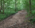
(2) Head uphill straight ahead to reach the woodland. Following the yellow markings, enter the woodland (it is well signposted, but you need to keep an eye out). You’ll reach a crossroads.

(3) Carry on straight ahead, then turn right (the path is quite damp) and you’ll arrive near a picnic table.

(4) Turn right to leave the woods and head downhill towards a farm. At the farm, carry on straight on towards the D149. Just before you reach it, turn left, then (after a left-hand bend) turn right to arrive near the source of the Embrienne (pumping station).

(5) Turn right again, towards the D149. Just before reaching it, turn left and, following the river, you’ll come to a T-junction. Turn left uphill, pass a farm and reach a three-way junction.

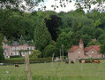
(6) Take the path opposite, then turn right. Stay roughly along the edge of the woods on a somewhat overgrown path (lovely view of Embry) and join the D108 near a large chapel. Follow the D108 to the right for a few metres.

(7) Take the path on the right to cut across the hairpin bend. Ignore the path on the right and rejoin the D108. Cross it to follow the small road opposite, which descends to L’Embrienne. Cross the river and turn right into Rue du Haut Pont until you reach a T-junction. Turn left (Rue de la Place) and continue to the D149 (small square on the right).

(8) Follow it for a few metres to the left and turn right onto a lovely grassy path. Pass close to a motorhome site (with tables). Ignore the road on the right and head up the narrow path opposite. You’ll reach a good track which you follow to the right until you reach a T-junction.

(9) Turn left onto the tarmac road. 150 metres further on, at the bend, leave the tarmac and take the path opposite. 1.5 km further on, you’ll reach a T-junction.

(10) Turn left, walk 1 km and join a wider path.

(11) Take a sharp right-hand bend and follow this wide path to a T-junction.

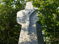
(12) Turn right, then left, and then right again to reach the ‘centre’ of Saint-Wandrille: the crossroads with the wayside cross.

(13) Head straight on. About 150 metres further on, turn right onto a dirt track. Ignore the path coming from the right and continue to the D108.

(14) Cross it and follow the small road opposite, which descends towards Rimboval for about 1 km.

(15) Just after a 90° right-hand bend, leave the tarmac and take the dirt track opposite (this track can be in very poor condition in wet weather, but you can avoid it by joining the D149 and then following it to the right). Continue to the very end, where you’ll reach the town hall (S/E).
.

Waypoints

  1. S/E : mi 0 - alt. 328 ft - Rimboval Town Hall
  2. 1 : mi 0.13 - alt. 381 ft - Crossroads (chapel)
  3. 2 : mi 0.36 - alt. 361 ft - Crossing the D149
  4. 3 : mi 0.86 - alt. 541 ft - Crossroads in the woods.
  5. 4 : mi 1.27 - alt. 535 ft - Picnic table
  6. 5 : mi 2.51 - alt. 318 ft - Opposite the pumping station
  7. 6 : mi 3.38 - alt. 312 ft - Three-way junction
  8. 7 : mi 3.73 - alt. 390 ft - Path to the right of the D108
  9. 8 : mi 4.36 - alt. 256 ft - Junction with the D149 in Embry
  10. 9 : mi 4.67 - alt. 315 ft - Small road
  11. 10 : mi 5.54 - alt. 528 ft - T-junction
  12. 11 : mi 6.23 - alt. 463 ft - Sharp right-hand bend
  13. 12 : mi 7.06 - alt. 502 ft - T-junction
  14. 13 : mi 7.62 - alt. 538 ft - Saint-Wandrille town centre: wayside cross
  15. 14 : mi 8.62 - alt. 568 ft - Crossing the D108
  16. 15 : mi 9.27 - alt. 354 ft - Dirt track after the 90° right-hand bend
  17. S/E : mi 9.55 - alt. 328 ft - Rimboval Town Hall

Notes

Proper kit is essential.

There are two alternative routes that can improve and shorten the route, but you need to know how to find your way:

- 1: At point (4), do not turn right, but continue along the edge of the woodland to reach point (6): you will immediately come to a three-way junction where you turn left. The path is well-marked with numerous blue markings in particular. A little further on, the markings disappear and you come to a descent, then a wide track leading to point (6).

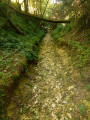
- 2: At the T-junction, between points (8) and (9), turn left onto the wide path that climbs. It becomes grassy as it runs alongside a pasture and ends in front of a field (wheat in April 2018). Walk along the left-hand side of the field, then follow the (often dry) gully on the right to reach point (11). (The Neuvaine path follows this route.) It’s fairly easy when the crops are short.

Worth a visit

Don’t miss the remarkable chapel on Mont du Calvaire (and its legend).

Reviews and comments

4.7 / 5
Based on 1 review

Reliability of the description
5 / 5
Ease of following the route
5 / 5
Route interest
4 / 5
felicie617
felicie617

Overall rating : 4.7 / 5

Date of your route : May 14, 2018
Reliability of the description : ★★★★★ Very good
Ease of following the route : ★★★★★ Very good
Route interest : ★★★★☆ Good

I walked this route on 13 May, going in the opposite direction from Embry. The section up to Rimboval is very pretty (you follow the Embrienne) with a lovely little steep climb in this direction leading up towards a wood (beautiful view).
I found the section from the exit of Rimboval to Saint-Wandrille rather long and monotonous, so I decided to take a shortcut from Saint-Wandrille towards the Calvary at elevation 159, then rejoin the normal route back towards Embry.
All in all, a good three-hour walk. A route I’ll probably take again in the future.

Machine-translated

Other walks in the area

For more walks, use our search engine .

The GPS track and description are the property of this route's author. Please do not copy them without permission.