


Refine your search for walks in Raucourt-et-Flaba
Raucourt-et-Flaba walks


 The Ennemane Valley and the Margotte wind farm
 Visorando Member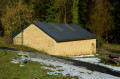
 4.44 mi
 +413 ft
 -404 ft
 2h 25
2h 25
 Easy
Easy
 Departure from Raucourt-et-Flaba (Ardennes)
A short, easy route ideal for families. At the bottom of the valley, you’ll find a bit of local history and lovely views across the plateau.
 Walk through the Ennemane valley and on to the Meuse valley
19.65 mi
+636 ft
-646 ft
3 hrs
 Moderate
Departure from Remilly-Aillicourt (Ardennes)
Moderate
Departure from Remilly-Aillicourt (Ardennes)
This mountain bike route, which presents no technical difficulties, features two sections of greenway, traditional farm and forest tracks, and even a section of the Roman road that linked Reims to Trier.
La Marfée
 5.69 mi
+358 ft
-335 ft
2h 55
Easy
Departure from Noyers-Pont-Maugis (Ardennes)
5.69 mi
+358 ft
-335 ft
2h 55
Easy
Departure from Noyers-Pont-Maugis (Ardennes)
The Col de la Marfée, the village of Chaumont and its superb inscriptions on the pediments of the houses, panoramic views of Cheuveuges, the Meuse valley and Sedan: this is what awaits you on this walk, which takes you effortlessly through meadows, fields and forest.
Mont-Dieu
 5.84 mi
+482 ft
-472 ft
3h 05
Easy
Departure from Le Mont-Dieu (Ardennes)
5.84 mi
+482 ft
-472 ft
3h 05
Easy
Departure from Le Mont-Dieu (Ardennes)
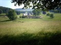
The Chartreuse du Mont-Dieu was built in a vast 24-hectare clearing in the middle of a huge 1,123-hectare forest, whose springs feed the numerous ponds. We invite you to explore this wooded, hilly region, as well as the park and the rear of the charterhouse.
Chartreuse du Mont-Dieu circular loop
 Local authority
 1.45 mi
+171 ft
-190 ft
0h 50
Easy
Departure from Le Mont-Dieu (Ardennes)
1.45 mi
+171 ft
-190 ft
0h 50
Easy
Departure from Le Mont-Dieu (Ardennes)
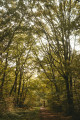
This circular route invites you to discover the surroundings of the Chartreuse du Mont-Dieu along a pleasant forest path. Accessible to the whole family, the route winds its way through wooded areas and offers a peaceful immersion in a preserved natural environment. Throughout the hike, the rich heritage of the site is revealed, combining monastic history and remarkable landscapes.
Mont-Dieu trail
 5.09 mi
+446 ft
-449 ft
2h 45
Easy
Departure from Le Mont-Dieu (Ardennes)
5.09 mi
+446 ft
-449 ft
2h 45
Easy
Departure from Le Mont-Dieu (Ardennes)
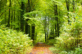
Starting from the Chartreuse du Mont-Dieu, this family-friendly circular walk takes you along a pleasant forest path in the heart of the national forest. The route offers a peaceful immersion in a preserved natural environment and allows you to discover the monumental barn of La Corrérie and the Château de la Barbière, which bear witness to the site's rich heritage and history.
La Truche and Lombut Castle
 9.01 mi
+1,030 ft
-1,027 ft
5h 00
Moderate
Departure from Mouzon (Ardennes)
9.01 mi
+1,030 ft
-1,027 ft
5h 00
Moderate
Departure from Mouzon (Ardennes)
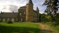
A walk starting from Mouzon, offering lovely views of the Meuse and Chiers valleys and the neighbouring villages throughout the route.
The Piot Cross at the start of the route from Wadelincourt
 11.01 mi
+1,230 ft
-1,214 ft
6h 10
Moderate
Departure from Wadelincourt (Ardennes)
11.01 mi
+1,230 ft
-1,214 ft
6h 10
Moderate
Departure from Wadelincourt (Ardennes)
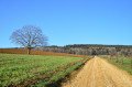
A route with very few sections through woodland which, throughout the walk, offers hikers sweeping panoramic views over the Bar and Meuse valleys.
 From Douzy (Camping du Lac) to Chassepierre
14.70 mi
+958 ft
-551 ft
2.5 hrs
Moderate
Departure from Douzy (Ardennes)
From Lac de Douzy, after passing through the Forges de Brévilly industrial site – which was very active in the 19th century – we reach the nearby Belgian border (10 km) via a small road that turns into a track suitable for vehicles. From there, simply follow numbers 30, then 11, then 13 on the cycle network’s ‘points-nœuds’ system to reach the village of Chassepierre and the campsite on the banks of the Semois. Halfway along the route, after Muno, a short walk takes you to a remarkable geological feature.
Within the grounds of the Chartreuse du Mont-Dieu
9.24 mi
+814 ft
-787 ft
4h 55
Moderate
Departure from Les Grandes-Armoises (Ardennes)
This walk is a journey back in time.
Starting from areas of livestock farming and crop cultivation, you’ll come across monuments and information boards along the route that recount the resistance to the German invasion during the Battle of Stonne in May 1940.
You’ll journey back to the 12th century with the Chartreuse du Mont-Dieu, the forest and the estates that belonged to it, and finish the route on the Roman road that led from Reims to Trier.
On the hill at Stonne
6.30 mi
+492 ft
-515 ft
3h 20
Moderate
Departure from Les Grandes-Armoises (Ardennes)
Before reaching Stonne, with its highest point known as ‘le pain de sucre’, its panoramic views and its orientation table, you’ll walk through the shade of the forest.
The short ‘mountainous’ section around the village can be avoided. The return route takes you across a plateau amidst meadows and fields.
The village of Stonne was the scene of fierce fighting in May 1940 following the German army’s breakthrough at Sedan.
The Saint-Aignan Tunnel
 Tourist office
 3.54 mi
+427 ft
-433 ft
2h 00
Easy
Departure from Omicourt (Ardennes)
3.54 mi
+427 ft
-433 ft
2h 00
Easy
Departure from Omicourt (Ardennes)
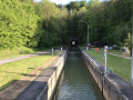
Between the Mazarin Forest and the Bar Valley, near the village of Saint-Aignan, discover one of the secrets of the Ardennes Canal, which, to avoid detours, passes under the mountain. A lovely little walk to enjoy with the family, making ‘woo-hoo’ sounds to create an echo in the river tunnel.
The Marfée massif, a promontory steeped in history
 9.14 mi
+863 ft
-843 ft
4h 55
Moderate
Departure from Sedan (Ardennes)
9.14 mi
+863 ft
-843 ft
4h 55
Moderate
Departure from Sedan (Ardennes)
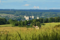
Rising to an altitude of 340 metres, the Marfée massif was particularly coveted during various conflicts. This wooded promontory, overlooking the Meuse valley, has witnessed many historic tragedies in the ‘Pays Sedanais’.
From the viewpoint, where more than ten villages can be seen, it is easy to understand the strategic importance of this key location near the border. Nearly 30,000 German and French soldiers are buried in the two cemeteries at Noyers.
Sedan, the lake and the canal
 4.64 mi
+39 ft
-36 ft
2h 10
Easy
Departure from Sedan (Ardennes)
4.64 mi
+39 ft
-36 ft
2h 10
Easy
Departure from Sedan (Ardennes)
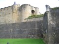
A walk around the lake in November, shrouded in mist, with a detour through the town centre and the renovated old quarters, then back along the canal, admiring the reflections of the bourgeois houses in its dark waters.
Discovering the Sedan region
 5.60 mi
+492 ft
-486 ft
3h 00
Moderate
Departure from Sedan (Ardennes)
5.60 mi
+492 ft
-486 ft
3h 00
Moderate
Departure from Sedan (Ardennes)
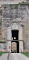
Set off to discover the historic sites that have shaped the Sedan region. Places steeped in history and emotion.
The Vendresse Arboretum, the Ligne aux Sapins and the Cogneux springs.
 8.15 mi
+955 ft
-958 ft
4h 35
Moderate
Departure from Vendresse (Ardennes)
8.15 mi
+955 ft
-958 ft
4h 35
Moderate
Departure from Vendresse (Ardennes)
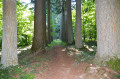
Enjoy the Vendresse State Forest, remarkable for its many species and rows of Douglas fir trees.
Take in the view of the vast Bar valley and the Ardennes canal before descending towards Omicourt. Climb back up to return to the Bar valley.
Walk along the Rouge Cogneux and discover its resurgent springs.
Return to the "Domaniale".
From the heights of Sedan to the Chasseurs d’Afrique memorial in Floing
 8.71 mi
+725 ft
-725 ft
4h 40
Moderate
Departure from Sedan (Ardennes)
8.71 mi
+725 ft
-725 ft
4h 40
Moderate
Departure from Sedan (Ardennes)
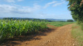
A lovely walk combining the idyllic charm of a pleasant country stroll with the educational aspect of a chapter in French history: the Battle of Sedan, which took place on1 September 1870 and led to the surrender of the French army the very next day and, consequently, the end of the Franco-Prussian War of 1870.
Les Terres Anesse
5.74 mi
+66 ft
-69 ft
2h 40
Easy
Departure from Vendresse (Ardennes)
An easy walk combining tarmac and gravel paths through meadows, woods and ponds.
Iges Peninsula
4.89 mi
+253 ft
-256 ft
2h 30
Easy
Departure from Glaire (Ardennes)
The Iges peninsula, formed by a circular bend in the Meuse downstream from Sedan, has always been a crossing point. A secondary Roman road, linking the two major routes from Reims to Cologne and from Reims to Trier, passed through Iges and crossed the Meuse via a paved ford. Following the surrender of 1870, 80,000 French soldiers were crammed onto the peninsula in appalling conditions before being transferred to Germany, hence the name ‘Camp de la Misère’ (Camp of Misery) given to the peninsula.
The Margueritte Division March
6.18 mi
+646 ft
-646 ft
3h 25
Easy
Departure from Ardennes
During the Franco-Prussian War of 1870, the sacrifice of the Chasseurs d’Afrique of the Margueritte Division earned the admiration of William I, who remarked, “Ah! What brave men.” Follow in their footsteps and discover the countryside and battlefields of the Sedan region.
Along the Givonne and the Ruisseau des Fraichis
 7.58 mi
+676 ft
-650 ft
4h 05
Moderate
Departure from Givonne (Ardennes)
7.58 mi
+676 ft
-650 ft
4h 05
Moderate
Departure from Givonne (Ardennes)
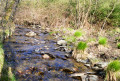
This forest walk features numerous small paths, with two main landmarks: the Givonne and the Ruisseau des Fraichis.
31/7/22: the footbridge over the Givonne at (6) has been fully restored
The Douaire, Lazareth and Bouillonnais paths
 11.27 mi
+1,257 ft
-1,250 ft
6h 15
Moderate
Departure from Givonne (Ardennes)
11.27 mi
+1,257 ft
-1,250 ft
6h 15
Moderate
Departure from Givonne (Ardennes)
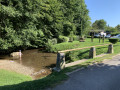
This route follows a variety of paths through a forest with a wide range of tree species. It is located almost entirely within the Sedan National Forest.
From Les Glaynées to Woaygnie
 4.79 mi
+371 ft
-374 ft
2h 30
Easy
Departure from Illy (Ardennes)
4.79 mi
+371 ft
-374 ft
2h 30
Easy
Departure from Illy (Ardennes)
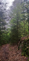
A short, leisurely walk through woodland with varied terrain.
Along the streams of Olly
 5.49 mi
+558 ft
-558 ft
3h 00
Easy
Departure from Illy (Ardennes)
5.49 mi
+558 ft
-558 ft
3h 00
Easy
Departure from Illy (Ardennes)
Amidst the greenery and the scents of the woodland, a short walk to the sound of babbling brooks that you cross by fording.
Following the water between the Givonne and the Hatrelle
5.81 mi
+597 ft
-577 ft
3h 10
Easy
Departure from Illy (Ardennes)
This walk, mostly through state-owned forest, will take you close to or past the Givonne and two of its main tributaries: the Ruisseau des Dix Frères and the Ruisseau de la Hatrelle. In places, you will also walk along the old route of the Bouillonnais, a small train that linked Sedan and Bouillon.
Circuit du Mortehan
18.93 mi
+1,969 ft
-1,962 ft
4 hrs
Moderate
Departure from Givonne (Ardennes)
This forest route follows a variety of paths, including many sections of the Pays Sedanais mountain bike routes and various forest trails in Villers Cernay, Francheval and Pouru-aux-Bois.The elevation changes are not excessive and the numerous streams that line the route add a special charm to this route.
This is a difficult route requiring some portage.
Autruche trail
 7.58 mi
+456 ft
-456 ft
3h 55
Moderate
Departure from Autruche (Ardennes)
7.58 mi
+456 ft
-456 ft
3h 55
Moderate
Departure from Autruche (Ardennes)
This countryside route starting from Autruche takes you across open fields to a remarkable viewpoint over the Tourbières de la Bar, a Natura 2000 classified natural site. Interpretive panels provide a better understanding of the ecological richness of these exceptional wetlands. An accessible and informative hike, ideal for lovers of nature and biodiversity, to discover a preserved natural heritage.
Lumes, the Meuse and the Villers-Semeuse gravel pits
 6.34 mi
+56 ft
-56 ft
3h 00
Moderate
Departure from Lumes (Ardennes)
6.34 mi
+56 ft
-56 ft
3h 00
Moderate
Departure from Lumes (Ardennes)
Rainwater, seepage, river flooding, trees and vegetation have transformed the former gravel pits into a very pleasant walk, in a maze of paths running alongside ponds, each more beautiful than the last, bordering the Meuse with very pretty landscapes as a backdrop and the peaceful murmur of human activity all around.
More walks in Raucourt-et-Flaba
Select a point of interest below: