Mont-Dieu trail

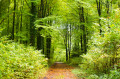
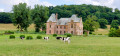
Starting from the Chartreuse du Mont-Dieu, this family-friendly circular walk takes you along a pleasant forest path in the heart of the national forest. The route offers a peaceful immersion in a preserved natural environment and allows you to discover the monumental barn of La Corrérie and the Château de la Barbière, which bear witness to the site's rich heritage and history.

Details

91776258
Creation:
Last update:
Last review:
  • Walking
    Activity: Walking
  • ↔
    Distance: 5.09 mi
  • ◔
    Average duration: 2h 45 
  • ▲
    Difficulty: Easy

  • ⚐
    Back to start: Yes
  • ↗
    Ascent: + 446 ft
  • ↘
    Descent: - 449 ft

  • ▲
    Highest point: 873 ft
  • ▼
    Lowest point: 584 ft

Photos

Description of the walk

Park in the car park above the Chartreuse du Mont-Dieu on the D230a. Follow footpath no. 29.

(S/E) Opposite the charterhouse, turn left onto the forest path. Cross the three footbridges, then climb a steep hill to reach a wider forest path. Turn left to leave the woods and come out onto a white forest road.

(1) Turn right to continue along this forest road, following several bends until you reach the junction with a small road a few metres from the D30 and at the end of the old Roman road.

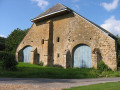
(2) Turn right to follow the small road. Pass in front of the Château de la Barbière, then in front of the pond of the same name on the right. Reach La Corrérie, an annex of La Chartreuse, where the buildings that housed the lay brothers and their workshops and a monumental monastic barn dating from 1275 stand.

(3) Continue straight ahead on the small road until you reach a crossroads.

(4) Turn right to go back up towards the Chartreuse.

(5) At the foot of the monastery, turn left to reach the car park further up.

(6) Visit the remarkable oak tree by taking the stairs on the left and walking about a hundred metres into the woods. Then turn right into the undergrowth to return to the car park (S/E).

Waypoints

  1. S/E : mi 0 - alt. 696 ft - Car park
  2. 1 : mi 0.65 - alt. 873 ft - Forest road, on the right
  3. 2 : mi 2.52 - alt. 778 ft - Crossroads at the end of the Roman road
  4. 3 : mi 3.37 - alt. 600 ft - La Corrérie
  5. 4 : mi 3.97 - alt. 600 ft - Crossroads, on the right
  6. 5 : mi 4.56 - alt. 627 ft - Crossroads, on the left - La Chartreuse du Mont-Dieu
  7. 6 : mi 4.79 - alt. 686 ft - Stairs
  8. S/E : mi 5.09 - alt. 699 ft - Car park

Notes

Between October and February, check the hunting dates before setting off.

Worth a visit

Other walks in the area

For more walks, use our search engine .

The GPS track and description are the property of this route's author. Please do not copy them without permission.