Refine your search for walks in Pierrecourt
Pierrecourt walks


 Pierrecourt and its points of interest
 Visorando Member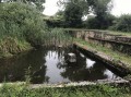
 4.32 mi
 +223 ft
 -230 ft
 2h 10
2h 10
 Easy
Easy
 Departure from Pierrecourt (Haute-Saône)
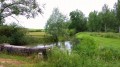
Nestled in lush green surroundings, 8 km from Champlitte, the village of Pierrecourt boasts:a washhouse, ‘Le Magny’a covered fountain, “Coulvot”, just outside the village.
A lovely, rural circular loop from Pierrecourt to Champlitte
9.28 mi
+505 ft
-531 ft
4h 45
 Moderate
Departure from Pierrecourt (Haute-Saône)
Moderate
Departure from Pierrecourt (Haute-Saône)
This short circular loop of around fifteen kilometres, which presents no particular difficulty, allows you to discover beautiful, peaceful and serene countryside and, if you’re as lucky as we were, to spot some roe deer in the woodland.
Legends Trail in Argillières
 5.41 mi
+410 ft
-407 ft
2h 50
Moderate
Departure from Argillières (Haute-Saône)
5.41 mi
+410 ft
-407 ft
2h 50
Moderate
Departure from Argillières (Haute-Saône)
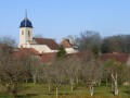
Argillières is a small village steeped in legend... Its castle is said to have been home in the 18th century to the famous bandit Mandrin, a hero to the people but a thief whom the authorities were determined to bring down at any cost. Concealed by a high wall, this castle, built in the 17th and 18th centuries, is now mainly occupied during the summer months.
La Pâturie, Le Prélot and the “Sentier des Pierres sèches” in Champlitte
 6.79 mi
+413 ft
-390 ft
3h 30
Moderate
Departure from Champlitte (Haute-Saône)
6.79 mi
+413 ft
-390 ft
3h 30
Moderate
Departure from Champlitte (Haute-Saône)
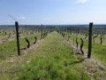
A pleasant little walk through the vineyards and the heritage of Franche-Comté.
The stone bridges over the Salon
 7.22 mi
+512 ft
-489 ft
3h 45
Moderate
Departure from Achey (Haute-Saône)
7.22 mi
+512 ft
-489 ft
3h 45
Moderate
Departure from Achey (Haute-Saône)
Between dirt tracks, cattle tracks and stone bridges spanning the Salon, you will enjoy a pleasant walk discovering remarkable architectural heritage (churches, fountains, calvaries, etc.).
The Tacot Trail
 7.59 mi
+256 ft
-259 ft
3h 45
Moderate
Departure from Lavoncourt (Haute-Saône)
7.59 mi
+256 ft
-259 ft
3h 45
Moderate
Departure from Lavoncourt (Haute-Saône)
In a rural landscape where industry has nevertheless left its mark, let's follow the route of the jalopy, which stopped in each village to load goods.
Route de découverte de Fayl-Billot
3.34 mi
+200 ft
-207 ft
1h 45
Easy
Departure from Fayl-Billot (Haute-Marne)
Fayl-Billot is a village of 1,300 inhabitants located in the Haute-Marne department. It is best known as the capital of basketry. There are many artisans practising this craft in the village. At the end of this walk, do not hesitate to take home a souvenir. This walk takes in the village’s main tourist and cultural attractions, such as the National School of Osier Cultivation and Basketry, Notre-Dame Church, as well as all the village’s wash houses and fountains.
La Rochelle Castle
 5.88 mi
+413 ft
-423 ft
3h 05
Moderate
Departure from La Rochelle (Haute-Saône) (Haute-Saône)
5.88 mi
+413 ft
-423 ft
3h 05
Moderate
Departure from La Rochelle (Haute-Saône) (Haute-Saône)
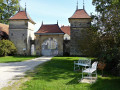
The village of La Rochelle takes its name from ‘Roche’, in the medieval sense of a hilltop on which a fortified castle stands.
This small village is clustered around the castle square; the water from its fountains adds to its charm and authenticity.
Rigny via Gray beach
 6.24 mi
+13 ft
-13 ft
2h 55
Easy
Departure from Gray (Haute-Saône)
6.24 mi
+13 ft
-13 ft
2h 55
Easy
Departure from Gray (Haute-Saône)
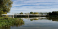
A pleasant walk along the banks of the Saône with little traffic, starting and finishing in a leisure area.
In the footsteps of Henry IV at Fontaine-Française
6.42 mi
+79 ft
-98 ft
3h 00
Easy
Departure from Fontaine-Française (Côte-d'Or)
In the Vingeanne valley, a walk amongst ponds, springs, canals, streams and the river, exploring the châteaux of Fontaine-Française and Rosières, the ruins of an old blast furnace, and observing resident birds (such as the reed warbler) or migratory birds in a reed bed or meadow.
Discover the banks of the Saône and Gray
8.92 mi
+108 ft
-108 ft
4h 10
Moderate
Departure from Gray (Haute-Saône)
A hike to discover Gray, its surroundings and the Saône river via paths accessible on foot and by bike (except for a staircase at the end of the route, which can be easily bypassed). Also accessible by hybrid or mountain bike, except for the staircase at the end of the route, which can be easily bypassed via the adjacent streets.
Exploring Old Gray
 2.25 mi
+112 ft
-108 ft
1h 10
Easy
Departure from Gray (Haute-Saône)
2.25 mi
+112 ft
-108 ft
1h 10
Easy
Departure from Gray (Haute-Saône)
A short, easy walk allowing you to discover the heritage of the town of Gray through numerous forgotten alleyways, finishing near the pubs and small restaurants along the banks of the Saône.
Route around Rosières Castle
 9.42 mi
+217 ft
-194 ft
4h 30
Moderate
Departure from Autrey-lès-Gray (Haute-Saône)
9.42 mi
+217 ft
-194 ft
4h 30
Moderate
Departure from Autrey-lès-Gray (Haute-Saône)
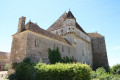
This walk will take you around the Château de Rosières, passing through Verfontaine and Saint-Seine-la-Tour, alongside two ponds where you can see plenty of birds and ducks. The Château de Rosières, currently run as a guesthouse, is open to visitors.
Avoid this route in very hot weather as a large part of it is in the open.
See the reviews; some sections of the trail are difficult to navigate.
In the Vingeanne region, the Château de Rosières
 7.12 mi
+66 ft
-66 ft
3h 20
Moderate
Departure from Fontenelle (Côte-d'Or) (Côte-d'Or)
7.12 mi
+66 ft
-66 ft
3h 20
Moderate
Departure from Fontenelle (Côte-d'Or) (Côte-d'Or)
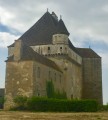
This easy hike will take you between Vingeanne and the canal to the Château de Rosières, a 15th-century fortified manor house that is still inhabited and operates as a bed and breakfast. It is open to visitors.
To Montigny-lès-Cherlieu Abbey
 5.58 mi
+581 ft
-577 ft
3h 05
Moderate
Departure from Montigny-lès-Cherlieu (Haute-Saône)
5.58 mi
+581 ft
-577 ft
3h 05
Moderate
Departure from Montigny-lès-Cherlieu (Haute-Saône)
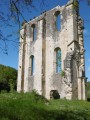
It’s well worth venturing deep into the woods to discover the ruins of the Cistercian Abbey of Cherlieu.