Rigny via Gray beach

A pleasant walk along the banks of the Saône with little traffic, starting and finishing in a leisure area.

Details

4042680
Creation:
Last update:
Last review:
  • Walking
    Activity: Walking
  • ↔
    Distance: 6.24 mi
  • ◔
    Average duration: 2h 55 
  • ▲
    Difficulty: Easy

  • ⚐
    Back to start: Yes
  • ↗
    Ascent: + 13 ft
  • ↘
    Descent: - 13 ft

  • ▲
    Highest point: 636 ft
  • ▼
    Lowest point: 620 ft
  • ⚐ Country: France
  • ⚐ City: Gray (70100)
  • ⚑
    Start/End: N 47.452813° / E 5.602604°
  • Accessible from the train station Gare d'Arc-les-Gray.
  • ❏
    IGN map(s): Ref. 3222E
  • Hour-by-hour weather

Photos

Description of the walk

Start from the car park at the Gray beach leisure area.

(S/E) Turn your back on Gray and head upstream along the Saône, walking across the plain.

(1) Cross the Morthe and continue to the canal bridge.

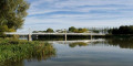
(2) Cross the Rigny Canal, then the bridge over the Saône, and follow the Saône on the left.

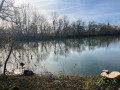
(3) Follow the banks of the Saône and take the fishermen’s path.

(4) After passing the Bouchot, take the first road on the right and you’ll arrive in the industrial estate. Turn right, then left, and carry on until you reach the supermarket.

(5) Turn left onto Rue de Vergy and you’ll come to a small roundabout.

(6) Stay on the pavement on the left and cross the bridge. Enter the park on the left just after the bridge.

(7) Walk through the park, then across the car park, and turn right at the end of Rue de Sauzay to join Avenue Carnot.

(8) Turn left, walk past the bike shop, then carry on straight ahead along Rue de la Plage.

(9) Once you reach the beach leisure area, go through the gate to enter the park (S/E).

Waypoints

  1. S/E : mi 0 - alt. 623 ft - Beach car park
  2. 1 : mi 0.85 - alt. 623 ft - Cross the - Morthe (rivière) - Affluent de la Saône
  3. 2 : mi 2.09 - alt. 627 ft - Canal at Rigny
  4. 3 : mi 2.82 - alt. 627 ft - Fishermen’s path along the - La Saône
  5. 4 : mi 3.74 - alt. 627 ft - Road towards Arc-lès-Gray after the oyster bed
  6. 5 : mi 5.07 - alt. 623 ft - Turn left onto Rue de Vergy
  7. 6 : mi 5.31 - alt. 633 ft - Paris roundabout
  8. 7 : mi 5.46 - alt. 630 ft - Access to Île Sauzay Park
  9. 8 : mi 5.64 - alt. 627 ft - Turn left towards Rue de la Plage
  10. 9 : mi 5.99 - alt. 623 ft - Access to the beach leisure area
  11. S/E : mi 6.24 - alt. 623 ft - Beach car park

Notes

Wear suitable footwear for a 10 km walk, much of which is on dirt tracks.
Bring a water bottle.
Please respect the peace and quiet of the anglers.
Watch out for traffic in the industrial estate.

Worth a visit

(S/E) Bar and restaurant. Leisure area for children and relaxation for all (games, mini-golf, swimming pool, beach, etc.).

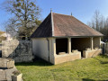
A pleasant rest area in Rigny after crossing the bridge.
Amenity areas for anglers beyond Rigny, ideal for picnics.

Reviews and comments

4.5 / 5
Based on 2 reviews

Reliability of the description
5 / 5
Ease of following the route
5 / 5
Route interest
3.5 / 5
OliChabot
OliChabot

Overall rating : 4 / 5

Date of your route : Jul 12, 2023
Reliability of the description : ★★★★★ Very good
Ease of following the route : ★★★★★ Very good
Route interest : ★★☆☆☆ Disappointing
Very busy route : No

A disappointing ride; the first section consisted of a very long straight stretch of uninteresting road (no shade).
The only pleasant part was the towpath from Rigny (30 mins max). An unpleasant finish in the industrial estate.
Best avoided.

Machine-translated

nabeloma
nabeloma

Overall rating : 5 / 5

Date of your route : Jan 24, 2022
Reliability of the description : ★★★★★ Very good
Ease of following the route : ★★★★★ Very good
Route interest : ★★★★★ Very good
Very busy route : No

A lovely walk along the banks of the Saône, and almost entirely in the sunshine.

Machine-translated

Other walks in the area

For more walks, use our search engine .

The GPS track and description are the property of this route's author. Please do not copy them without permission.