Exploring Old Gray

A short, easy walk allowing you to discover the heritage of the town of Gray through numerous forgotten alleyways, finishing near the pubs and small restaurants along the banks of the Saône.

Details

4042515
Creation:
Last update:
Last review:
  • Walking
    Activity: Walking
  • ↔
    Distance: 2.25 mi
  • ◔
    Average duration: 1h 10 
  • ▲
    Difficulty: Easy

  • ⚐
    Back to start: Yes
  • ↗
    Ascent: + 112 ft
  • ↘
    Descent: - 108 ft

  • ▲
    Highest point: 735 ft
  • ▼
    Lowest point: 620 ft
  • ⚐ Country: France
  • ⚐ City: Gray (70100)
  • ⚑
    Start/End: N 47.448969° / E 5.593282°
  • Accessible from the train station Gare de Gray-Gare-Routière.
  • ❏
    IGN map(s): Ref. 3222E
  • Hour-by-hour weather

Photos

Description of the walk

Park in the Sauzay car park.

(S/E) Head to the Tourist Office and the information point. Take the unnamed street opposite, which runs perpendicular to Rue de Sauzay, then turn left. Cross Avenue Carnot and take the street opposite, Rue Augustin Cournot, until you reach Rue Vanoise.

Turn left, then take the stairs up to the Tertre du Château on the right. Walk along the car park that runs alongside the ramparts, then follow the street on the right to reach Gray Town Hall.

(1) Opposite the town hall, take the path between the two buildings, then turn left into Rue des Casernes. At the end, continue to the right along Ruelle du Commandant Cécile, then take the first alleyway on the left.

(2) Turn right as you pass through the archway into the Parc des Carmes. After strolling through the park, exit onto Rue Victor Hugo and head to the right. Turn left at the first junction onto Rue Louis Jobard. Turn right straight away to enter the car park. Take the staircase at the far right and walk on until you reach the square with a fountain.

Turn right to reach the town hall square, then continue straight ahead to the sub-prefecture square. Go to the far end of the square to find some steps leading down Rue Malcouverte. Turn left onto this street to reach the junction with the Grande Rue.

(3) Turn left onto this street and follow it up to No. 71 on the right. Push open the gate, then go to the far end of the courtyard and follow the path and the stairs. Continue left along Rue du Lycée until you reach the junction with Rue de l’Arsenal.

(4) Turn right onto it; a little further on, near the Jesuit secondary school, take the ramp on the right just before a small bridge. Pass under an archway, then exit the courtyard onto Rue de l’Abreuvoir. Continue to the right and return to the junction you passed earlier.

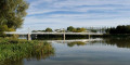
(3) Turn left down Rue Gambetta, then cross Avenue des Grands Moulins. Walk past the Bistrot des Bateliers. Go down the steps to spend a moment by the banks of the Saône. Head back up towards the bridge and cross the road. Enter Sauzay Park. On leaving, walk round the market halls to easily find the Tourist Office and the Sauzay car park (S/E).

Waypoints

  1. S/E : mi 0 - alt. 627 ft - Sauzay car park - Gare de Gray-Gare-Routière
  2. 1 : mi 0.34 - alt. 722 ft - Gray Town Hall
  3. 2 : mi 0.59 - alt. 732 ft - Entrance to the Parc des Carmes
  4. 3 : mi 1.26 - alt. 636 ft - Grande Rue junction. Towards the - La Saône
  5. 4 : mi 1.49 - alt. 702 ft - Crossroads at Rue de l’Arsenal
  6. S/E : mi 2.25 - alt. 627 ft - Sauzay car park - Gare d'Arc-les-Gray

Notes

Large car park at the start, right next to the tourist information office on the Île Sauzay site near the Saône
Local food shops on the Grande Rue, with places to eat and drink offering views of the Saône on either side of the bridge.
Wear shoes suitable for walking in town and up and down stairs.
It may be worth taking this walk at dusk to enjoy the city lights, but in that case, there are no places to eat.

Worth a visit

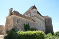
Between (S/E) and (1) When you reach the top of the stairs, you can admire the 13th-century Paravis Tower, which now serves as the entrance to the Baron Martin Museum grounds.
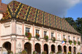
(1) You can admire the glazed tiles on the town hall building (1567).
(2) In the Parc des Carmes there is an analemmatic sundial.
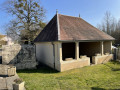
After the small fountain, you’ll see a series of historic buildings marked by information signs
(2) and (S/E) The Parc des Carmes, halfway along the route, and the Parc de l’Île Sauzay, at the end, are very child-friendly.
(S/E) Make the most of the Saturday morning market under the Hall Sauzay.

Reviews and comments

4.7 / 5
Based on 3 reviews

Reliability of the description
4.3 / 5
Ease of following the route
5 / 5
Route interest
4.7 / 5
User 30353384

Overall rating : 5 / 5

Date of your route : Aug 31, 2026
Reliability of the description : ★★★★★ Very good
Ease of following the route : ★★★★★ Very good
Route interest : ★★★★★ Very good
Very busy route : No

A really handy app
I was able to see everything there was to discover in Gray
It was a great help
Thank you

Machine-translated

DROUILLOT
DROUILLOT

Overall rating : 4.7 / 5

Date of your route : Mar 20, 2025
Reliability of the description : ★★★★☆ Good
Ease of following the route : ★★★★★ Very good
Route interest : ★★★★★ Very good
Very busy route : No

Thank you, “Adoptelec”, for this lovely walk, which introduced us to the historic centre of Gray – it’s well worth a visit!
We were unable to take the path opposite the town hall (1), nor enter the courtyard at No. 71 (3), due to building works.

Machine-translated

LORANEL
LORANEL

Overall rating : 4.3 / 5

Date of your route : Oct 21, 2020
Reliability of the description : ★★★★☆ Good
Ease of following the route : ★★★★★ Very good
Route interest : ★★★★☆ Good
Very busy route : No

The distance given isn’t the one we actually covered, even though we followed the route exactly. You should expect it to be between 6.5 km and 7 km!
But it’s a lovely route that gives you a good insight into old Gray and its historic houses with their pretty wooden doors.

Machine-translated

Other walks in the area

For more walks, use our search engine .

The GPS track and description are the property of this route's author. Please do not copy them without permission.