Refine your search for walks in Mont Calvaire de l'Oelberg
Mont Calvaire de l'Oelberg walks


 The circular route through the four communal forests from Guebwiller
 Visorando Member
 15.66 mi
 +3,107 ft
 -3,100 ft
 10 hrs
 Very difficult
 Departure from Guebwiller (Haut-Rhin)
A long hike taking you through four communal forests: those of Lautenbach, Guebwiller, Bergholtzzel and Orschwihr. It features four climbs with an elevation gain of around 150 to 250 metres, the gradient of which varies depending on the section. There are numerous points of interest, including the town of Guebwiller, the viewpoint in the Bergholtzzell Communal Forest, and the Oelberg Calvary. The walk offers the chance to discover the remains of several castles as well as the Hochfelsen rock formation. Furthermore, it takes you around a small peak rising to an altitude of 688 metres: the Engelstein.
Castle Trail: from Guebwiller to Orschwihr
 Tourist office10.54 mi
+1,214 ft
-1,211 ft
5h 55
Tourist office10.54 mi
+1,214 ft
-1,211 ft
5h 55
 Moderate
Departure from Guebwiller (Haut-Rhin)
Moderate
Departure from Guebwiller (Haut-Rhin)
A themed walk exploring the castles around Guebwiller.
From Guebwiller to Rouffach through the vineyards
 15.15 mi
+1,480 ft
-1,483 ft
8h 15
15.15 mi
+1,480 ft
-1,483 ft
8h 15
 Difficult
Departure from Guebwiller (Haut-Rhin)
Difficult
Departure from Guebwiller (Haut-Rhin)
A long circular walk connecting two towns in the Haut-Rhin: Guebwiller and Rouffach. What makes this circular walk unique is that it mainly passes through vineyards. Other crops can be seen in the first part of the walk, but the bulk of the route is through vineyards. The return leg is particularly interesting, featuring chapels, a nature reserve and some remarkable views. The route passes through several charming villages
Route de découverte de Bergholtz-Zell
 1.22 mi
+108 ft
-115 ft
0h 40
1.22 mi
+108 ft
-115 ft
0h 40
 Easy
Departure from Orschwihr (Haut-Rhin)
Easy
Departure from Orschwihr (Haut-Rhin)
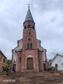
Bergholtz-Zell is a small Alsatian village situated in the heart of a vineyard. It is bordered by a wooded hill to the west. This short route offers a pleasant stroll through the heart of this wine-growing village. The main point of interest is a visit to the Mont Calvaire de l’Œlberg. This walk can easily be combined with a visit to the neighbouring village of Orschwihr or Bergholtz.
Walks near Mont Calvaire de l'Oelberg
3-day tour of the Grand Ballon: from Guebwiller to the Grand Ballon
8.23 mi
+3,622 ft
-174 ft
6h 55
Difficult
Departure from Guebwiller (Haut-Rhin)
First day of the 3-day Grand Ballon circuit. Starting from Guebwiller, the first day of this multi-day hike will take you to the Grand Ballon, the highest peak in the Vosges mountains, which rises to an altitude of 1,424 metres. The ascent is quite challenging and requires a good level of fitness. Along the way, you can enjoy the varied landscapes and the flora and fauna of the Vosges, and on arrival, the exceptional panoramic views across the whole of the Alsace plain, the Black Forest and, on a clear day, even the Bernese Alps.
Guebwiller – Grand Ballon
8.25 mi
+3,622 ft
-174 ft
6h 55
Difficult
Departure from Guebwiller (Haut-Rhin)
Get straight to the heart of the matter with the ascent of the Grand Ballon, which will delight the fittest walkers!
Starting from Guebwiller, the first day of this multi-day hike will take you to the Grand Ballon, the highest peak in the Vosges mountains, which rises to an altitude of 1,424 metres. The climb to this pass is therefore quite challenging and requires a good level of fitness. Along the way, you’ll be able to enjoy the varied landscapes and the flora and fauna of the Vosges, and on arrival, the exceptional panoramic views across the whole of the Alsace plain, the Black Forest and even the Bernese Alps if the sky is clear.
From Soultzmatt to the Guebwiller valley
9.43 mi
+1,818 ft
-1,699 ft
5h 55
Moderate
Departure from Soultzmatt (Haut-Rhin)
The Florival Valley seen from above – a perfect way to end the walk!
Setting off from Soultzmatt, you’ll enjoy ‘heritage stops’ along the Val du Pâtre Way of the Cross, pausing to visit the churches and chapels of Soultzmatt, Val de Pâtre and Saint-Gangolphe. This long hike concludes on the balcony paths through the Guebwiller vineyards, offering exceptional panoramic views of the Florival Valley, the Grand Ballon and the Petit Ballon. You’ll be able to look back and admire the routes you’ve covered over the last few days.
Le Col du Grand Ballon depuis Soultz
8.15 mi
+3,596 ft
-89 ft
6h 55
Difficult
Departure from Soultz-Haut-Rhin (Haut-Rhin)
Randonnée presque quasiment en montée qui permet de relier Soultz, sympathique village culturel, au Col du Grand Ballon où vous pourrez passer la nuit avant d'aller le lendemain matin au sommet. Bien que cette étape soit courte en kilomètres, elle comporte un important dénivelé à ne pas négliger. Mais que de beautés en revanche entre les forêts et points de vues remarquables dans la dernière partie du parcours.
Rouffach – Turckheim
14.19 mi
+1,375 ft
-1,250 ft
7h 45
Difficult
Departure from Rouffach (Haut-Rhin)
Wine-growing is an integral part of the Alsatian landscape. There is also a route named after it. This route is the third stage of the ‘Traversée des Vignes’ and links Rouffach to Turckheim. There are numerous vantage points, indeed they are almost everywhere outside the villages. The villages themselves are very traditional, with pretty half-timbered houses, and possess an undeniable charm. The region’s heritage is equally well represented.
Linthal – Grand Ballon – Markstein
12.20 mi
+3,553 ft
-1,319 ft
8h 40
Difficult
Departure from Linthal (Haut-Rhin)
A very physically demanding first day with a wide variety of landscapes.
Starting from Linthal, the most mountainous village in the Guebwiller region, the first day of this multi-day hike will take you to the Auberge du Steinlebach, via the Grand Ballon – the highest peak in the Vosges mountains, rising to an altitude of 1,424 metres – and the Markstein resort. The ascent is quite challenging and requires a good level of fitness. Along the way, you’ll pass the Gustiberg farmhouse inn, Lake Ballon and the Haag farmhouse inn…
Ascent to the Grand Ballon from Sengern (Guebwiller) via the lake
 5.78 mi
+2,910 ft
-39 ft
5h 10
Difficult
Departure from Lautenbachzell (Haut-Rhin)
5.78 mi
+2,910 ft
-39 ft
5h 10
Difficult
Departure from Lautenbachzell (Haut-Rhin)
A challenging climb to the Grand Ballon from Sengern (past Guebwiller). The route passes by the beautiful Lac du Ballon and the Gustiberg farmhouse inn, both of which offer very pleasant places to stop for a break.
Descent into the Noble Valley
11.33 mi
+705 ft
-3,825 ft
5h 50
Moderate
Departure from Sondernach (Haut-Rhin)
Begin your descent through varied landscapes towards the first villages of the Alsace plain, situated on the Wine Route.
After enjoying the 360° view from the Petit Ballon over the valleys of Guebwiller and Munster and the Hohneck and Grand Ballon mountain ranges, it is as you begin the descent at the end of the ridge that you will catch sight of the Petit Ballon glacial cirque. Beautiful little paths, winding through woods and meadows, vineyards and mountains, will take you to the village of Soultzmatt, via Wintzfelden and Osenbach, not forgetting a short stop at the remarkable site of the ruins of Schwartzenthann Convent.
A day trip to Lac du Ballon
8.50 mi
+1,467 ft
-2,031 ft
5h 10
Moderate
Departure from Murbach (Haut-Rhin)
Enjoy a relaxing break at Lac du Ballon before setting off again along the Route des Crêtes.
The route for this second day, starting from the Grand Ballon, includes a short detour to Lac du Ballon, so you can take in the scenery and the tranquillity of this little paradise. The walk continues along the Route des Crêtes to Markstein, with views of the Grand Ballon and the Thur Valley, and, if you wish, you can enjoy the leisure and outdoor activities on offer at the Markstein resort.