Country:

 City:


(S) On leaving the Guebwiller Tourist Office, walk round the back of Notre-Dame Church and continue up Rue des Chanoines to its end, at the junction with Rue du Maréchal Joffre. Turn left towards the fire station. At the first roundabout (fire station – Crédit Mutuel), carry on straight ahead along Rue du Vieil Armand, towards the secondary school – military cemetery – Auberge du Vallon. At the second roundabout, carry on straight ahead uphill for 100 metres until you reach a junction.
(1) The tarmac road splits. Head left towards the small wooden footbridge spanning a stream. This is the entrance to the Promenade Paul Déroulède (with numerous benches, tables and remarkable trees). Continue straight on along this promenade (marked with oak leaf signs). On the left, you’ll see the graves of the military cemetery and, on the right, the dog training ground.
(2) At the end of the Promenade Paul Déroulède, take the small road on the right called Chemin du Vallon (do not take the forest track marked with a Yellow Disc, which leads to the Maison Forestière de l’Ax). Walk past the inn (on your right: a warm welcome and good traditional cuisine). At the Fontaine de l’Ax, the path curves to the right and leads to the Sandgrube car park (start of the fitness trail).
(3) Take the wide forest track marked with a Yellow Disc towards the Col du Bildstoeckle.
(4) A few metres before the pass, turn right onto the forest track marked with a Blue Triangle, heading towards the Rehbrunnenkopf. Keep to the left straight away. Continue to the first junction with the Red Triangle path.
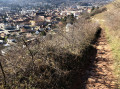
(5) Leave the forest track and take the path leading uphill, still marked with a Blue Triangle. After a hairpin bend and a short climb, the path emerges at the summit of the Rehbrunnenkopf (altitude: 632 metres. There is a bench and a viewpoint overlooking the entrance to the Florival Valley and the mission cross). The descent begins on the Simbert Krenger trail (named after the former president of the Guebwiller Club Vosgien). Steep at first, it levels out and leads to the Col de Peternit (altitude: 566 metres. Benches and a table).
(6) Follow the signs for Rimbach, opposite, for a few metres, then turn left and immediately right onto the small path marked with a Red Rectangle crossed by a White Rectangle, which branches off to the right towards the Col du Munsteraeckerle. This narrow track, which in places becomes a footpath, leads gently up to the pass via the southern slope of the Geisskopf (altitude: 655 metres; a charming little open wooden shelter, with tables and benches). At the pass, turn right then head straight ahead along a gently ascending forest track marked with a Red Rectangle crossed by a White Rectangle, towards the Judenhut. Further on, this track takes a sharp left-hand bend and passes two cave entrances.
(7) Shortly afterwards, leave the track and take a small path on the left, marked with a Blue Triangle, towards the Rocher Saint-Pirmin and the Judenhut. The path winds its way up the northern slope of the Ebeneck in a series of hairpin bends. After a final, very steep hairpin bend, the slope levels out, giving you a chance to catch your breath. 150 metres further on, leave the signposted path to the left, enter the pastures via a cleared path and head leftwards on a gentle climb (follow the visible track in the grass) to the summit of the Ebeneck (altitude: 859 metres. Bench. Magnificent views over the Alsace plain, the Black Forest, the hills above Guebwiller, the Hartmannswillerkopf and the Grand Ballon).
(8) Retrace your steps to the crossroads in the forest and continue uphill along the signposted path.
(9) Shortly afterwards, the path leads out onto the rocky ridge of the Rocher Saint-Pirmin (altitude: 908 metres. Viewpoint over the Murbach valley). The path crosses the rocky outcrop and joins another path coming from the left, marked with a Red Rectangle crossed by a White Rectangle.
(10) Follow this lovely path, which leads, over a few small humps, to the Col de Judenhut (altitude: 979 metres. Large clearing with numerous benches, tables and the unstaffed Judenhut shelter. Drinking water available at the Schlumberger Fountain). There is now about an hour’s steady climb to the Grand Ballon.
(11) Take the track that starts in front of the Schlumberger Fountain, following the forest path marked with a Blue Cross. A few metres further on, leave this path and take the narrower one that climbs to the right, marked with a Red Rectangle crossed out in white. As you climb, it narrows and turns into a footpath.
It leads onto another forest track; follow this to the left for about a hundred metres, then turn right. Cross a track. Shortly afterwards, walk alongside the drinking water catchment areas for the town of Soultz, then cut across the path marked with a ‘Red Diamond’, cross an old ski run twice and, after a final hairpin bend, finally emerge from the forest at the foot of the buildings of the Self de la Vue des Alpes.
(12) Cross the Route des Crêtes. The Chalet-Hôtel du Grand Ballon is directly opposite (altitude: 1,343 metres) (E).

 Tourist office
 Easy
 Visorando Member
 Very difficult
 Moderate